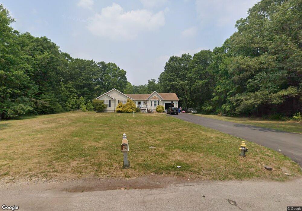
245 E Stanger Ave Glassboro, NJ 08028
Estimated Value: $367,000 - $461,530
--
Bed
--
Bath
2,084
Sq Ft
$203/Sq Ft
Est. Value
About This Home
This home is located at 245 E Stanger Ave, Glassboro, NJ 08028 and is currently estimated at $422,883, approximately $202 per square foot. 245 E Stanger Ave is a home located in Gloucester County with nearby schools including J Harvey Rodgers School, Dorothy L Bullock Elementary, and Glassboro Intermediate School.
Ownership History
Date
Name
Owned For
Owner Type
Purchase Details
Closed on
May 30, 2007
Sold by
Masso Bonnie
Bought by
Masso Amy M
Current Estimated Value
Purchase Details
Closed on
Nov 15, 2004
Sold by
Stewart Kenneth L and Stewart Vicki L
Bought by
Masso Bonnie
Purchase Details
Closed on
Jun 16, 1995
Sold by
Bratcher Garfield A and Bratcher Sheila L
Bought by
Stewart Kenneth L and Stewart Vicki L
Create a Home Valuation Report for This Property
The Home Valuation Report is an in-depth analysis detailing your home's value as well as a comparison with similar homes in the area
Home Values in the Area
Average Home Value in this Area
Purchase History
| Date | Buyer | Sale Price | Title Company |
|---|---|---|---|
| Masso Amy M | -- | None Available | |
| Masso Bonnie | $90,000 | Intercoastal Title Agency | |
| Stewart Kenneth L | $119,900 | Presidential Title Agency In |
Source: Public Records
Tax History Compared to Growth
Tax History
| Year | Tax Paid | Tax Assessment Tax Assessment Total Assessment is a certain percentage of the fair market value that is determined by local assessors to be the total taxable value of land and additions on the property. | Land | Improvement |
|---|---|---|---|---|
| 2025 | $8,068 | $229,200 | $82,100 | $147,100 |
| 2024 | $8,020 | $229,200 | $82,100 | $147,100 |
| 2023 | $8,020 | $229,200 | $82,100 | $147,100 |
| 2022 | $7,939 | $229,200 | $82,100 | $147,100 |
| 2021 | $8,075 | $229,200 | $82,100 | $147,100 |
| 2020 | $8,121 | $229,200 | $82,100 | $147,100 |
| 2019 | $8,134 | $229,200 | $82,100 | $147,100 |
| 2018 | $8,139 | $229,200 | $82,100 | $147,100 |
| 2017 | $8,178 | $229,200 | $82,100 | $147,100 |
| 2016 | $7,942 | $229,200 | $82,100 | $147,100 |
| 2015 | $9,116 | $268,900 | $82,100 | $186,800 |
| 2014 | $8,909 | $268,900 | $82,100 | $186,800 |
Source: Public Records
Map
Nearby Homes
- 161 165 S Delsea Dr
- 1400 Walnut St
- 1200 Walnut St
- 428 Truman Ave
- 125 Earl Ave
- 1701 Filbert St
- 122 Earl Ave
- 1504 S Academy St
- 1215 S Academy St
- 254 Stanger Ave
- 1447 S Mallard St
- 306 Wilson Ave
- 314 Wilson Ave
- 213 15 S Academy St
- 119 S Academy St
- 301 Mazzeo Dr
- 309 Mazzeo Dr
- 192 Mazzeo Dr
- 10 Grove St
- 47 S Academy St
- 243 E Stanger Ave
- 237 E Stanger Ave
- 239 E Stanger Ave
- 235 E Stanger Ave
- 230 E Stanger Ave
- 231 E Stanger Ave
- 227 E Stanger Ave
- 225 E Stanger Ave
- 223 E Stanger Ave
- 219 E Stanger Ave
- 200 Stanger Ave Unit 202
- 178 Delsea Dr S
- 224 Delsea Dr S
- 184 Delsea Dr S
- 0 Stanger and Delsea Dr Unit NJGL2011852
- 185 Delsea Dr S
- 232 Delsea Dr S
- 179 Delsea Dr S
- 177 Delsea Dr S
- 160 Delsea Dr S