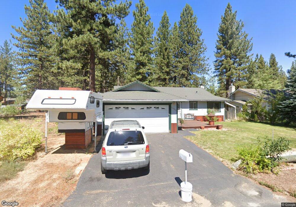
2453 Conestoga St South Lake Tahoe, CA 96150
Estimated Value: $597,000 - $688,000
3
Beds
2
Baths
1,400
Sq Ft
$449/Sq Ft
Est. Value
About This Home
This home is located at 2453 Conestoga St, South Lake Tahoe, CA 96150 and is currently estimated at $627,911, approximately $448 per square foot. 2453 Conestoga St is a home located in El Dorado County with nearby schools including Tahoe Valley Elementary School, South Tahoe Middle School, and South Tahoe High School.
Ownership History
Date
Name
Owned For
Owner Type
Purchase Details
Closed on
Aug 20, 2004
Sold by
Ford Wendy
Bought by
Ford Dennis P
Current Estimated Value
Home Financials for this Owner
Home Financials are based on the most recent Mortgage that was taken out on this home.
Original Mortgage
$197,000
Interest Rate
5.5%
Mortgage Type
New Conventional
Purchase Details
Closed on
Dec 7, 2002
Sold by
Ford Dennis P and Pfefferkorn Wendy
Bought by
Ford Dennis P and Ford Wendy
Home Financials for this Owner
Home Financials are based on the most recent Mortgage that was taken out on this home.
Original Mortgage
$113,600
Interest Rate
5.86%
Purchase Details
Closed on
Nov 25, 1997
Sold by
Ford Dennis P
Bought by
Ford Dennis P and Pfefferkorn Wendy
Home Financials for this Owner
Home Financials are based on the most recent Mortgage that was taken out on this home.
Original Mortgage
$118,100
Interest Rate
7.31%
Create a Home Valuation Report for This Property
The Home Valuation Report is an in-depth analysis detailing your home's value as well as a comparison with similar homes in the area
Home Values in the Area
Average Home Value in this Area
Purchase History
| Date | Buyer | Sale Price | Title Company |
|---|---|---|---|
| Ford Dennis P | -- | Old Republic Title Co | |
| Ford Dennis P | -- | Fidelity Natl Title Co | |
| Ford Dennis P | -- | First American Title Co |
Source: Public Records
Mortgage History
| Date | Status | Borrower | Loan Amount |
|---|---|---|---|
| Closed | Ford Dennis P | $197,000 | |
| Closed | Ford Dennis P | $113,600 | |
| Closed | Ford Dennis P | $118,100 |
Source: Public Records
Tax History Compared to Growth
Tax History
| Year | Tax Paid | Tax Assessment Tax Assessment Total Assessment is a certain percentage of the fair market value that is determined by local assessors to be the total taxable value of land and additions on the property. | Land | Improvement |
|---|---|---|---|---|
| 2025 | $2,477 | $236,345 | $43,753 | $192,592 |
| 2024 | $2,477 | $231,712 | $42,896 | $188,816 |
| 2023 | $2,433 | $227,169 | $42,055 | $185,114 |
| 2022 | $2,408 | $222,716 | $41,231 | $181,485 |
| 2021 | $2,370 | $218,350 | $40,423 | $177,927 |
| 2020 | $2,335 | $216,112 | $40,009 | $176,103 |
| 2019 | $2,323 | $211,875 | $39,225 | $172,650 |
| 2018 | $2,270 | $207,721 | $38,456 | $169,265 |
| 2017 | $2,234 | $203,649 | $37,702 | $165,947 |
| 2016 | $2,187 | $199,657 | $36,963 | $162,694 |
| 2015 | $2,075 | $196,659 | $36,408 | $160,251 |
| 2014 | $2,075 | $192,809 | $35,696 | $157,113 |
Source: Public Records
Map
Nearby Homes
- 941 Silver Dollar Ave
- 2948 Pinewood Dr
- 2337 Sky Meadows Ct
- 2293 Eloise Ave Unit D
- 923 Sagewood Dr
- 1029 Reno Ave
- 2605 Chris Ave
- 2525 Knox Ave
- 2539 Knox Ave
- 1025 Winnemucca Ave
- 1040 Truckee Dr
- 1078 Reno Ave
- 2602 William Ave
- 941 Brockway Ave
- 783 Michael Ct Unit Share B
- 783 Michael Ct
- 2634 Chris Ave
- 1145 Sierra Blvd
- 2610 Knox Ave
- 2569 Alma Ave
- 2447 Conestoga St
- 2459 Conestoga St
- 2465 Conestoga St
- 929 Sunset Dr
- 2452 Conestoga St
- 2446 Conestoga St
- 2456 Conestoga St
- 2460 Conestoga St
- 2469 Conestoga St
- 942 Lodi Ave
- 2477 Conestoga St
- 2459 Ponderosa St Unit 12
- 2449 Ponderosa St
- 2465 Ponderosa St
- 949 Sunset Dr
- 949 Sunset Dr Unit C
- 910 Sunset Dr
- 2476 Conestoga St
- 950 Lodi Ave
- 920 Sunset Dr