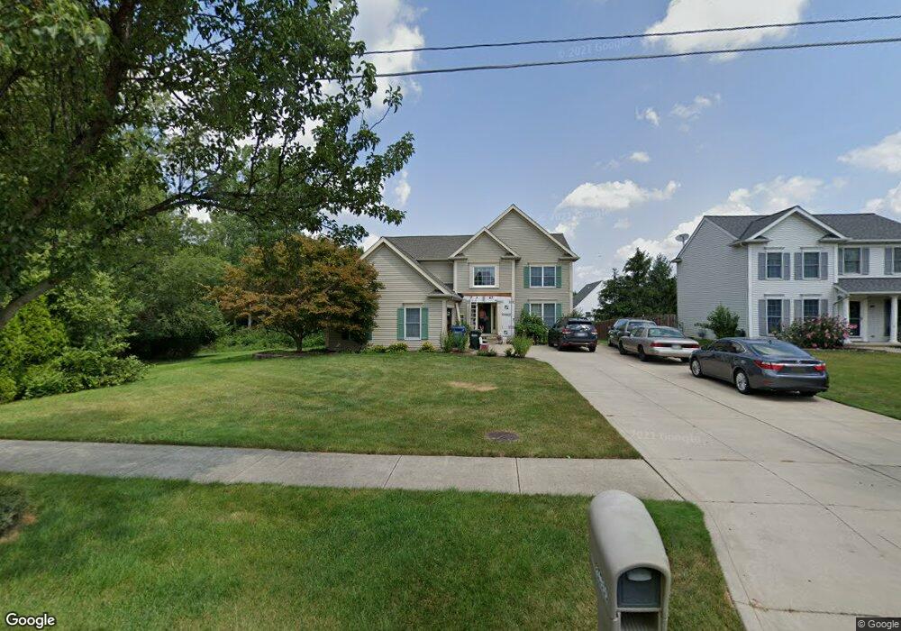
24690 West Rd Olmsted Falls, OH 44138
Estimated Value: $411,398 - $498,000
4
Beds
3
Baths
2,708
Sq Ft
$167/Sq Ft
Est. Value
About This Home
This home is located at 24690 West Rd, Olmsted Falls, OH 44138 and is currently estimated at $453,100, approximately $167 per square foot. 24690 West Rd is a home located in Cuyahoga County with nearby schools including Falls-Lenox Primary Elementary School, Olmsted Falls Intermediate Building, and Olmsted Falls Middle School.
Ownership History
Date
Name
Owned For
Owner Type
Purchase Details
Closed on
Sep 17, 1997
Sold by
Bridlewood Homes Inc
Bought by
Maurer Richard and Maurer Margot E
Current Estimated Value
Home Financials for this Owner
Home Financials are based on the most recent Mortgage that was taken out on this home.
Original Mortgage
$130,000
Outstanding Balance
$20,288
Interest Rate
7.55%
Mortgage Type
New Conventional
Estimated Equity
$432,812
Create a Home Valuation Report for This Property
The Home Valuation Report is an in-depth analysis detailing your home's value as well as a comparison with similar homes in the area
Home Values in the Area
Average Home Value in this Area
Purchase History
| Date | Buyer | Sale Price | Title Company |
|---|---|---|---|
| Maurer Richard | $192,000 | -- |
Source: Public Records
Mortgage History
| Date | Status | Borrower | Loan Amount |
|---|---|---|---|
| Open | Maurer Richard | $130,000 |
Source: Public Records
Tax History Compared to Growth
Tax History
| Year | Tax Paid | Tax Assessment Tax Assessment Total Assessment is a certain percentage of the fair market value that is determined by local assessors to be the total taxable value of land and additions on the property. | Land | Improvement |
|---|---|---|---|---|
| 2024 | $8,346 | $129,745 | $23,205 | $106,540 |
| 2023 | $7,845 | $97,940 | $21,250 | $76,690 |
| 2022 | $7,570 | $97,020 | $21,250 | $75,780 |
| 2021 | $7,495 | $97,020 | $21,250 | $75,780 |
| 2020 | $7,590 | $87,400 | $19,150 | $68,250 |
| 2019 | $6,738 | $249,700 | $54,700 | $195,000 |
| 2018 | $6,721 | $87,400 | $19,150 | $68,250 |
| 2017 | $6,286 | $73,780 | $15,540 | $58,240 |
| 2016 | $6,257 | $73,780 | $15,540 | $58,240 |
| 2015 | $6,068 | $73,780 | $15,540 | $58,240 |
| 2014 | $6,068 | $69,620 | $14,670 | $54,950 |
Source: Public Records
Map
Nearby Homes
- 8757 Roberts Ct Unit 25C
- 8241 Lewis Rd
- Anderson Plan at Smokestack Trails
- Bramante Ranch Plan at Smokestack Trails
- Hudson Plan at Smokestack Trails
- Columbia Plan at Smokestack Trails
- Lehigh Plan at Smokestack Trails
- 0
- Caroline Plan at Falls Landing - Villas
- Wexford Plan at Falls Landing - Villas
- Rosecliff Plan at Falls Landing - Villas
- 396 Crossbrook Dr
- 136 River Rock Way Unit D
- 100 River Rock Way
- 25950 Bagley Rd
- 549 Wyleswood Dr
- 543 Wyleswood Dr
- 105 Clay Ct
- 260 Stone Ridge Way
- 537 Wyleswood Dr
- 24630 West Rd
- 24637 Thicket Ln Unit G16
- 24615 Thicket Ln Unit G17
- 24645 Thicket Ln Unit G15
- 24580 West Rd
- 24655 Thicket Ln
- 24659 Thicket Ln
- 24655 Thicket Ln Unit 14
- 24520 West Rd
- 24515 Thicket Ln Unit H20
- 24547 Thicket Ln Unit H19
- 24589 Thicket Ln Unit H18
- 24640 Thicket Ln Unit K28
- 24620 Thicket Ln Unit K27
- 24600 Thicket Ln Unit K26
- 24470 West Rd
- 24680 Thicket Ln Unit L30
- 24670 Thicket Ln Unit L29
- 24683 Thicket Ln Unit E11
- 24661 Thicket Ln Unit E12