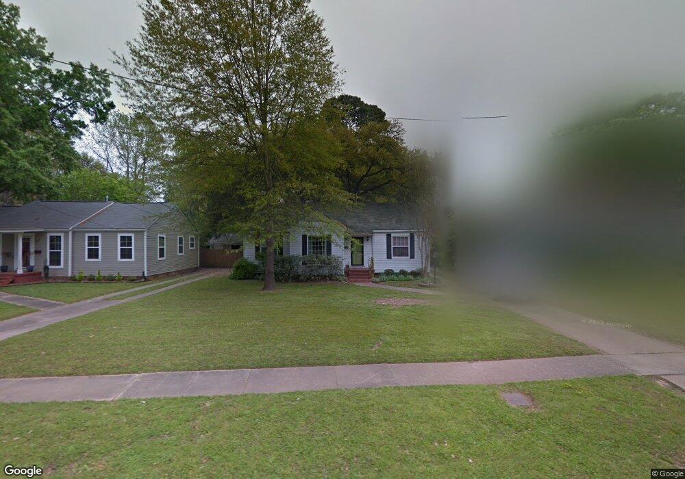
247 Atlantic Ave Shreveport, LA 71105
Broadmoor/Anderson Island/Shreve Isle NeighborhoodEstimated Value: $173,000 - $206,000
3
Beds
1
Bath
1,595
Sq Ft
$122/Sq Ft
Est. Value
About This Home
This home is located at 247 Atlantic Ave, Shreveport, LA 71105 and is currently estimated at $194,000, approximately $121 per square foot. 247 Atlantic Ave is a home located in Caddo Parish with nearby schools including Broadmoor STEM Academy, Fairfield Magnet School, and Eden Gardens Fundamental Elementary School.
Ownership History
Date
Name
Owned For
Owner Type
Purchase Details
Closed on
Jan 10, 2014
Sold by
Maddox Rhonda Branch and Maddox Todd A
Bought by
Abrams Angela David and Abrams David Matthews
Current Estimated Value
Home Financials for this Owner
Home Financials are based on the most recent Mortgage that was taken out on this home.
Original Mortgage
$143,100
Outstanding Balance
$107,825
Interest Rate
4.34%
Mortgage Type
Unknown
Estimated Equity
$86,175
Create a Home Valuation Report for This Property
The Home Valuation Report is an in-depth analysis detailing your home's value as well as a comparison with similar homes in the area
Home Values in the Area
Average Home Value in this Area
Purchase History
| Date | Buyer | Sale Price | Title Company |
|---|---|---|---|
| Abrams Angela David | $159,000 | Pierremont Title |
Source: Public Records
Mortgage History
| Date | Status | Borrower | Loan Amount |
|---|---|---|---|
| Open | Abrams Angela David | $143,100 |
Source: Public Records
Tax History Compared to Growth
Tax History
| Year | Tax Paid | Tax Assessment Tax Assessment Total Assessment is a certain percentage of the fair market value that is determined by local assessors to be the total taxable value of land and additions on the property. | Land | Improvement |
|---|---|---|---|---|
| 2024 | $2,059 | $13,206 | $3,954 | $9,252 |
| 2023 | $1,940 | $12,170 | $3,766 | $8,404 |
| 2022 | $1,940 | $12,170 | $3,766 | $8,404 |
| 2021 | $1,910 | $12,170 | $3,766 | $8,404 |
| 2020 | $1,910 | $12,170 | $3,766 | $8,404 |
| 2019 | $1,972 | $12,195 | $3,766 | $8,429 |
| 2018 | $605 | $12,195 | $3,766 | $8,429 |
| 2017 | $2,003 | $12,195 | $3,766 | $8,429 |
| 2015 | $581 | $11,980 | $3,770 | $8,210 |
| 2014 | $585 | $11,980 | $3,770 | $8,210 |
| 2013 | -- | $11,980 | $3,770 | $8,210 |
Source: Public Records
Map
Nearby Homes
- 187 Atlantic Ave
- 226 Albert Ave
- 202 Preston Ave
- 902 Anniston Ave
- 240 Carrollton Ave
- 266 Carrollton Ave
- 230 Pennsylvania Ave
- 174 Carrollton Ave
- 271 Carrollton Ave
- 153 Carrollton Ave
- 117 Preston Ave
- 129 Carrollton Ave
- 107 Preston Ave
- 246 Russell Ave
- 910 E Kings Hwy
- 106 Leo Ave
- 147 Pennsylvania Ave
- 382 Ockley Dr
- 171 Archer Ave
- 297 Pennsylvania Ave
- 241 Atlantic Ave
- 253 Atlantic Ave
- 259 Atlantic Ave
- 235 Atlantic Ave
- 265 Atlantic Ave
- 229 Atlantic Ave
- 260 Patton Ave
- 256 Patton Ave
- 271 Atlantic Ave
- 236 Atlantic Ave
- 225 Atlantic Ave
- 266 Patton Ave
- 232 Atlantic Ave
- 232 Atlantic Ave
- 242 Patton Ave
- 242 Atlantic Ave
- 230 Atlantic Ave
- 274 Patton Ave
- 246 Atlantic Ave
- 226 Atlantic Ave