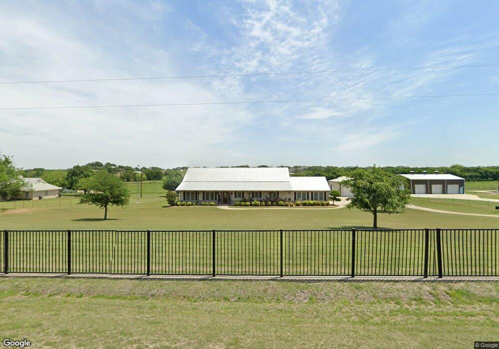
248 Edward Farris Rd Weatherford, TX 76085
Estimated Value: $537,000 - $742,000
--
Bed
--
Bath
2,855
Sq Ft
$230/Sq Ft
Est. Value
About This Home
This home is located at 248 Edward Farris Rd, Weatherford, TX 76085 and is currently estimated at $655,485, approximately $229 per square foot. 248 Edward Farris Rd is a home located in Parker County with nearby schools including Silver Creek Elementary School, Azle Elementary School, and Azle Junior High School.
Ownership History
Date
Name
Owned For
Owner Type
Purchase Details
Closed on
Jun 8, 2005
Sold by
Veterans Land Board
Bought by
Gilbert Darrell L and Gilbert Vickey M
Current Estimated Value
Purchase Details
Closed on
May 31, 2005
Sold by
Gilbert Darrel L and Gilbert Vickey M
Bought by
Massey James V and Massey Melissa K
Purchase Details
Closed on
Jul 10, 2003
Sold by
Gilbert Dalton Ladell
Bought by
Massey James V and Massey Melissa
Purchase Details
Closed on
Jul 23, 1998
Bought by
Massey James V and Massey Melissa
Purchase Details
Closed on
Sep 19, 1997
Bought by
Massey James V and Massey Melissa
Purchase Details
Closed on
Jan 1, 1901
Bought by
Massey James V and Massey Melissa
Create a Home Valuation Report for This Property
The Home Valuation Report is an in-depth analysis detailing your home's value as well as a comparison with similar homes in the area
Home Values in the Area
Average Home Value in this Area
Purchase History
| Date | Buyer | Sale Price | Title Company |
|---|---|---|---|
| Gilbert Darrell L | $23,500 | None Available | |
| Massey James V | -- | None Available | |
| Massey James V | -- | -- | |
| Massey James V | -- | -- | |
| Massey James V | -- | -- | |
| Massey James V | -- | -- |
Source: Public Records
Tax History Compared to Growth
Tax History
| Year | Tax Paid | Tax Assessment Tax Assessment Total Assessment is a certain percentage of the fair market value that is determined by local assessors to be the total taxable value of land and additions on the property. | Land | Improvement |
|---|---|---|---|---|
| 2025 | $3,100 | $573,540 | -- | -- |
| 2024 | $3,100 | $521,400 | -- | -- |
| 2023 | $3,100 | $474,000 | $0 | $0 |
| 2022 | $7,974 | $460,110 | $117,470 | $342,640 |
| 2021 | $7,595 | $460,110 | $117,470 | $342,640 |
| 2020 | $6,867 | $398,210 | $108,910 | $289,300 |
| 2019 | $6,617 | $398,210 | $108,910 | $289,300 |
| 2018 | $6,034 | $294,320 | $70,290 | $224,030 |
| 2017 | $5,750 | $294,320 | $70,290 | $224,030 |
| 2016 | $5,358 | $274,240 | $50,210 | $224,030 |
| 2015 | $1,975 | $274,240 | $50,210 | $224,030 |
| 2014 | $5,098 | $271,120 | $50,210 | $220,910 |
Source: Public Records
Map
Nearby Homes
- 100 Oak Meadow Ln
- 341 Oak Meadow Ln
- 105 Ash Ln
- 629 Bent Tree Ln
- The Wilder Plan at Brooks Meadow
- The Ryder Plan at Brooks Meadow
- The Curran Plan at Brooks Meadow
- The Bennett Plan at Brooks Meadow
- The Jackson Plan at Brooks Meadow
- The Hunter Plan at Brooks Meadow
- The Aylin Plan at Brooks Meadow
- The Wellington II Plan at Brooks Meadow
- 683 Bent Tree Ln
- The Greyson II Plan at Brooks Meadow
- 687 Bent Tree Ln
- 1057 Silver Sage Trail
- 313 Oak Meadow Ln
- 1046 Silver Sage Trail
- 1033 Silver Sage Trail
- 1050 Silver Sage Trail
- 260 Edward Farris Rd
- 236 Edward Farris Rd
- 272 Edward Farris Rd
- 261 Edward Farris Rd
- 249 Edward Farris Rd
- 212 Edward Farris Rd
- 284 Edward Farris Rd
- 237 Edward Farris Rd
- 273 Edward Farris Rd
- 213 Edward Farris Rd
- 200 Edward Farris Rd
- 285 Edward Farris Rd
- 451 Finney Dr
- 401 Finney Dr
- 201 Edward Farris Rd
- 7344 Comer Ln
- 7344 Comer Ln
- 351 Finney Dr
- 180 Edward Farris Rd
- 253 Finney Dr