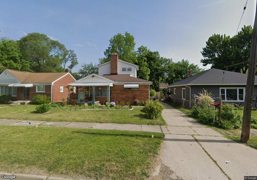
248 Voorheis St Pontiac, MI 48341
Estimated Value: $174,000 - $213,000
4
Beds
2
Baths
835
Sq Ft
$235/Sq Ft
Est. Value
About This Home
This home is located at 248 Voorheis St, Pontiac, MI 48341 and is currently estimated at $196,120, approximately $234 per square foot. 248 Voorheis St is a home located in Oakland County with nearby schools including Walt Whitman Elementary School, Pontiac Middle School, and Pontiac High School.
Ownership History
Date
Name
Owned For
Owner Type
Purchase Details
Closed on
Mar 19, 2013
Sold by
Fields Snow
Bought by
Fields Melvin and Fields Snow
Current Estimated Value
Purchase Details
Closed on
May 22, 1997
Sold by
Thompson Lorene E
Bought by
Fields Snow
Home Financials for this Owner
Home Financials are based on the most recent Mortgage that was taken out on this home.
Original Mortgage
$57,311
Outstanding Balance
$7,938
Interest Rate
8.13%
Estimated Equity
$188,182
Create a Home Valuation Report for This Property
The Home Valuation Report is an in-depth analysis detailing your home's value as well as a comparison with similar homes in the area
Home Values in the Area
Average Home Value in this Area
Purchase History
| Date | Buyer | Sale Price | Title Company |
|---|---|---|---|
| Fields Melvin | -- | None Available | |
| Fields Snow | $58,500 | -- |
Source: Public Records
Mortgage History
| Date | Status | Borrower | Loan Amount |
|---|---|---|---|
| Open | Fields Snow | $57,311 |
Source: Public Records
Tax History Compared to Growth
Tax History
| Year | Tax Paid | Tax Assessment Tax Assessment Total Assessment is a certain percentage of the fair market value that is determined by local assessors to be the total taxable value of land and additions on the property. | Land | Improvement |
|---|---|---|---|---|
| 2024 | $1,826 | $76,330 | $0 | $0 |
| 2023 | $1,740 | $67,430 | $0 | $0 |
| 2022 | $1,195 | $61,560 | $0 | $0 |
| 2021 | $1,613 | $52,770 | $0 | $0 |
| 2020 | $1,058 | $47,560 | $0 | $0 |
| 2019 | $1,133 | $40,810 | $0 | $0 |
| 2018 | $1,094 | $39,270 | $0 | $0 |
| 2017 | $1,034 | $36,020 | $0 | $0 |
| 2016 | $1,058 | $32,030 | $0 | $0 |
| 2015 | -- | $29,520 | $0 | $0 |
| 2014 | -- | $26,840 | $0 | $0 |
| 2011 | -- | $33,800 | $0 | $0 |
Source: Public Records
Map
Nearby Homes
- 10 Wenonah Dr
- 8 Myra Ave
- 181 Navajo Ave
- 10 Niagara Ave
- 243 Cherokee Rd
- 166 Cherokee Rd
- 871 Menominee Rd
- 26 Edna Ave
- 14 Riverbank Dr Unit 300-114
- 12 Edna Ave
- 117 E Iroquois Rd
- 25 Riverbank Dr Unit 300-125
- 27 Riverbank Dr Unit 300-127
- 21 Canal Dr Unit 300-021
- 14 Canal Dr Unit 300-014
- 49 Canal Dr Unit 300-049
- 38 Canal Dr Unit 300-038
- 990 Voorheis Rd
- V/L W Huron St
- 832 W Huron St
- 242 Voorheis St
- 252 Voorheis St
- 258 Voorheis St
- 238 Voorheis St
- 29 Illinois Ave
- 264 Voorheis St
- 232 Voorheis St
- 23 Illinois Ave
- Vac Lot - Voorheis St
- VL Voorheis St
- 33 Illinois Ave
- 249 Voorheis St
- 251 Voorheis St
- 239 Voorheis St
- 11 Illinois Ave
- 39 Illinois Ave
- 261 Voorheis St
- 262 Navajo Ave
- 270 Navajo Ave