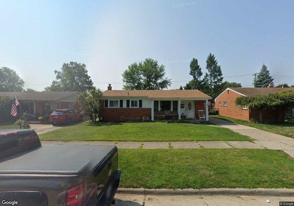
24863 Powers Ave Dearborn Heights, MI 48125
Estimated Value: $166,000 - $176,000
3
Beds
1
Bath
1,014
Sq Ft
$169/Sq Ft
Est. Value
About This Home
This home is located at 24863 Powers Ave, Dearborn Heights, MI 48125 and is currently estimated at $171,130, approximately $168 per square foot. 24863 Powers Ave is a home located in Wayne County with nearby schools including West Village Academy and Quest Charter Academy.
Ownership History
Date
Name
Owned For
Owner Type
Purchase Details
Closed on
Feb 5, 2025
Sold by
Kochie Lisa and Kochie Robert
Bought by
Kochie Robert and Kochie Lisa
Current Estimated Value
Purchase Details
Closed on
Mar 13, 2006
Sold by
Hamilton James and Hamilton Loretta
Bought by
Hamilton James
Purchase Details
Closed on
May 27, 2005
Sold by
Estate Of Regina J Tomei
Bought by
Hamilton James
Purchase Details
Closed on
Jul 23, 2002
Sold by
Sayger Laura
Bought by
Tomei Regina J
Create a Home Valuation Report for This Property
The Home Valuation Report is an in-depth analysis detailing your home's value as well as a comparison with similar homes in the area
Home Values in the Area
Average Home Value in this Area
Purchase History
| Date | Buyer | Sale Price | Title Company |
|---|---|---|---|
| Kochie Robert | -- | None Listed On Document | |
| Kochie Robert | -- | None Listed On Document | |
| Hamilton James | -- | None Available | |
| Hamilton James | $131,660 | Commonwealth Land Title | |
| Estate Of Regina J Tomei | -- | Guardian Title Agency Inc | |
| Tomei Regina J | -- | -- |
Source: Public Records
Tax History Compared to Growth
Tax History
| Year | Tax Paid | Tax Assessment Tax Assessment Total Assessment is a certain percentage of the fair market value that is determined by local assessors to be the total taxable value of land and additions on the property. | Land | Improvement |
|---|---|---|---|---|
| 2025 | $1,863 | $81,800 | $0 | $0 |
| 2024 | $1,863 | $74,700 | $0 | $0 |
| 2023 | $1,693 | $65,000 | $0 | $0 |
| 2022 | $1,819 | $55,800 | $0 | $0 |
| 2021 | $1,822 | $48,000 | $0 | $0 |
| 2019 | $1,661 | $38,400 | $0 | $0 |
| 2018 | $1,162 | $35,000 | $0 | $0 |
| 2017 | $911 | $34,500 | $0 | $0 |
| 2016 | $1,579 | $35,000 | $0 | $0 |
| 2015 | $3,260 | $32,600 | $0 | $0 |
| 2013 | $3,260 | $33,400 | $0 | $0 |
| 2010 | -- | $41,400 | $0 | $0 |
Source: Public Records
Map
Nearby Homes
- 4856 Carolee Ln
- 24443 Powers Ave
- 5118 Michael St
- 24754 Annapolis St
- 24360 Pennie St
- 24727 Hopkins St
- 24339 Eton Ave
- 25474 McDonald St
- 5963 Vivian St
- 25628 Powers Ave
- 25243 Lehigh St
- 25118 Lehigh St
- 24117 Eton Ave
- 6020 Vivian St
- 25212 Lehigh St
- 24035 Currier St
- 24635 Stanford St
- 4147 Westlake St
- 6055 Bailey St
- 24426 Lehigh St
- 24851 Powers Ave
- 24903 Powers Ave
- 24839 Powers Ave
- 25026 Currier St
- 25014 Currier St
- 25002 Currier St
- 24840 Currier St
- 5190 Westlake St
- 25038 Currier St
- 24915 Powers Ave
- 24923 Powers Ave
- 24825 Powers Ave
- 5191 Westlake St
- 25050 Currier St
- 24916 Powers Ave
- 24931 Powers Ave
- 24816 Currier St
- 5172 Westlake St
- 24811 Powers Ave
- 5173 Westlake St