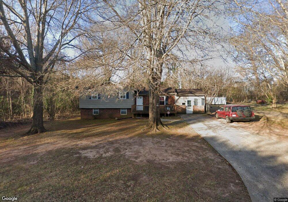
249 Hardin Rd Forest City, NC 28043
Estimated Value: $248,000 - $290,000
4
Beds
2
Baths
2,190
Sq Ft
$123/Sq Ft
Est. Value
About This Home
This home is located at 249 Hardin Rd, Forest City, NC 28043 and is currently estimated at $268,700, approximately $122 per square foot. 249 Hardin Rd is a home located in Rutherford County with nearby schools including Forest City-Dunbar Elementary School, East Rutherford Middle School, and East Rutherford High School.
Ownership History
Date
Name
Owned For
Owner Type
Purchase Details
Closed on
Jun 29, 2007
Sold by
Roderick Steven A and Roderick Dana D
Bought by
Wilkerson William H and Wilkerson Sharlene L
Current Estimated Value
Home Financials for this Owner
Home Financials are based on the most recent Mortgage that was taken out on this home.
Original Mortgage
$84,500
Outstanding Balance
$52,870
Interest Rate
6.52%
Mortgage Type
New Conventional
Estimated Equity
$215,830
Purchase Details
Closed on
May 4, 2006
Sold by
State Street Bank & Trust Company
Bought by
Roderick Steven A and Roderick Dana D
Home Financials for this Owner
Home Financials are based on the most recent Mortgage that was taken out on this home.
Original Mortgage
$63,800
Interest Rate
6.54%
Mortgage Type
Credit Line Revolving
Purchase Details
Closed on
Jan 25, 2005
Sold by
Tate Henry and Tate Robyn
Bought by
State Street Bank & Trust Co
Create a Home Valuation Report for This Property
The Home Valuation Report is an in-depth analysis detailing your home's value as well as a comparison with similar homes in the area
Home Values in the Area
Average Home Value in this Area
Purchase History
| Date | Buyer | Sale Price | Title Company |
|---|---|---|---|
| Wilkerson William H | $84,500 | None Avileabel | |
| Roderick Steven A | $44,000 | None Available | |
| State Street Bank & Trust Co | $47,000 | None Avelable |
Source: Public Records
Mortgage History
| Date | Status | Borrower | Loan Amount |
|---|---|---|---|
| Open | Wilkerson William H | $84,500 | |
| Previous Owner | Roderick Steven A | $63,800 |
Source: Public Records
Tax History Compared to Growth
Tax History
| Year | Tax Paid | Tax Assessment Tax Assessment Total Assessment is a certain percentage of the fair market value that is determined by local assessors to be the total taxable value of land and additions on the property. | Land | Improvement |
|---|---|---|---|---|
| 2025 | $2,215 | $207,900 | $12,000 | $195,900 |
| 2024 | $2,173 | $207,900 | $12,000 | $195,900 |
| 2023 | $1,450 | $207,900 | $12,000 | $195,900 |
| 2022 | $1,450 | $121,500 | $15,400 | $106,100 |
| 2021 | $1,074 | $121,500 | $15,400 | $106,100 |
| 2020 | $1,074 | $121,500 | $15,400 | $106,100 |
| 2019 | $1,066 | $121,500 | $15,400 | $106,100 |
| 2018 | $794 | $88,500 | $8,000 | $80,500 |
| 2016 | $794 | $88,500 | $8,000 | $80,500 |
| 2013 | -- | $88,500 | $8,000 | $80,500 |
Source: Public Records
Map
Nearby Homes
- 183 Caldwell St
- 168 Collins Ave
- 0 Hardin Rd
- 179 Sedgefield Dr
- 311 Franklin Dr
- 230 Mcarthur St
- 148 Westhaven St
- 0000 Butler Rd
- 108 W Spruce St
- 229 W Liberty St
- 272 Washington St
- 324 Harmon St
- 115 Hill St
- 1180 Piney Ridge Rd
- 187 Oakridge Dr
- 0 Commercial Dr Unit CAR4102089
- Lot 23 Commercial Dr
- Lot 19 Commercial Dr
- Lot 20 Commercial Dr
- Lot 21 Commercial Dr