L
Seller's Agent in 2022
Leo Lisitsyn
Dani Blain Real Estate, Inc


Estimated Value: $206,000 - $282,000
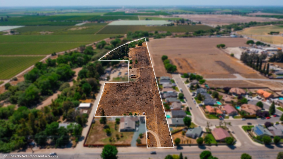
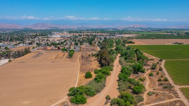
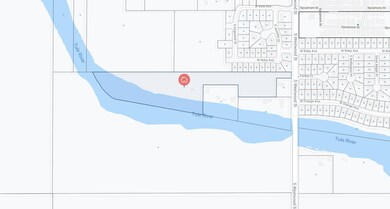
Own 14.31 Acres! The property has been in family hands since 1896. The water is the purest, sweetest water you will ever taste. Forever unbordered by dairies and vineyards, it has never been tainted with pollution from man made chemical contaminants. It is filtered through the deep sands of the aquifer running underneath the Tule River and is replenished annually both by rainfall and, thanks to the river, the snowpack up in the Sierras. Mandated by law and the Lower Tule Irrigation District's rights to water from Lake Success, the ''Riparian Run'' (in June) assures the annual replenishment of the aquifer. The soil is sandy loam and it is not beset by the plague of adobe, caliche, compaction, or ANY other difficult-to-work profiles underneath the surface. There are some rocks WAY down deep, but even they have not hindered any efforts to drill a well on the north side of the river. The soil tends toward the alkaline side of the pH scale, running about 7.5 or 7.6 as the seller recalls.
Last Agent to Sell the Property
Leo Lisitsyn
Dani Blain Real Estate, Inc Listed on: 01/27/2022
Last Buyer's Agent
Michael Sanchez
Century 21 Jordan-Link & Co.
| Date | Buyer | Sale Price | Title Company |
|---|---|---|---|
| Porterville Irrigation District | -- | -- | |
| Prestage David R | -- | None Available |
| Date | Event | Price | List to Sale | Price per Sq Ft |
|---|---|---|---|---|
| 04/21/2022 04/21/22 | Sold | $219,900 | -4.3% | -- |
| 03/30/2022 03/30/22 | Pending | -- | -- | -- |
| 01/27/2022 01/27/22 | For Sale | $229,900 | -- | -- |
| Year | Tax Paid | Tax Assessment Tax Assessment Total Assessment is a certain percentage of the fair market value that is determined by local assessors to be the total taxable value of land and additions on the property. | Land | Improvement |
|---|---|---|---|---|
| 2025 | $801 | $232,935 | $232,935 | -- |
| 2024 | $801 | $73,970 | $62,092 | $11,878 |
| 2023 | $1,245 | $112,761 | $60,875 | $51,886 |
| 2022 | $1,206 | $110,551 | $59,682 | $50,869 |
| 2021 | $1,192 | $108,383 | $58,512 | $49,871 |
| 2020 | $1,180 | $107,271 | $57,912 | $49,359 |
| 2019 | $1,158 | $105,167 | $56,776 | $48,391 |
| 2018 | $1,138 | $103,105 | $55,663 | $47,442 |
| 2017 | $1,110 | $101,084 | $54,572 | $46,512 |
| 2016 | $1,065 | $99,102 | $53,502 | $45,600 |
| 2015 | $1,024 | $97,613 | $52,698 | $44,915 |
| 2014 | $1,024 | $95,702 | $51,666 | $44,036 |
L
Seller's Agent in 2022
Leo Lisitsyn
Dani Blain Real Estate, Inc
M
Buyer's Agent in 2022
Michael Sanchez
Century 21 Jordan-Link & Co.
Source: Tulare County MLS
MLS Number: 215500
APN: 240-120-042-000
Disclaimer: Certain information contained herein is derived from information provided by parties other than Homes.com. All information provided is deemed reliable, but is not guaranteed to be accurate and should be independently verified.
![]() Based on information from the Tulare County Association of REALTORS®. All data, including all measurements and calculations of area, is obtained from various sources and has not been, and will not be, verified by broker or MLS. All information should be independently reviewed and verified for accuracy. Properties may or may not be listed by the office/agent presenting the information.
Based on information from the Tulare County Association of REALTORS®. All data, including all measurements and calculations of area, is obtained from various sources and has not been, and will not be, verified by broker or MLS. All information should be independently reviewed and verified for accuracy. Properties may or may not be listed by the office/agent presenting the information.