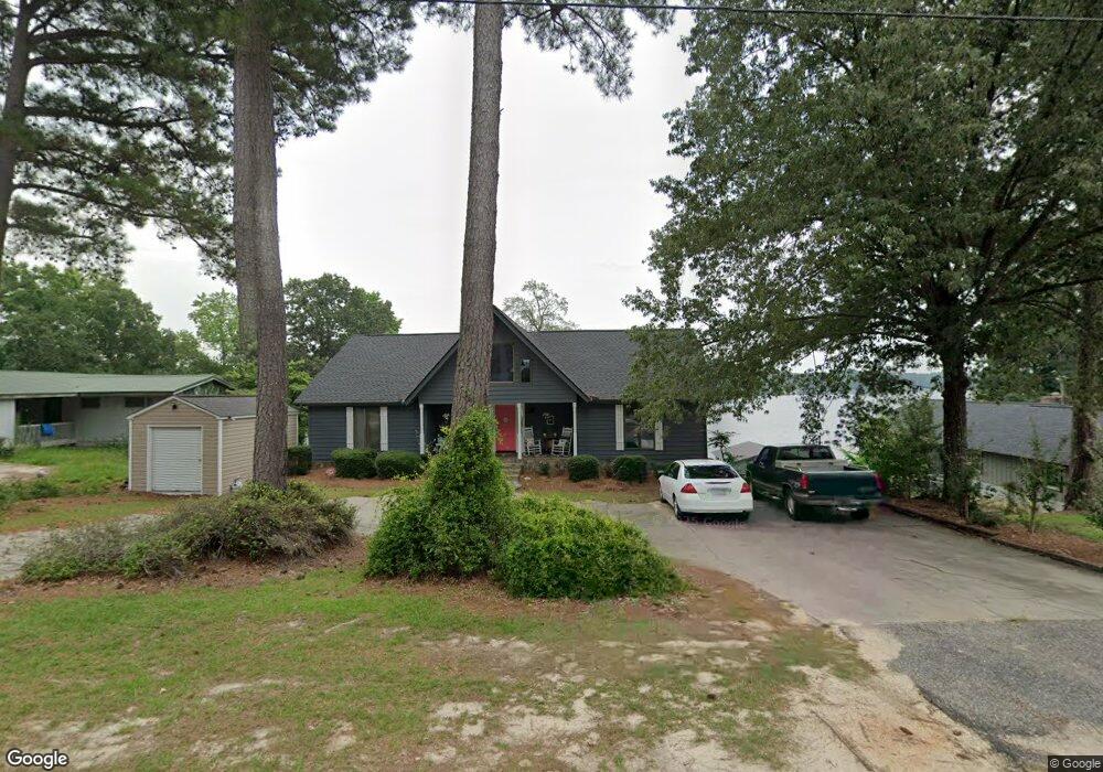
249 Sandy Point Ln Hartsville, SC 29550
Estimated Value: $312,834 - $591,000
--
Bed
--
Bath
--
Sq Ft
0.35
Acres
About This Home
This home is located at 249 Sandy Point Ln, Hartsville, SC 29550 and is currently estimated at $459,209. 249 Sandy Point Ln is a home with nearby schools including McBee Elementary School, McBee High School, and New Heights Middle School.
Ownership History
Date
Name
Owned For
Owner Type
Purchase Details
Closed on
Mar 23, 2015
Sold by
Bansiewicz Joseph Ted and Banasiewicz Patricia
Bought by
Banasiewicz Brent J and Banasiewicz Kimberly
Current Estimated Value
Home Financials for this Owner
Home Financials are based on the most recent Mortgage that was taken out on this home.
Original Mortgage
$94,950,000
Outstanding Balance
$34,482,224
Interest Rate
3.89%
Mortgage Type
Commercial
Estimated Equity
-$34,023,015
Create a Home Valuation Report for This Property
The Home Valuation Report is an in-depth analysis detailing your home's value as well as a comparison with similar homes in the area
Home Values in the Area
Average Home Value in this Area
Purchase History
| Date | Buyer | Sale Price | Title Company |
|---|---|---|---|
| Banasiewicz Brent J | $315,000 | None Available |
Source: Public Records
Mortgage History
| Date | Status | Borrower | Loan Amount |
|---|---|---|---|
| Open | Banasiewicz Brent J | $94,950,000 |
Source: Public Records
Tax History Compared to Growth
Tax History
| Year | Tax Paid | Tax Assessment Tax Assessment Total Assessment is a certain percentage of the fair market value that is determined by local assessors to be the total taxable value of land and additions on the property. | Land | Improvement |
|---|---|---|---|---|
| 2024 | $1,749 | $13,530 | $3,400 | $10,130 |
| 2023 | $1,677 | $13,530 | $3,400 | $10,130 |
| 2022 | $1,591 | $13,530 | $3,400 | $10,130 |
| 2021 | $1,584 | $13,530 | $3,400 | $10,130 |
| 2020 | $4,871 | $13,530 | $3,400 | $10,130 |
| 2019 | $4,906 | $13,530 | $3,400 | $10,130 |
| 2018 | $4,798 | $13,530 | $3,400 | $10,130 |
| 2015 | $1,281 | $20,300 | $5,100 | $15,200 |
| 2014 | $1,103 | $13,470 | $3,400 | $10,070 |
| 2010 | -- | $11,500 | $4,000 | $7,500 |
Source: Public Records
Map
Nearby Homes
- TBD Sailclub Rd (Tm#164) State Rd S-13-674
- TBD Sail Club Road Tm#160 (State Rd S-13-674)
- 4211 Middendorf Rd
- 958 Sailclub Rd
- TBD Sail Club Rd (State Rd S-13-674) Tms 162
- 2600 Robinson View Dr
- 2545 Robinson View Dr
- 165 Forest Dr
- 000 Overflow Rd
- 0 New Market Rd
- 52 Scott Pond Rd
- 0 Peace Ln
- 000 Peace Ln
- 2606 Bullard Ford Rd
- 2800 Bullard Ford Rd
- 291 Peace Ln
- 3 Harold Funderburke Ln
- TBD Regency Dr
- TBD 11 acres Ousleydale Rd
- TBD 8.5 Ousleydale Rd
- 235 Sandy Point Ln
- 268 Sandy Point Ln
- 303 Sandy Point Ln
- 306 Sandy Point Ln
- 310 Sandy Point Ln
- 180 Sandy Point Ln
- 12 Sandy Point Ln
- 163 Sandy Point Ln
- 347 Sandy Point Ln
- 355 Sandy Point Ln
- 377 Sandy Point Ln
- 586 Sandy Point Ln
- 462 Sandy Point Ln
- 403 Sandy Point Ln
- 614 Sandy Point Ln
- 184 Ski Cove Ln
- 187 Ski Cove Ln
- 178 Ski Cove Ln
- 419 Sandy Point Ln
- 168 Ski Cove Ln