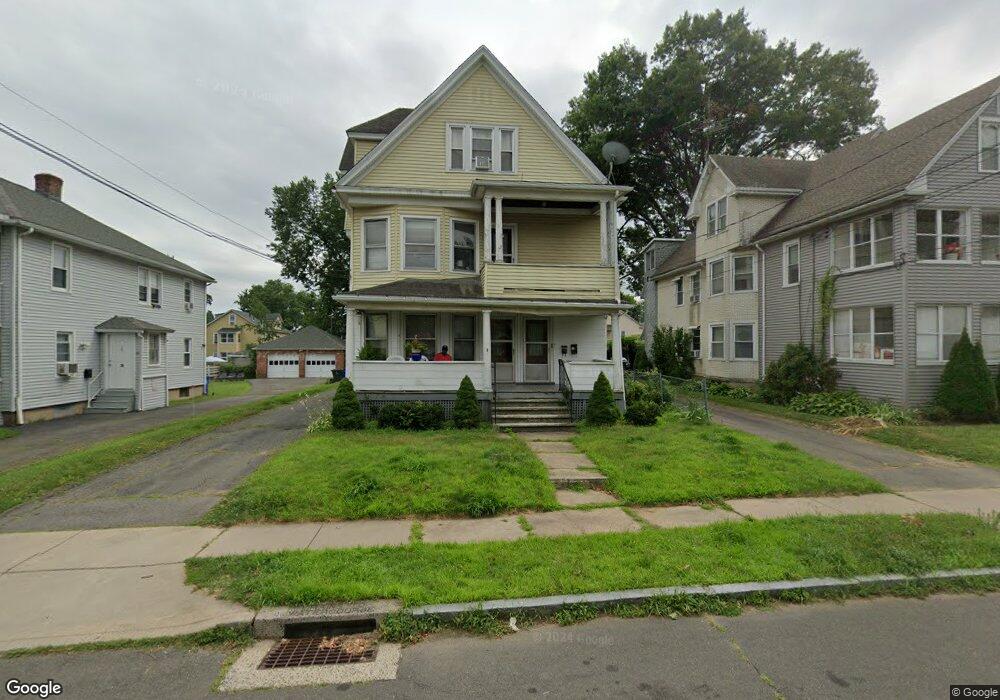
25 Crosby St West Hartford, CT 06119
Estimated Value: $500,928 - $653,000
5
Beds
3
Baths
3,739
Sq Ft
$151/Sq Ft
Est. Value
About This Home
This home is located at 25 Crosby St, West Hartford, CT 06119 and is currently estimated at $564,732, approximately $151 per square foot. 25 Crosby St is a home located in Hartford County with nearby schools including Whiting Lane School, Adams Elementary School, and King Philip Middle School.
Ownership History
Date
Name
Owned For
Owner Type
Purchase Details
Closed on
Jan 28, 2014
Sold by
Lansing Joseph and Lansing Mary E
Bought by
Crosby Wh Llc
Current Estimated Value
Purchase Details
Closed on
Jul 27, 2010
Sold by
Glorighian Bedros
Bought by
Lansing Joseph and Lansing Mary E
Home Financials for this Owner
Home Financials are based on the most recent Mortgage that was taken out on this home.
Original Mortgage
$21,875
Interest Rate
4.76%
Create a Home Valuation Report for This Property
The Home Valuation Report is an in-depth analysis detailing your home's value as well as a comparison with similar homes in the area
Home Values in the Area
Average Home Value in this Area
Purchase History
| Date | Buyer | Sale Price | Title Company |
|---|---|---|---|
| Crosby Wh Llc | -- | -- | |
| Lansing Joseph | $282,500 | -- |
Source: Public Records
Mortgage History
| Date | Status | Borrower | Loan Amount |
|---|---|---|---|
| Previous Owner | Lansing Joseph | $21,875 |
Source: Public Records
Tax History Compared to Growth
Tax History
| Year | Tax Paid | Tax Assessment Tax Assessment Total Assessment is a certain percentage of the fair market value that is determined by local assessors to be the total taxable value of land and additions on the property. | Land | Improvement |
|---|---|---|---|---|
| 2025 | $11,269 | $251,650 | $49,280 | $202,370 |
| 2024 | $10,657 | $251,650 | $49,280 | $202,370 |
| 2023 | $10,298 | $251,650 | $49,280 | $202,370 |
| 2022 | $10,237 | $251,650 | $49,280 | $202,370 |
| 2021 | $9,796 | $230,930 | $44,800 | $186,130 |
| 2020 | $8,801 | $210,560 | $38,430 | $172,130 |
| 2019 | $8,801 | $210,560 | $38,430 | $172,130 |
| 2018 | $8,633 | $210,560 | $38,430 | $172,130 |
| 2017 | $8,641 | $210,560 | $38,430 | $172,130 |
| 2016 | $8,159 | $206,500 | $51,940 | $154,560 |
| 2015 | $7,911 | $206,500 | $51,940 | $154,560 |
| 2014 | $7,717 | $206,500 | $51,940 | $154,560 |
Source: Public Records
Map
Nearby Homes
- 102 Oakwood Ave Unit B5
- 39 Fairlawn St
- 21 Warren Terrace
- 89 Price Blvd
- 136 Kane St Unit B10
- 100 Kane St Unit D10
- 16 Lockwood Terrace
- 50 Acadia St
- 72 Saint Charles St
- 90-92 Rowe Ave
- 478 Prospect Ave
- 101 Madison Ave
- 99 Caya Ave
- 89 Madison Ave Unit 91
- 26 Saint Augustine St
- 54 James St Unit 56
- 518 Prospect Ave
- 69 Saint Augustine St
- 126 Heath St
- 39 S Whitney St
- 29 Crosby St
- 21 Crosby St
- 35 Crosby St
- 17 Crosby St
- 11 Crosby St
- 37 Crosby St
- 46 Gillette St
- 50 Gillette St
- 42 Gillette St
- 17 Kingston St
- 54 Gillette St
- 36 Kingston St Unit 1st
- 36 Kingston St Unit 3rd floor
- 36 Kingston St
- 38 Gillette St
- 35 Kingston St
- 43 Crosby St
- 58 Gillette St
- 34 Gillette St
- 32 Kingston St