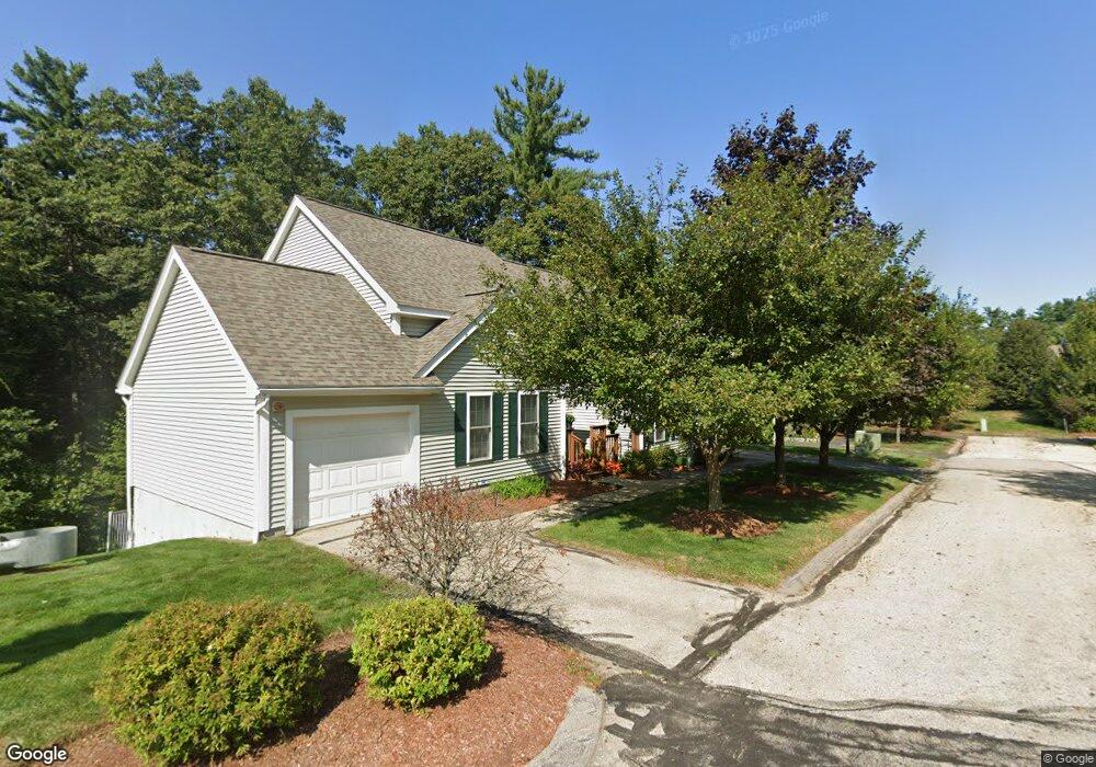
25 Gray Hawk Rd Merrimack, NH 03054
Estimated Value: $423,000 - $478,371
2
Beds
2
Baths
1,637
Sq Ft
$279/Sq Ft
Est. Value
About This Home
This home is located at 25 Gray Hawk Rd, Merrimack, NH 03054 and is currently estimated at $456,593, approximately $278 per square foot. 25 Gray Hawk Rd is a home located in Hillsborough County with nearby schools including Thorntons Ferry School, Merrimack Middle School, and James Mastricola Upper Elementary School.
Ownership History
Date
Name
Owned For
Owner Type
Purchase Details
Closed on
May 6, 2025
Sold by
Bonke Joanne and Bonke Stefan A
Bought by
Bonke Ft and Bonke
Current Estimated Value
Purchase Details
Closed on
Sep 5, 2014
Sold by
Moore Keith E and Moore Phyllis J
Bought by
Bonke Stefan A and Bonke Joanne
Purchase Details
Closed on
Jul 1, 2010
Sold by
Nicolai Maria G
Bought by
Moore Keith E and Moore Phyllis J
Create a Home Valuation Report for This Property
The Home Valuation Report is an in-depth analysis detailing your home's value as well as a comparison with similar homes in the area
Home Values in the Area
Average Home Value in this Area
Purchase History
| Date | Buyer | Sale Price | Title Company |
|---|---|---|---|
| Bonke Ft | -- | None Available | |
| Bonke Ft | -- | None Available | |
| Bonke Stefan A | $223,000 | -- | |
| Bonke Stefan A | $223,000 | -- | |
| Moore Keith E | $185,000 | -- | |
| Moore Keith E | $185,000 | -- |
Source: Public Records
Mortgage History
| Date | Status | Borrower | Loan Amount |
|---|---|---|---|
| Previous Owner | Moore Keith E | $100,000 | |
| Closed | Moore Keith E | $0 |
Source: Public Records
Tax History Compared to Growth
Tax History
| Year | Tax Paid | Tax Assessment Tax Assessment Total Assessment is a certain percentage of the fair market value that is determined by local assessors to be the total taxable value of land and additions on the property. | Land | Improvement |
|---|---|---|---|---|
| 2024 | $7,171 | $346,600 | $0 | $346,600 |
| 2023 | $6,741 | $346,600 | $0 | $346,600 |
| 2022 | $6,024 | $346,600 | $0 | $346,600 |
| 2021 | $5,951 | $346,600 | $0 | $346,600 |
| 2020 | $5,517 | $229,300 | $0 | $229,300 |
| 2019 | $5,533 | $229,300 | $0 | $229,300 |
| 2018 | $5,531 | $229,300 | $0 | $229,300 |
| 2017 | $5,359 | $229,300 | $0 | $229,300 |
| 2016 | $5,226 | $229,300 | $0 | $229,300 |
| 2015 | $4,897 | $198,100 | $0 | $198,100 |
| 2014 | $4,763 | $197,700 | $0 | $197,700 |
| 2013 | $4,344 | $181,700 | $0 | $181,700 |
Source: Public Records
Map
Nearby Homes
- 5 Lynn Dr
- 7 Hadley Rd
- 8 Highland Green Ln
- 77 E Ridge Rd
- 23 Pondview Dr
- 27 Sarah Dr
- 3 Independence Dr
- 7 Beacon Dr
- 40 Turkey Hill Rd
- 5 Jennifer Dr Unit B
- 5 Jennifer Dr
- 5 Jennifer Dr Unit A
- 98 Indian Rock Rd
- 14 Mayflower Dr
- 343 Charles Bancroft Hwy
- 22 Clay St
- 14 Turnbuckle Ln Unit 38
- 5 Fernwood Dr
- 1 Longwood Ln
- 12 Clinton Ct
- 21 Cascade Cir
- 14 Cascade Cir
- 18 Echo Shore Dr
- 12 Echo Shore Dr
- 10 Echo Shore Dr
- 6 Clearwater Ln
- 6 Clearwater Ln Unit 21
- 20 Cascade Cir
- 2 Clearwater Ln
- 4 Clearwater Ln
- 20 Cascade Cir Unit 36
- 25 Gray Hawk Rd Unit 28
- 4 Clearwater Ln Unit 22
- 3 Cascade Cir
- 9 Cascade Cir
- 9 Cascade Cir Unit 41
- 23 Cascade Cir
- 8 Clearwater Ln
- 5 Cascade Cir
- 11 Cascade Cir