Estimated Value: $342,000 - $364,000
4
Beds
3
Baths
2,820
Sq Ft
$125/Sq Ft
Est. Value
About This Home
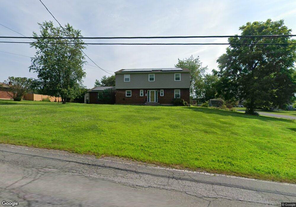
This home is located at 25 Police Grove Rd, Drums, PA 18222 and is currently estimated at $352,411, approximately $124 per square foot. 25 Police Grove Rd is a home located in Luzerne County with nearby schools including Hazleton Area High School.
Ownership History
Date
Name
Owned For
Owner Type
Purchase Details
Closed on
Mar 3, 2022
Sold by
Delaurentis and Lisa
Bought by
Ramsey Heather and Ramsey Derek
Current Estimated Value
Home Financials for this Owner
Home Financials are based on the most recent Mortgage that was taken out on this home.
Original Mortgage
$265,109
Outstanding Balance
$247,047
Interest Rate
3.69%
Mortgage Type
FHA
Estimated Equity
$105,364
Purchase Details
Closed on
Oct 25, 2007
Sold by
Bogdon Eugene C and Bogdon Jane
Bought by
Delaurentis Anthony and Delaurentis Lisa
Home Financials for this Owner
Home Financials are based on the most recent Mortgage that was taken out on this home.
Original Mortgage
$153,000
Interest Rate
6.39%
Mortgage Type
Purchase Money Mortgage
Create a Home Valuation Report for This Property
The Home Valuation Report is an in-depth analysis detailing your home's value as well as a comparison with similar homes in the area
Home Values in the Area
Average Home Value in this Area
Purchase History
| Date | Buyer | Sale Price | Title Company |
|---|---|---|---|
| Ramsey Heather | $270,000 | None Listed On Document | |
| Delaurentis Anthony | $180,000 | None Available |
Source: Public Records
Mortgage History
| Date | Status | Borrower | Loan Amount |
|---|---|---|---|
| Open | Ramsey Heather | $265,109 | |
| Previous Owner | Delaurentis Anthony | $153,000 |
Source: Public Records
Tax History Compared to Growth
Tax History
| Year | Tax Paid | Tax Assessment Tax Assessment Total Assessment is a certain percentage of the fair market value that is determined by local assessors to be the total taxable value of land and additions on the property. | Land | Improvement |
|---|---|---|---|---|
| 2025 | $4,115 | $198,900 | $36,800 | $162,100 |
| 2024 | $3,950 | $198,900 | $36,800 | $162,100 |
| 2023 | $3,874 | $198,900 | $36,800 | $162,100 |
| 2022 | $3,837 | $198,900 | $36,800 | $162,100 |
| 2021 | $3,722 | $198,900 | $36,800 | $162,100 |
| 2020 | $3,628 | $198,900 | $36,800 | $162,100 |
| 2019 | $3,478 | $198,900 | $36,800 | $162,100 |
| 2018 | $3,348 | $198,900 | $36,800 | $162,100 |
| 2017 | $3,276 | $198,900 | $36,800 | $162,100 |
| 2016 | -- | $198,900 | $36,800 | $162,100 |
| 2015 | $2,577 | $198,900 | $36,800 | $162,100 |
| 2014 | $2,577 | $198,900 | $36,800 | $162,100 |
Source: Public Records
Map
Nearby Homes
- 30 Kings Rd
- 70 Louis Cir
- 0 Saint Johns Rd
- LOT Saint Johns Rd
- 69 Old Saint Johns Ln
- 36 Lamont Dr
- 0 Middle Rd
- 0 S Beisels Rd
- 0 S Old Turnpike Rd
- 10 Bentwood Rd
- 733 Quarry Rd
- 35 Bentwood Rd
- Lot 11 Bentwood Rd
- 40 Reserve Dr
- 323 Long Run Rd
- 844 Champions Dr Unit 24B
- 846 Champions Dr Unit 24A
- 849 Champions Dr Unit 12A
- 849 Champions Dr
- Lot 70 Mountain Rd
- 22 Police Grove Rd
- 30 Police Grove Rd
- 138 Applegate Ln
- 18 Police Grove Rd
- 132 Applegate Ln
- 55 Rings Rd
- 128 Applegate Ln
- 14 Police Grove Rd
- 34 Police Grove Rd
- 13 Police Grove Rd
- 137 Applegate Ln
- 51 Kings Rd
- 126 Applegate Ln
- 38 Police Grove Rd
- 131 Applegate Ln
- 37 Police Grove Rd
- 10 Police Grove Rd
- 146 Woodring Rd
- 124 Applegate Ln
- 147 Woodring Rd