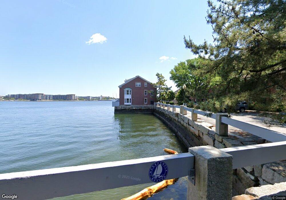
25 Union Wharf Unit 25 Boston, MA 02109
North End NeighborhoodEstimated Value: $3,099,675
3
Beds
3
Baths
2,304
Sq Ft
$1,345/Sq Ft
Est. Value
About This Home
This home is located at 25 Union Wharf Unit 25, Boston, MA 02109 and is currently estimated at $3,099,675, approximately $1,345 per square foot. 25 Union Wharf Unit 25 is a home located in Suffolk County with nearby schools including St John School, Boston Children's School, and Torit Montessori School.
Ownership History
Date
Name
Owned For
Owner Type
Purchase Details
Closed on
Aug 1, 2013
Sold by
Lee Timothy B and Lee Margaret J
Bought by
Collins Edward P and Ward Pamela G
Current Estimated Value
Purchase Details
Closed on
Jun 26, 2001
Sold by
Silversteina Lawrence
Bought by
Schubnel Raymond L
Purchase Details
Closed on
Mar 12, 1998
Sold by
Fox Gretchen
Bought by
Register David C and Register Victoria C
Purchase Details
Closed on
Sep 3, 1996
Sold by
2V Rt and Liston Raymond F
Bought by
Fox Gretchen P
Create a Home Valuation Report for This Property
The Home Valuation Report is an in-depth analysis detailing your home's value as well as a comparison with similar homes in the area
Home Values in the Area
Average Home Value in this Area
Purchase History
| Date | Buyer | Sale Price | Title Company |
|---|---|---|---|
| Collins Edward P | $1,457,625 | -- | |
| Collins Edward P | $1,457,625 | -- | |
| Schubnel Raymond L | $945,000 | -- | |
| Register David C | $650,000 | -- | |
| Fox Gretchen P | $835,000 | -- |
Source: Public Records
Mortgage History
| Date | Status | Borrower | Loan Amount |
|---|---|---|---|
| Previous Owner | Fox Gretchen P | $210,000 | |
| Previous Owner | Fox Gretchen P | $755,000 | |
| Previous Owner | Fox Gretchen P | $756,000 |
Source: Public Records
Tax History Compared to Growth
Tax History
| Year | Tax Paid | Tax Assessment Tax Assessment Total Assessment is a certain percentage of the fair market value that is determined by local assessors to be the total taxable value of land and additions on the property. | Land | Improvement |
|---|---|---|---|---|
| 2025 | -- | $0 | $0 | $0 |
| 2024 | -- | $0 | $0 | $0 |
| 2023 | $0 | $0 | $0 | $0 |
| 2022 | $0 | $0 | $0 | $0 |
| 2021 | $0 | $0 | $0 | $0 |
| 2020 | $0 | $0 | $0 | $0 |
| 2019 | $0 | $0 | $0 | $0 |
| 2018 | $0 | $0 | $0 | $0 |
| 2017 | $0 | $0 | $0 | $0 |
| 2016 | -- | $0 | $0 | $0 |
| 2015 | -- | $0 | $0 | $0 |
| 2014 | -- | $0 | $0 | $0 |
Source: Public Records
Map
Nearby Homes
- 343 Commercial St Unit 212
- 50 Battery St Unit 103-4
- 2.5 Battery Wharf Unit 4302
- 342-344 North St Unit 1A
- 4 Battery Wharf Unit 4604
- 4 Battery Wharf Unit 4302
- 4 Battery Wharf Unit 4602
- 386 Commercial St Unit 4E
- 1 Lewis Wharf
- 0 Fairfield Unit 71812438
- 19 Salutation St Unit 52
- 28 Atlantic Ave Unit 638
- 28 Atlantic Ave Unit 424
- 28 Atlantic Ave Unit 534
- 290 North St Unit 4
- 3 Battery Wharf Unit 3309
- 220 Commercial St Unit 5A
- 21 Moon St Unit 2
- 63 Atlantic Ave Unit 9B
- 63 Atlantic Ave Unit 7E
- 343 Commercial St Unit 102
- 343 Commercial St Unit 108
- 343 Commercial St Unit 105
- 343 Commercial St Unit 103
- 343 Commercial St Unit 305
- 343 Commercial St Unit 608
- 343 Commercial St Unit 607
- 343 Commercial St Unit 606
- 343 Commercial St Unit 604
- 343 Commercial St Unit 602
- 343 Commercial St Unit 508
- 343 Commercial St Unit 507
- 343 Commercial St Unit 506
- 343 Commercial St Unit 505
- 343 Commercial St Unit 504
- 343 Commercial St Unit 503
- 343 Commercial St Unit 502
- 343 Commercial St Unit 501
- 343 Commercial St Unit 408
- 343 Commercial St Unit 407