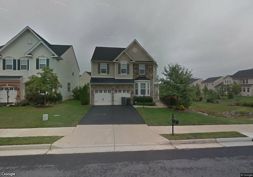
25024 White Sands Dr Chantilly, VA 20152
Estimated Value: $948,346 - $1,032,000
--
Bed
4
Baths
3,084
Sq Ft
$322/Sq Ft
Est. Value
About This Home
This home is located at 25024 White Sands Dr, Chantilly, VA 20152 and is currently estimated at $992,087, approximately $321 per square foot. 25024 White Sands Dr is a home located in Loudoun County with nearby schools including Liberty Elementary School, Mercer Middle School, and John Champe High School.
Ownership History
Date
Name
Owned For
Owner Type
Purchase Details
Closed on
Aug 9, 2013
Sold by
Malaska Edward H
Bought by
Gattu Hanumantharao
Current Estimated Value
Home Financials for this Owner
Home Financials are based on the most recent Mortgage that was taken out on this home.
Original Mortgage
$416,000
Outstanding Balance
$310,104
Interest Rate
4.45%
Mortgage Type
New Conventional
Estimated Equity
$681,983
Purchase Details
Closed on
Jan 14, 2010
Sold by
The Drees Company
Bought by
Malaska Edward H
Home Financials for this Owner
Home Financials are based on the most recent Mortgage that was taken out on this home.
Original Mortgage
$487,561
Interest Rate
4.71%
Mortgage Type
VA
Create a Home Valuation Report for This Property
The Home Valuation Report is an in-depth analysis detailing your home's value as well as a comparison with similar homes in the area
Home Values in the Area
Average Home Value in this Area
Purchase History
| Date | Buyer | Sale Price | Title Company |
|---|---|---|---|
| Gattu Hanumantharao | $520,000 | -- | |
| Malaska Edward H | $477,325 | -- |
Source: Public Records
Mortgage History
| Date | Status | Borrower | Loan Amount |
|---|---|---|---|
| Open | Gattu Hanumantharao | $416,000 | |
| Previous Owner | Malaska Edward H | $487,561 |
Source: Public Records
Tax History Compared to Growth
Tax History
| Year | Tax Paid | Tax Assessment Tax Assessment Total Assessment is a certain percentage of the fair market value that is determined by local assessors to be the total taxable value of land and additions on the property. | Land | Improvement |
|---|---|---|---|---|
| 2025 | $7,595 | $943,480 | $296,700 | $646,780 |
| 2024 | $7,597 | $878,230 | $271,700 | $606,530 |
| 2023 | $7,510 | $858,270 | $271,700 | $586,570 |
| 2022 | $7,304 | $820,640 | $241,700 | $578,940 |
| 2021 | $6,693 | $683,000 | $216,700 | $466,300 |
| 2020 | $6,447 | $622,870 | $196,700 | $426,170 |
| 2019 | $6,209 | $594,190 | $196,700 | $397,490 |
| 2018 | $6,186 | $570,140 | $176,700 | $393,440 |
| 2017 | $6,059 | $538,540 | $176,700 | $361,840 |
| 2016 | $6,167 | $538,580 | $0 | $0 |
| 2015 | $5,982 | $350,370 | $0 | $350,370 |
| 2014 | $5,865 | $331,110 | $0 | $331,110 |
Source: Public Records
Map
Nearby Homes
- 24994 White Fir Ct
- 42344 Abney Wood Dr
- 42210 Terrazzo Terrace
- 25202 Justice Dr
- 24769 Stone Pillar Dr
- 42006 Kudu Ct
- 24958 Brookbark Terrace
- 25272 Oribi Place
- 24661 Clock Tower Square
- 42104 Fremont Preserve Square
- 41925 Moreland Mine Terrace
- 25065 Riding Center Dr
- 41971 Blue Flag Terrace
- 41973 Blue Flag Terrace
- 42643 Homefront Terrace
- 24666 Buttonbush Terrace
- 24634 Rosebay Terrace
- 42020 Glade Creek Terrace
- 41863 Cinnabar Square
- Tia 24-F2 Plan at Prosperity Plains
- 25020 White Sands Dr
- 25016 White Sands Dr
- 24999 White Fir Ct
- 25003 White Fir Ct
- 25012 White Sands Dr
- 42228 Palm Cove Ct
- 25025 White Sands Dr
- 42232 Palm Cove Ct
- 25021 White Sands Dr
- 24995 White Fir Ct
- 42236 Palm Cove Ct
- 25017 White Sands Dr
- 25008 White Sands Dr
- 25031 White Sands Dr
- 25013 White Sands Dr
- 0 White Fir Ct Unit LO7231006
- 0 White Fir Ct Unit 1009003990
- 24991 White Fir Ct
- 25002 White Fir Ct
- 25035 White Sands Dr