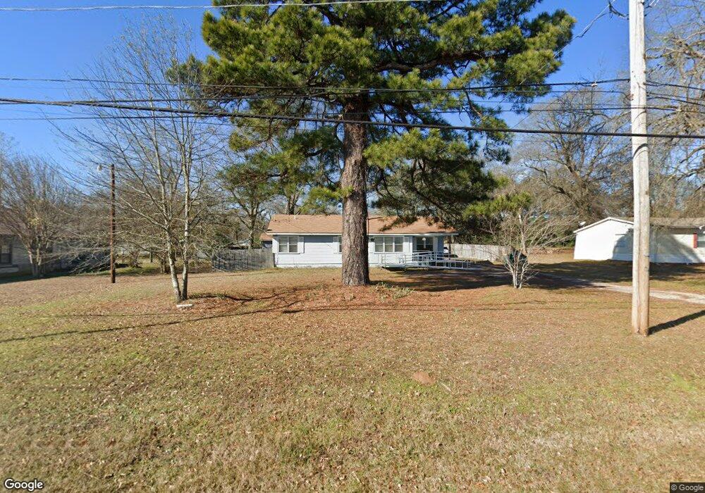
2510 Buchanan Rd Texarkana, TX 75501
Estimated Value: $153,000 - $192,000
4
Beds
3
Baths
2,093
Sq Ft
$84/Sq Ft
Est. Value
About This Home
This home is located at 2510 Buchanan Rd, Texarkana, TX 75501 and is currently estimated at $176,612, approximately $84 per square foot. 2510 Buchanan Rd is a home located in Bowie County with nearby schools including Liberty-Eylau Early Childhood Center, Liberty-Eylau Primary School, and Liberty-Eylau C.K. Bender Elementary Campus.
Ownership History
Date
Name
Owned For
Owner Type
Purchase Details
Closed on
Jun 18, 2025
Sold by
Kimball Terance Lee and Kimball Linda Lee
Bought by
Kimball Family Trust and Kimball
Current Estimated Value
Purchase Details
Closed on
Jun 27, 2019
Sold by
Seifert Gary W and Seifert Madison B
Bought by
Kimball Terance L and Kimball Linda
Home Financials for this Owner
Home Financials are based on the most recent Mortgage that was taken out on this home.
Original Mortgage
$80,000
Interest Rate
4%
Mortgage Type
New Conventional
Purchase Details
Closed on
Dec 26, 2012
Sold by
Durbam Mary Frances and Durbam W C
Bought by
Seifert Gary W
Home Financials for this Owner
Home Financials are based on the most recent Mortgage that was taken out on this home.
Original Mortgage
$72,659
Interest Rate
3.37%
Mortgage Type
FHA
Create a Home Valuation Report for This Property
The Home Valuation Report is an in-depth analysis detailing your home's value as well as a comparison with similar homes in the area
Home Values in the Area
Average Home Value in this Area
Purchase History
| Date | Buyer | Sale Price | Title Company |
|---|---|---|---|
| Kimball Family Trust | -- | None Listed On Document | |
| Kimball Terance L | -- | None Available | |
| Seifert Gary W | -- | Twin City Title Co |
Source: Public Records
Mortgage History
| Date | Status | Borrower | Loan Amount |
|---|---|---|---|
| Previous Owner | Kimball Terance L | $80,000 | |
| Previous Owner | Seifert Gary W | $72,659 |
Source: Public Records
Tax History Compared to Growth
Tax History
| Year | Tax Paid | Tax Assessment Tax Assessment Total Assessment is a certain percentage of the fair market value that is determined by local assessors to be the total taxable value of land and additions on the property. | Land | Improvement |
|---|---|---|---|---|
| 2025 | -- | $182,266 | -- | -- |
| 2024 | $3,475 | $165,696 | $12,500 | $160,342 |
| 2023 | $3,185 | $150,633 | $0 | $0 |
| 2022 | $3,212 | $144,742 | $10,000 | $134,742 |
| 2021 | $3,115 | $124,490 | $7,500 | $116,990 |
| 2020 | $3,004 | $119,419 | $7,500 | $111,919 |
| 2019 | $2,993 | $114,585 | $7,500 | $107,085 |
| 2018 | $1,901 | $72,763 | $7,500 | $65,263 |
| 2017 | $1,890 | $72,555 | $7,500 | $65,055 |
| 2016 | $1,845 | $70,834 | $7,500 | $63,334 |
| 2015 | $1,731 | $70,268 | $7,500 | $62,768 |
| 2014 | $1,731 | $68,972 | $7,500 | $61,472 |
Source: Public Records
Map
Nearby Homes
- 0 Buchanan Rd
- 2803 Johnson Ln
- 3007 Hollywood St
- 3007 Post St
- 3009 Post St
- 2122 Parkham St
- 1601 Harlem
- 1407 S Lake Dr
- 0 Tbd 1 Ann St
- 0 Tbd 1 St W Unit 116362
- 1309 West St
- TBD Lp Frontage Wallace Pkwy
- 1306 Caldwell St
- 1104 Caldwell St
- 1304 Caldwell St
- 1716 S Robison Rd
- 1605 S Robison Rd
- 917 Capp St
- 2802 Flower Acre Rd
- 1020 Capp St
- 2512 Buchanan Rd
- 2508 Buchanan Rd
- TBD Buchanan Rd
- 2110 Phillips Ln
- 2504 Buchanan Rd
- 2114 Phillips Ln
- 2107 Phillips Ln
- 2116 Phillips Ln
- 2806 Buchanan Rd
- 2111 Phillips Ln
- 2202 Phillips Ln
- 2115 Phillips Ln
- 2201 Phillips Ln
- 2208 Phillips Ln
- 0 Phillips Ln
- 2205 Phillips Ln
- 2212 Phillips Ln
- 2207 Phillips Ln
- 2216 Phillips Ln
- 2225 Liberty Ln