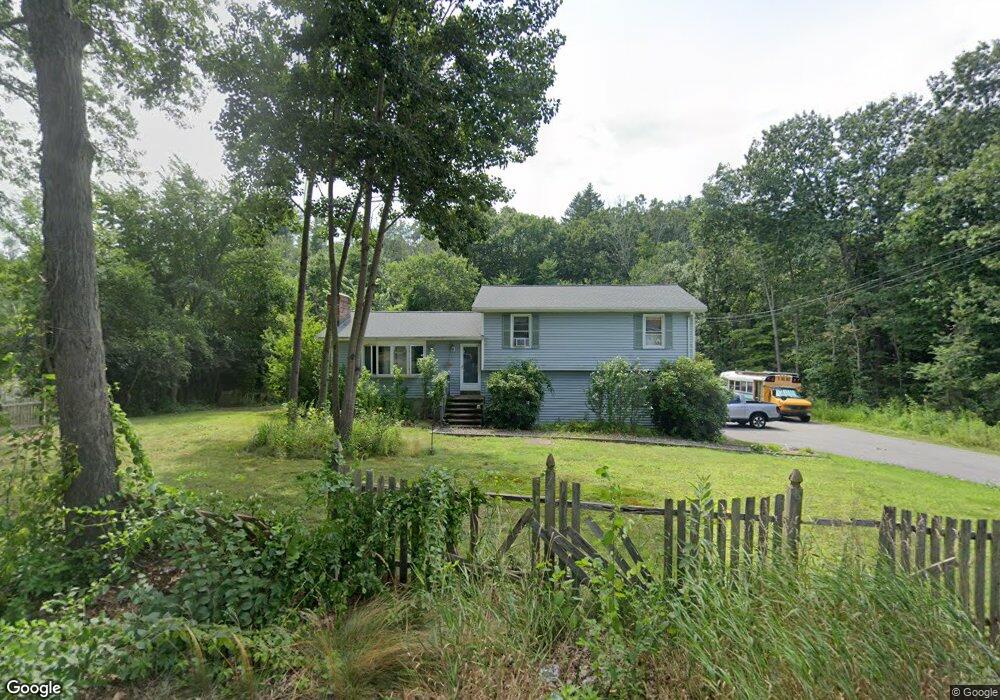
252 Hampstead St Methuen, MA 01844
The North End NeighborhoodEstimated Value: $600,000 - $654,000
3
Beds
1
Bath
1,629
Sq Ft
$383/Sq Ft
Est. Value
About This Home
This home is located at 252 Hampstead St, Methuen, MA 01844 and is currently estimated at $624,664, approximately $383 per square foot. 252 Hampstead St is a home located in Essex County with nearby schools including South Point Elementary School, Methuen High School, and St. Joseph Regional Catholic School.
Ownership History
Date
Name
Owned For
Owner Type
Purchase Details
Closed on
Aug 24, 1998
Sold by
Wescott Ronnie W
Bought by
Canales Christopher B
Current Estimated Value
Home Financials for this Owner
Home Financials are based on the most recent Mortgage that was taken out on this home.
Original Mortgage
$120,000
Outstanding Balance
$24,904
Interest Rate
6.86%
Mortgage Type
Purchase Money Mortgage
Estimated Equity
$599,760
Create a Home Valuation Report for This Property
The Home Valuation Report is an in-depth analysis detailing your home's value as well as a comparison with similar homes in the area
Home Values in the Area
Average Home Value in this Area
Purchase History
| Date | Buyer | Sale Price | Title Company |
|---|---|---|---|
| Canales Christopher B | $165,000 | -- |
Source: Public Records
Mortgage History
| Date | Status | Borrower | Loan Amount |
|---|---|---|---|
| Open | Canales Christopher B | $120,000 | |
| Previous Owner | Canales Christopher B | $30,000 |
Source: Public Records
Tax History Compared to Growth
Tax History
| Year | Tax Paid | Tax Assessment Tax Assessment Total Assessment is a certain percentage of the fair market value that is determined by local assessors to be the total taxable value of land and additions on the property. | Land | Improvement |
|---|---|---|---|---|
| 2025 | $6,037 | $570,600 | $297,300 | $273,300 |
| 2024 | $5,919 | $545,000 | $260,000 | $285,000 |
| 2023 | $5,559 | $475,100 | $228,900 | $246,200 |
| 2022 | $5,262 | $403,200 | $187,500 | $215,700 |
| 2021 | $4,921 | $373,100 | $177,200 | $195,900 |
| 2020 | $4,912 | $365,500 | $177,200 | $188,300 |
| 2019 | $4,795 | $337,900 | $166,800 | $171,100 |
| 2018 | $4,538 | $318,000 | $156,400 | $161,600 |
| 2017 | $4,543 | $310,100 | $156,400 | $153,700 |
| 2016 | $4,369 | $295,000 | $146,100 | $148,900 |
| 2015 | $4,307 | $295,000 | $146,100 | $148,900 |
Source: Public Records
Map
Nearby Homes
- 40 Stanwood Rd Unit 9
- 1 Ballard Ln
- 20 Stanwood Rd
- 74 Ayers Village Rd
- 1513 Broadway
- 6 Douglas Dr
- 139 North St
- 1 Kimball Ave
- 17 Sawmill Ridge Rd
- 47 Bailey Ct
- 27 General Pulaski Dr
- 20 Ashwood Ave
- 10 Sally Sweets Way Unit V104
- 35 Fraser Dr
- 8 Stoneybrook Ln
- 28 Emma Rose Cir Unit Lot 2
- 51 Bluff St
- 55A Millville Cir
- 8 Alta Ave
- 4 Therriault Ave
- 250 Hampstead St
- 264 Hampstead St
- 251 Hampstead St
- 266 Hampstead St
- 247 Hampstead St
- 245 Hampstead St
- 244 Hampstead St
- 239 Hampstead St
- 235 Hampstead St
- 11 Hitching Post Ln
- 5 Ayers Village Rd
- 268 Hampstead St
- 240 Hampstead St
- 9 Hitching Post Ln
- 7 Ayers Village Rd
- 15 Ayers Village Rd
- 15 Ayers Village Rd
- 231 Hampstead St
- 13 Hitching Post Ln
- 5 Hitching Post Ln