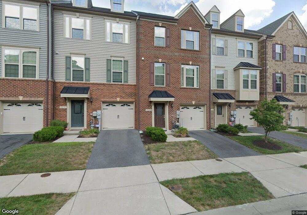
2530 Rolling Forest Dr Hanover, MD 21076
Estimated Value: $537,000 - $585,000
3
Beds
3
Baths
1,932
Sq Ft
$287/Sq Ft
Est. Value
About This Home
This home is located at 2530 Rolling Forest Dr, Hanover, MD 21076 and is currently estimated at $554,748, approximately $287 per square foot. 2530 Rolling Forest Dr is a home located in Anne Arundel County with nearby schools including Meade Heights Elementary School, MacArthur Middle School, and Meade High School.
Ownership History
Date
Name
Owned For
Owner Type
Purchase Details
Closed on
Dec 29, 2014
Sold by
Nvr Inc
Bought by
Farmer Mathew J
Current Estimated Value
Home Financials for this Owner
Home Financials are based on the most recent Mortgage that was taken out on this home.
Original Mortgage
$405,320
Outstanding Balance
$312,167
Interest Rate
3.99%
Mortgage Type
VA
Estimated Equity
$242,581
Purchase Details
Closed on
Apr 29, 2014
Sold by
B & S Eggerl Llc
Bought by
Nvr Inc
Create a Home Valuation Report for This Property
The Home Valuation Report is an in-depth analysis detailing your home's value as well as a comparison with similar homes in the area
Home Values in the Area
Average Home Value in this Area
Purchase History
| Date | Buyer | Sale Price | Title Company |
|---|---|---|---|
| Farmer Mathew J | $396,790 | Stewart Title Guaranty Co | |
| Nvr Inc | $813,756 | None Available |
Source: Public Records
Mortgage History
| Date | Status | Borrower | Loan Amount |
|---|---|---|---|
| Open | Farmer Mathew J | $405,320 |
Source: Public Records
Tax History Compared to Growth
Tax History
| Year | Tax Paid | Tax Assessment Tax Assessment Total Assessment is a certain percentage of the fair market value that is determined by local assessors to be the total taxable value of land and additions on the property. | Land | Improvement |
|---|---|---|---|---|
| 2025 | $5,403 | $481,900 | $155,000 | $326,900 |
| 2024 | $5,403 | $453,500 | $0 | $0 |
| 2023 | $5,056 | $425,100 | $0 | $0 |
| 2022 | $4,519 | $396,700 | $135,000 | $261,700 |
| 2021 | $9,039 | $396,700 | $135,000 | $261,700 |
| 2020 | $4,480 | $396,700 | $135,000 | $261,700 |
| 2019 | $4,620 | $409,600 | $140,000 | $269,600 |
| 2018 | $3,946 | $389,133 | $0 | $0 |
| 2017 | $4,095 | $368,667 | $0 | $0 |
| 2016 | -- | $348,200 | $0 | $0 |
| 2015 | -- | $331,533 | $0 | $0 |
| 2014 | -- | $26,833 | $0 | $0 |
Source: Public Records
Map
Nearby Homes
- 7444 Burnside Way
- 7215 Winding Hills Dr
- 2746 Fredericksburg Rd
- 2784 Fredericksburg Rd
- 7652 Telamon Way
- 7812 Patterson Way
- 7841 Chanceford Dr
- 2932 Hebron Ln
- 2914 Middleham Ct
- 3106 Laurel Hill Rd
- 7808 Union Hill Dr
- 8357 Meadowood Dr
- 2616 Hardaway Cir
- Maguire Plan at Shipley Homestead
- The Julianne Plan at Shipley Homestead
- The Tessa Plan at Shipley Homestead
- The Jenkins Plan at Shipley Homestead
- 7820 Mine Run Rd
- 3723 Cedar Mountain Way
- 7836 Mine Run Rd
- 2525 Rolling Forest Dr
- 2526 Rolling Forest Dr
- 2527 Rolling Forest Dr
- 2528 Rolling Forest Dr
- 2532 Rolling Forest Dr
- 2523 Rolling Forest Dr
- 2534 Rolling Forest Dr
- 2529 Rolling Forest Dr
- 2536 Rolling Forest Dr
- 7445 Burnside Way
- 7903 Old Calvary Rd
- 7907 Old Calvary Rd Unit C
- 7907 Old Calvary Rd
- 2521 Rolling Forest Dr
- 7447 Burnside Way
- 7449 Burnside Way
- 7429 Skirmish Dr
- 7433 Skirmish Dr
- 7343 Old Calvary Rd
- 7451 Burnside Way