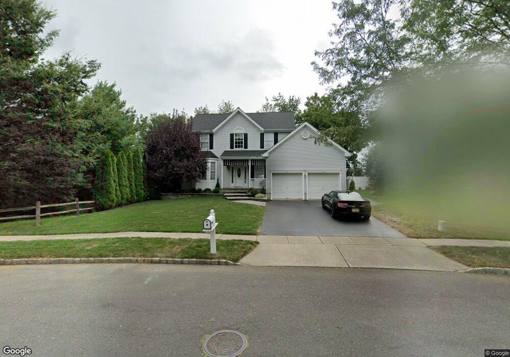
255 Sharps Ln Trenton, NJ 08610
Estimated Value: $483,000 - $658,000
--
Bed
--
Bath
2,166
Sq Ft
$266/Sq Ft
Est. Value
About This Home
This home is located at 255 Sharps Ln, Trenton, NJ 08610 and is currently estimated at $575,171, approximately $265 per square foot. 255 Sharps Ln is a home located in Mercer County with nearby schools including Robinson Elementary School, Albert E. Grice Middle School, and Hamilton West-Watson High School.
Ownership History
Date
Name
Owned For
Owner Type
Purchase Details
Closed on
Jan 12, 2007
Sold by
Kerwick Barbara
Bought by
Cuccagna Richard and Cuccagna Janet
Current Estimated Value
Home Financials for this Owner
Home Financials are based on the most recent Mortgage that was taken out on this home.
Original Mortgage
$165,000
Outstanding Balance
$98,658
Interest Rate
6.22%
Mortgage Type
Purchase Money Mortgage
Estimated Equity
$476,513
Purchase Details
Closed on
Mar 22, 1996
Sold by
Devt Sharbell
Bought by
Kerwick Robert and Kerwick Barbara
Home Financials for this Owner
Home Financials are based on the most recent Mortgage that was taken out on this home.
Original Mortgage
$65,000
Interest Rate
6.9%
Mortgage Type
Purchase Money Mortgage
Create a Home Valuation Report for This Property
The Home Valuation Report is an in-depth analysis detailing your home's value as well as a comparison with similar homes in the area
Home Values in the Area
Average Home Value in this Area
Purchase History
| Date | Buyer | Sale Price | Title Company |
|---|---|---|---|
| Cuccagna Richard | $400,000 | -- | |
| Kerwick Robert | $193,000 | -- |
Source: Public Records
Mortgage History
| Date | Status | Borrower | Loan Amount |
|---|---|---|---|
| Open | Cuccagna Richard | $165,000 | |
| Previous Owner | Kerwick Robert | $65,000 |
Source: Public Records
Tax History Compared to Growth
Tax History
| Year | Tax Paid | Tax Assessment Tax Assessment Total Assessment is a certain percentage of the fair market value that is determined by local assessors to be the total taxable value of land and additions on the property. | Land | Improvement |
|---|---|---|---|---|
| 2025 | $12,091 | $343,100 | $84,600 | $258,500 |
| 2024 | $11,333 | $343,100 | $84,600 | $258,500 |
| 2023 | $11,333 | $343,100 | $84,600 | $258,500 |
| 2022 | $11,154 | $343,100 | $84,600 | $258,500 |
| 2021 | $11,984 | $343,100 | $84,600 | $258,500 |
| 2020 | $10,749 | $343,100 | $84,600 | $258,500 |
| 2019 | $10,516 | $343,100 | $84,600 | $258,500 |
| 2018 | $10,423 | $343,100 | $84,600 | $258,500 |
| 2017 | $10,163 | $343,100 | $84,600 | $258,500 |
| 2016 | $9,277 | $343,100 | $84,600 | $258,500 |
| 2015 | $9,436 | $203,400 | $48,800 | $154,600 |
| 2014 | $9,277 | $203,400 | $48,800 | $154,600 |
Source: Public Records
Map
Nearby Homes
- 6 Wilbert Way
- 5 Sandy Ln
- 72 Englewood Blvd
- 44 Tantum Dr
- 19 Wolf Dr
- 15 Ashwood Rd
- 22 Wolf Dr
- 2 Godfrey Dr
- 868 White Horse Hamilton Square Rd
- 19 Copperfield Dr
- 153 Knapp Ave
- 376 White Horse Ave
- 250 Lacy Ave
- 9 Ann Marie Dr
- 147 Hempstead Rd
- 74 Taft Ave
- 1782 Orchard Ave
- 22 Ovington Dr
- 15 Marlow Ct
- 2203 Kuser Rd