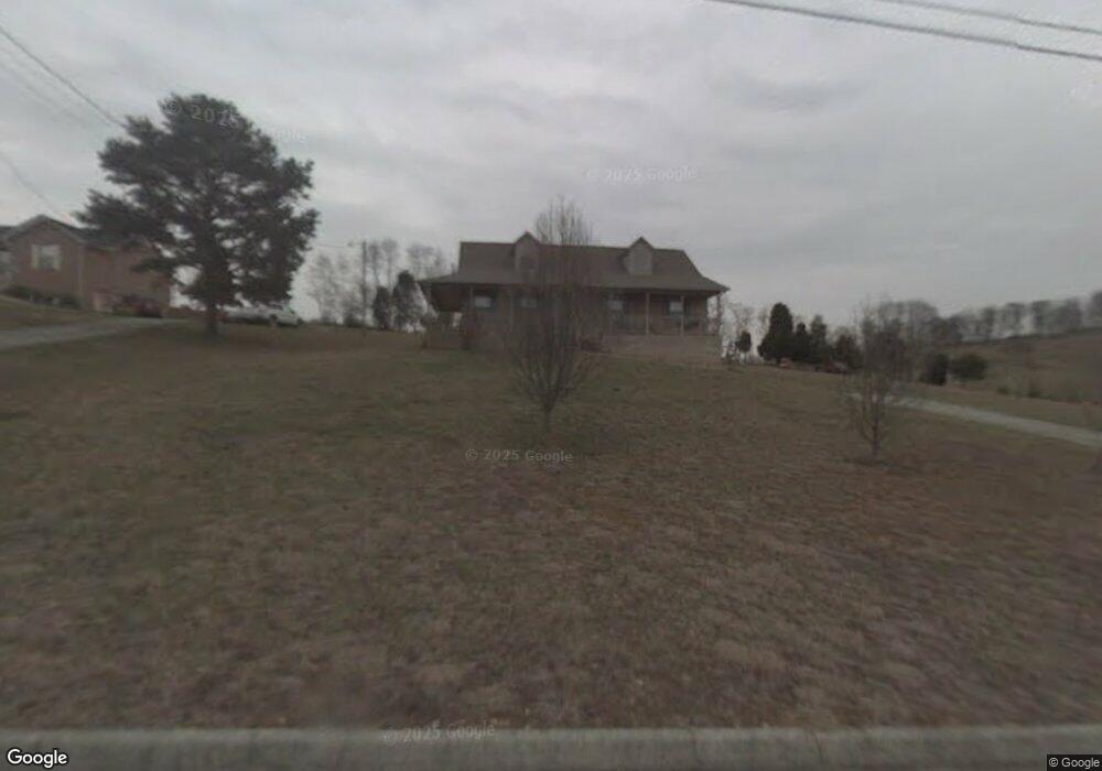
2556 Brandi Dr Russellville, TN 37860
Estimated Value: $281,354 - $339,000
--
Bed
2
Baths
1,426
Sq Ft
$222/Sq Ft
Est. Value
About This Home
This home is located at 2556 Brandi Dr, Russellville, TN 37860 and is currently estimated at $316,339, approximately $221 per square foot. 2556 Brandi Dr is a home located in Hamblen County with nearby schools including Russellville Elementary School, East Ridge Middle School, and Morristown East High School.
Ownership History
Date
Name
Owned For
Owner Type
Purchase Details
Closed on
May 6, 2022
Sold by
Portrum Michael R and Portrum Tracy
Bought by
Portrum Michael R and Portrum Tracy
Current Estimated Value
Home Financials for this Owner
Home Financials are based on the most recent Mortgage that was taken out on this home.
Original Mortgage
$189,255
Outstanding Balance
$179,820
Interest Rate
5.27%
Mortgage Type
FHA
Estimated Equity
$136,519
Purchase Details
Closed on
Sep 23, 2010
Bought by
Portrum Michael R
Purchase Details
Closed on
Jan 26, 1993
Bought by
Porter Ayers and Porter Lynn
Purchase Details
Closed on
Aug 10, 1979
Bought by
Porter Ayers and Porter Lynn
Create a Home Valuation Report for This Property
The Home Valuation Report is an in-depth analysis detailing your home's value as well as a comparison with similar homes in the area
Home Values in the Area
Average Home Value in this Area
Purchase History
| Date | Buyer | Sale Price | Title Company |
|---|---|---|---|
| Portrum Michael R | -- | None Listed On Document | |
| Portrum Michael R | -- | -- | |
| Porter Ayers | -- | -- | |
| Porter Ayers | -- | -- |
Source: Public Records
Mortgage History
| Date | Status | Borrower | Loan Amount |
|---|---|---|---|
| Open | Portrum Michael R | $189,255 |
Source: Public Records
Tax History Compared to Growth
Tax History
| Year | Tax Paid | Tax Assessment Tax Assessment Total Assessment is a certain percentage of the fair market value that is determined by local assessors to be the total taxable value of land and additions on the property. | Land | Improvement |
|---|---|---|---|---|
| 2024 | $776 | $39,400 | $6,400 | $33,000 |
| 2023 | $776 | $39,400 | $0 | $0 |
| 2022 | $756 | $38,350 | $6,400 | $31,950 |
| 2021 | $756 | $38,350 | $6,400 | $31,950 |
| 2020 | $756 | $38,350 | $6,400 | $31,950 |
| 2019 | $729 | $34,225 | $4,225 | $30,000 |
| 2018 | $729 | $34,225 | $4,225 | $30,000 |
| 2017 | $729 | $34,225 | $4,225 | $30,000 |
| 2016 | $681 | $34,225 | $4,225 | $30,000 |
| 2015 | $633 | $34,225 | $4,225 | $30,000 |
| 2014 | -- | $34,225 | $4,225 | $30,000 |
| 2013 | -- | $35,375 | $0 | $0 |
Source: Public Records
Map
Nearby Homes
- 5659 Browning Way
- 5601 Brights Pike
- 2145 Fall Creek Rd
- 5556 Denton Dr
- 2551 Cedar Creek Rd
- 6312 Turners Pond Trail
- 6350 Turners Pond Trail
- 6358 Turners Pond Trail
- 6276 Outlook Trail
- 6312 Turners Pond Tr
- 6219 Outlook Trail
- 1955 Turner Landing Rd
- 1955 Turners Landing Rd
- 1936 Turners Landing Rd
- 6213 Outlook Tr
- 6213 Outlook Trail
- 5110 Anne Cir
- 1987 Turners Landing Rd
- 2564 Brandi Dr
- 2553 Brandi Dr
- 2536 Brandi Dr
- 2565 Brandi Dr
- 2572 Brandi Dr
- 2541 Brandi Dr
- 2528 Brandi Dr
- 5700 Brights Pike
- 2555 Alisha Ave
- 2549 Alisha Ave
- 2561 Alisha Ave
- 2567 Alisha Ave
- 5706 Brights Pike
- 5710 Brights Pike
- 2537 Alisha Ave
- 2531 Alisha Ave
- 2525 Alisha Ave
- 5694 Brights Pike
- 2550 Alisha Ave
- 5754 Brights Pike