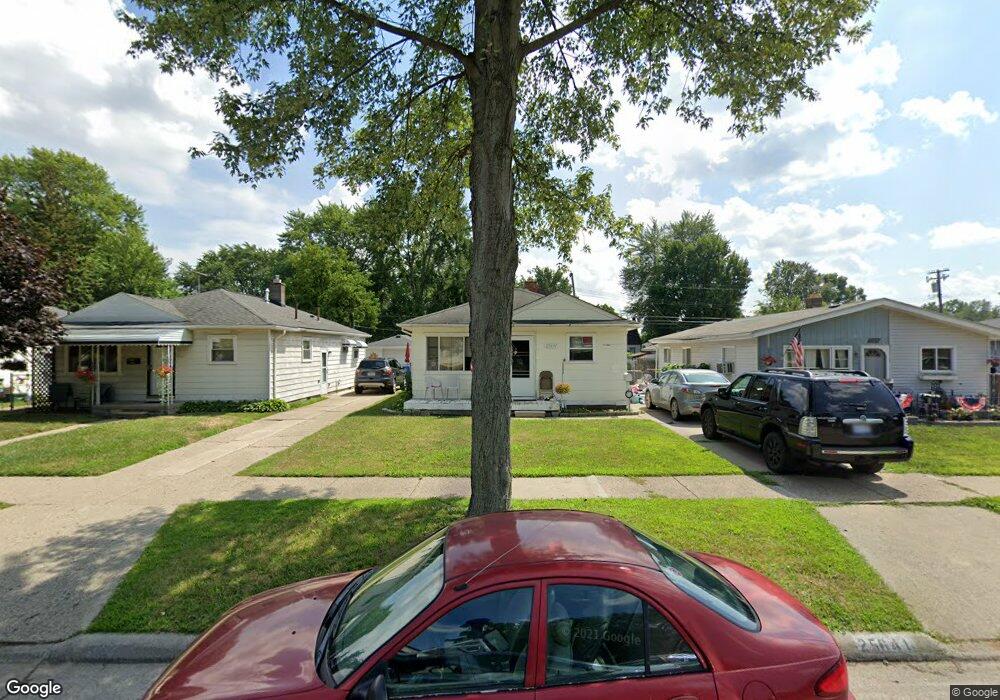
25641 Eton Ave Dearborn Heights, MI 48125
Estimated Value: $142,000 - $156,000
3
Beds
1
Bath
937
Sq Ft
$159/Sq Ft
Est. Value
About This Home
This home is located at 25641 Eton Ave, Dearborn Heights, MI 48125 and is currently estimated at $149,256, approximately $159 per square foot. 25641 Eton Ave is a home located in Wayne County with nearby schools including West Village Academy, Quest Charter Academy, and Peterson-Warren Academy.
Ownership History
Date
Name
Owned For
Owner Type
Purchase Details
Closed on
May 25, 2010
Sold by
Donovan Shaun
Bought by
Hu Ping and Chen Xiao
Current Estimated Value
Purchase Details
Closed on
Apr 29, 2009
Sold by
Flagstar Bank Fsb
Bought by
U S Department Of Housing & Urban Develo
Purchase Details
Closed on
Apr 2, 2009
Sold by
Sisco Roy H and Sisco Beth A
Bought by
Flagstar Bank Fsb
Purchase Details
Closed on
May 13, 2005
Sold by
Skocen Beverly
Bought by
Sisco Roy H
Purchase Details
Closed on
Jun 17, 2004
Sold by
Kirkland Jeffrey M
Bought by
Skocen Beverly
Create a Home Valuation Report for This Property
The Home Valuation Report is an in-depth analysis detailing your home's value as well as a comparison with similar homes in the area
Home Values in the Area
Average Home Value in this Area
Purchase History
| Date | Buyer | Sale Price | Title Company |
|---|---|---|---|
| Hu Ping | $13,600 | None Available | |
| U S Department Of Housing & Urban Develo | -- | None Available | |
| Flagstar Bank Fsb | $93,429 | None Available | |
| Sisco Roy H | $93,000 | Commonwealth Land Title | |
| Skocen Beverly | -- | -- |
Source: Public Records
Tax History Compared to Growth
Tax History
| Year | Tax Paid | Tax Assessment Tax Assessment Total Assessment is a certain percentage of the fair market value that is determined by local assessors to be the total taxable value of land and additions on the property. | Land | Improvement |
|---|---|---|---|---|
| 2025 | $1,446 | $70,000 | $0 | $0 |
| 2024 | $1,446 | $58,900 | $0 | $0 |
| 2023 | $1,314 | $50,800 | $0 | $0 |
| 2022 | $1,932 | $42,800 | $0 | $0 |
| 2021 | $1,918 | $37,700 | $0 | $0 |
| 2019 | $1,776 | $29,700 | $0 | $0 |
| 2018 | $1,140 | $27,600 | $0 | $0 |
| 2017 | $1,175 | $26,600 | $0 | $0 |
| 2016 | $1,689 | $27,000 | $0 | $0 |
| 2015 | $2,530 | $25,300 | $0 | $0 |
| 2013 | $2,740 | $29,000 | $0 | $0 |
| 2010 | -- | $33,800 | $0 | $0 |
Source: Public Records
Map
Nearby Homes
- 25628 Powers Ave
- 25474 McDonald St
- 25926 Powers Ave
- 5118 Michael St
- 25895 Annapolis St
- 25965 Currier St
- 26106 Powers Ave
- 25243 Lehigh St
- 5842 Janet St
- 4856 Carolee Ln
- 5845 Beech Daly Rd
- 26225 McDonald St
- 25212 Lehigh St
- 25118 Lehigh St
- 5904 Janet St
- 5961 Beech Daly Rd
- 26159 Stanford St
- 24754 Annapolis St
- 5961 Marvin St
- 25085 Colgate St
- 25649 Eton Ave
- 25633 Eton Ave
- 25701 Eton Ave
- 25625 Eton Ave
- 25709 Eton Ave
- 25609 Eton Ave
- 25640 Pennie St
- 25700 Pennie St
- 25624 Pennie St
- 25717 Eton Ave
- 25618 Pennie St
- 25714 Pennie St
- 25650 Eton Ave Unit Bldg-Unit
- 25650 Eton Ave
- 25642 Eton Ave
- 25702 Eton Ave
- 25603 Eton Ave
- 25725 Eton Ave
- 25626 Eton Ave
- 25722 Pennie St