Estimated Value: $263,000 - $373,000
3
Beds
2
Baths
1,711
Sq Ft
$197/Sq Ft
Est. Value
About This Home
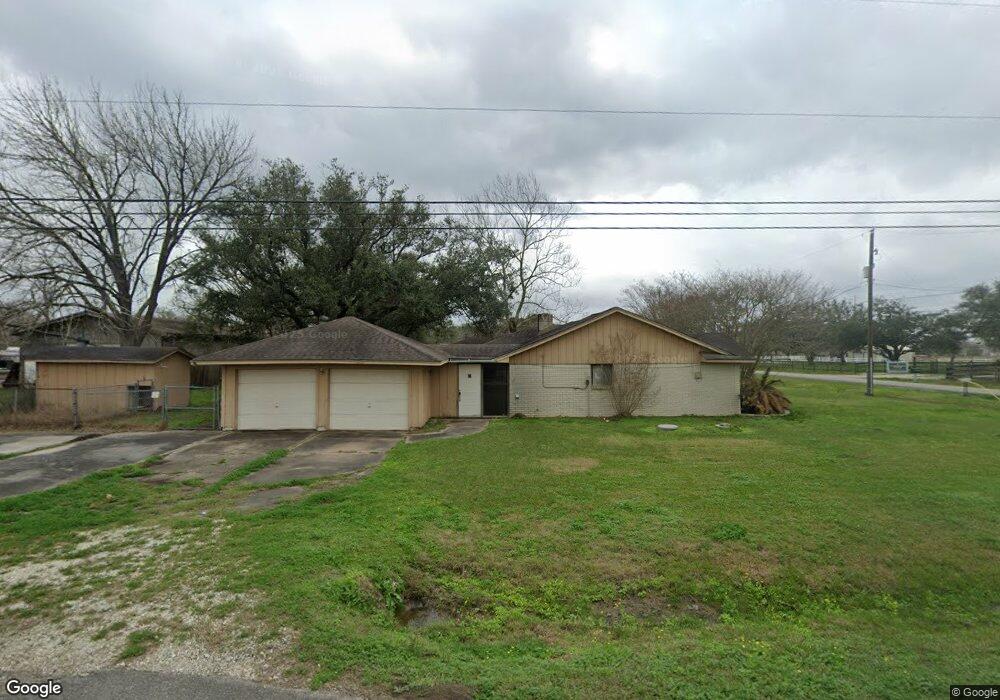
This home is located at 2570 County Road 357, Alvin, TX 77511 and is currently estimated at $337,859, approximately $197 per square foot. 2570 County Road 357 is a home located in Brazoria County with nearby schools including G.W. Harby Junior High School, Alvin High School, and Living Stones Christian School.
Ownership History
Date
Name
Owned For
Owner Type
Purchase Details
Closed on
Nov 8, 2007
Sold by
Wells Fargo Bank Na
Bought by
Roy Beverly and Roy Gerald
Current Estimated Value
Home Financials for this Owner
Home Financials are based on the most recent Mortgage that was taken out on this home.
Original Mortgage
$146,000
Outstanding Balance
$92,376
Interest Rate
6.38%
Mortgage Type
Purchase Money Mortgage
Estimated Equity
$245,483
Create a Home Valuation Report for This Property
The Home Valuation Report is an in-depth analysis detailing your home's value as well as a comparison with similar homes in the area
Home Values in the Area
Average Home Value in this Area
Purchase History
| Date | Buyer | Sale Price | Title Company |
|---|---|---|---|
| Roy Beverly | -- | Stewart Title Brazoria |
Source: Public Records
Mortgage History
| Date | Status | Borrower | Loan Amount |
|---|---|---|---|
| Open | Roy Beverly | $146,000 |
Source: Public Records
Tax History Compared to Growth
Tax History
| Year | Tax Paid | Tax Assessment Tax Assessment Total Assessment is a certain percentage of the fair market value that is determined by local assessors to be the total taxable value of land and additions on the property. | Land | Improvement |
|---|---|---|---|---|
| 2025 | $6,687 | $336,820 | $101,240 | $235,580 |
| 2023 | $6,687 | $353,670 | $121,490 | $232,180 |
| 2022 | $5,575 | $261,650 | $106,300 | $155,350 |
| 2021 | $3,830 | $172,580 | $48,800 | $123,780 |
| 2020 | $3,964 | $176,290 | $45,040 | $131,250 |
| 2019 | $3,498 | $151,100 | $12,900 | $138,200 |
| 2018 | $3,507 | $151,100 | $12,900 | $138,200 |
| 2017 | $3,307 | $140,760 | $12,360 | $128,400 |
| 2016 | $3,772 | $160,580 | $27,720 | $132,860 |
| 2014 | $3,297 | $139,310 | $22,140 | $117,170 |
Source: Public Records
Map
Nearby Homes
- 609 County Road 351 Beers
- 691 County Road 351
- 860 Farm To Market Road 517
- 2112 Washington Ave
- 2126 County Road 367
- 1176 Fm 517 Rd
- 2702 Silver Maple Dr
- 1300 Dickinson Rd
- 1483 E Highway 6
- 3080 Megan Lynn Ln
- 2002 E Highway 6
- 664 Imperial Loop
- 662 Imperial Loop
- 3373 E Highway 6
- 775 Steele Rd Unit 44
- 658 Imperial Loop
- 656 Imperial Loop
- 3150 E Highway 6
- 659 Imperial Loop
- Plan 2130 Modeled at Imperial Forest
- 659 County Road 351
- 2541 County Road 357
- 665 County Road 351
- 2432 County Road 148
- 645 County Road 351
- 2326 County Road 367
- 5338 Cascade Ct
- 674 County Road 351
- 684 County Road 351
- 711 County Road 351
- 2385 County Road 357
- 631 County Road 351
- 631 County Road 351
- 2348 County Road 357
- 5339 Latigo Ct
- 5335 Latigo Ct
- 2367 County Road 357
- 2295 County Road 357
- 2295 County Road 357
- 2516 County Road 357a