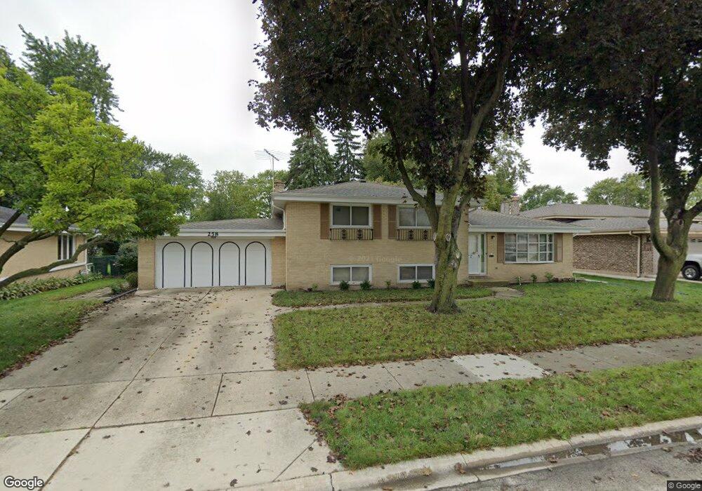
258 Apollo Ct Wood Dale, IL 60191
Estimated Value: $373,602 - $449,000
--
Bed
1
Bath
2,174
Sq Ft
$190/Sq Ft
Est. Value
About This Home
This home is located at 258 Apollo Ct, Wood Dale, IL 60191 and is currently estimated at $413,401, approximately $190 per square foot. 258 Apollo Ct is a home located in DuPage County with nearby schools including Raymond Benson Primary School, Elmer H Franzen Intermediate School, and F.E. Peacock Middle School.
Ownership History
Date
Name
Owned For
Owner Type
Purchase Details
Closed on
Sep 26, 2012
Sold by
Graves John C
Bought by
Graves John C and John C Graves Trust
Current Estimated Value
Purchase Details
Closed on
Dec 30, 2003
Sold by
Garcia Michael and Garcia Joanne S
Bought by
Peterson Steven R
Home Financials for this Owner
Home Financials are based on the most recent Mortgage that was taken out on this home.
Original Mortgage
$202,400
Outstanding Balance
$95,835
Interest Rate
6.08%
Mortgage Type
Purchase Money Mortgage
Estimated Equity
$317,566
Create a Home Valuation Report for This Property
The Home Valuation Report is an in-depth analysis detailing your home's value as well as a comparison with similar homes in the area
Home Values in the Area
Average Home Value in this Area
Purchase History
| Date | Buyer | Sale Price | Title Company |
|---|---|---|---|
| Graves John C | -- | None Available | |
| Peterson Steven R | $253,000 | Atg |
Source: Public Records
Mortgage History
| Date | Status | Borrower | Loan Amount |
|---|---|---|---|
| Open | Peterson Steven R | $202,400 | |
| Closed | Peterson Steven R | $37,950 |
Source: Public Records
Tax History Compared to Growth
Tax History
| Year | Tax Paid | Tax Assessment Tax Assessment Total Assessment is a certain percentage of the fair market value that is determined by local assessors to be the total taxable value of land and additions on the property. | Land | Improvement |
|---|---|---|---|---|
| 2024 | $7,443 | $116,612 | $48,385 | $68,227 |
| 2023 | $7,048 | $107,200 | $44,480 | $62,720 |
| 2022 | $6,899 | $101,100 | $41,370 | $59,730 |
| 2021 | $6,945 | $96,840 | $39,630 | $57,210 |
| 2020 | $6,526 | $92,760 | $37,960 | $54,800 |
| 2019 | $6,355 | $89,190 | $36,500 | $52,690 |
| 2018 | $6,403 | $89,190 | $36,500 | $52,690 |
| 2017 | $6,180 | $85,240 | $34,880 | $50,360 |
| 2016 | $5,961 | $78,700 | $32,200 | $46,500 |
| 2015 | $5,778 | $72,710 | $29,750 | $42,960 |
| 2014 | $5,597 | $68,380 | $28,870 | $39,510 |
| 2013 | $5,489 | $69,780 | $29,460 | $40,320 |
Source: Public Records
Map
Nearby Homes
- 272 Prospect Ave
- 445 Broker Ave
- 449 Broker Ave
- 418 Bonnie Brae Ave
- 261 Montgomery Ln Unit 18
- 500 S Princeton Ave
- 543 Sarah Dr
- 243 Washington Square Unit 16
- 206 E George St
- 249 N Addison Rd
- 330 S Maple St
- 105 E Irving Park Rd
- 443 S Lombard Rd
- 100 S Walnut St
- 711 E Greenview Rd
- 335 Arlington Rd
- 600 W Bloomingdale Rd
- 465 W Dominion Dr Unit 909
- 465 W Dominion Dr Unit 1302
- 465 W Dominion Dr Unit 1003