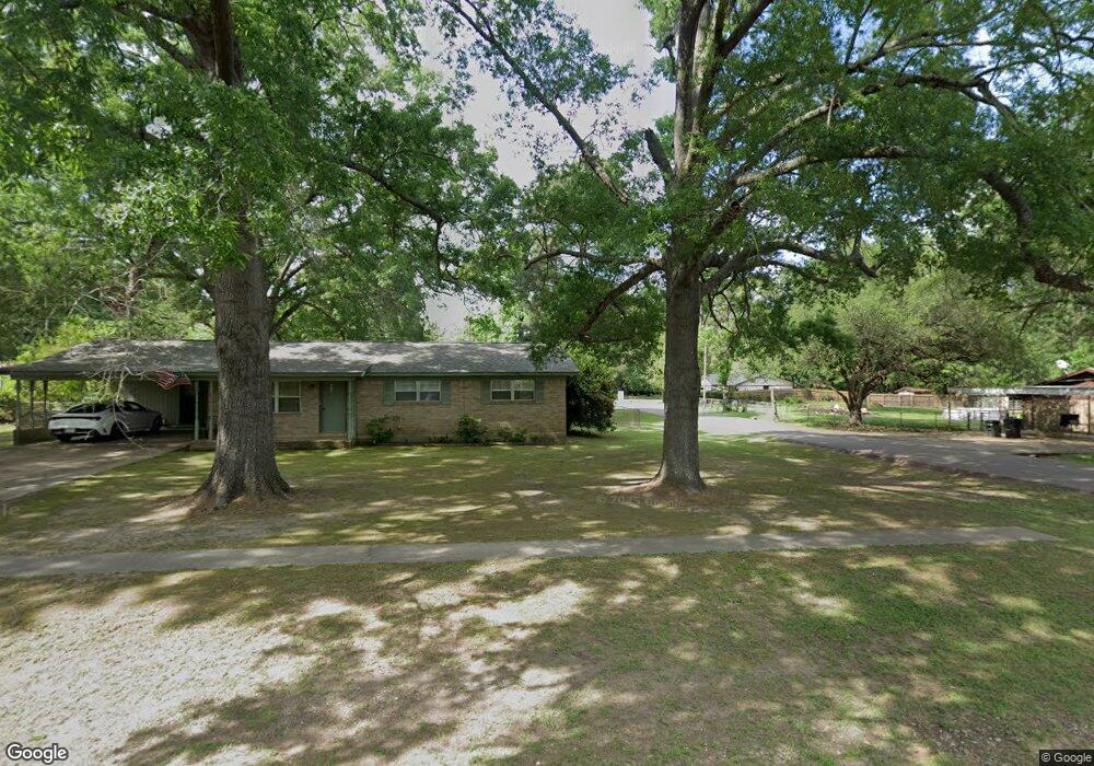
259 Maryland Dr Texarkana, TX 75501
--
Bed
--
Bath
2,112
Sq Ft
7.03
Acres
About This Home
This home is located at 259 Maryland Dr, Texarkana, TX 75501. 259 Maryland Dr is a home located in Bowie County with nearby schools including Liberty-Eylau Early Childhood Center, Liberty-Eylau Primary School, and Liberty-Eylau C.K. Bender Elementary Campus.
Ownership History
Date
Name
Owned For
Owner Type
Purchase Details
Closed on
Jun 25, 2014
Sold by
Lynch Christopher A and Hanes Tina D
Bought by
Morris Joshua C
Home Financials for this Owner
Home Financials are based on the most recent Mortgage that was taken out on this home.
Original Mortgage
$171,650
Outstanding Balance
$131,088
Interest Rate
4.23%
Mortgage Type
New Conventional
Purchase Details
Closed on
Dec 10, 2010
Sold by
Chesborough Lowell Dale
Bought by
Lynch Christopher A
Home Financials for this Owner
Home Financials are based on the most recent Mortgage that was taken out on this home.
Original Mortgage
$145,000
Interest Rate
4.24%
Mortgage Type
Purchase Money Mortgage
Create a Home Valuation Report for This Property
The Home Valuation Report is an in-depth analysis detailing your home's value as well as a comparison with similar homes in the area
Home Values in the Area
Average Home Value in this Area
Purchase History
| Date | Buyer | Sale Price | Title Company |
|---|---|---|---|
| Morris Joshua C | -- | None Available | |
| Lynch Christopher A | -- | None Available |
Source: Public Records
Mortgage History
| Date | Status | Borrower | Loan Amount |
|---|---|---|---|
| Open | Morris Joshua C | $171,650 | |
| Previous Owner | Lynch Christopher A | $145,000 |
Source: Public Records
Tax History Compared to Growth
Tax History
| Year | Tax Paid | Tax Assessment Tax Assessment Total Assessment is a certain percentage of the fair market value that is determined by local assessors to be the total taxable value of land and additions on the property. | Land | Improvement |
|---|---|---|---|---|
| 2020 | $0 | $0 | $0 | $0 |
| 2019 | -- | $185,701 | $30,699 | $155,002 |
| 2018 | -- | $179,967 | $30,699 | $149,268 |
| 2017 | -- | $175,729 | $30,699 | $145,030 |
| 2016 | -- | $175,229 | $30,199 | $145,030 |
| 2015 | -- | $173,852 | $30,199 | $143,653 |
| 2014 | -- | $171,416 | $30,199 | $141,217 |
Source: Public Records
Map
Nearby Homes
- 0 Randall Rd
- 6514 Buchanan Loop Rd
- 403 Brookfield St
- 101 Redwood Dr
- 2043 Randall Rd
- lot15 B2 Quail Brook
- lot15 B1 Quail Brook
- lot14 B2 Quail Brook
- Lot 1 B2 Quail Brook
- 6815 Buchanan Loop Rd
- 39 Quail Brook Dr
- 194 W Starlite Dr
- 6606 Us-59
- 280 Patriot Way
- 6606 Us Highway 59 S
- 6 Southridge St
- 5789 U S 59
- 144 Joe Tyl Rd
- 7689 Us-59
- 7685 State Highway 59
- 0 Comanche Rd
- 434 Comanche Ln
- 463 Comanche Rd
- 481 Comanche Ln
- 468 Comanche Ln
- 407 Cummings Ln
- 1557 Randall Rd
- 481 Comanche Ln
- 1582 Randall Rd
- 18 Rayn St
- 234 Cherokee Trail
- 1622 Randall Rd
- 1311 Randall Rd
- 228 Cherokee Trail
- 101 Ralph Dr
- 102 Coke Dr
- 1603 Randall Rd
- 100 Ralph Dr
- 101 Coke Dr
- 1260 Randall Rd