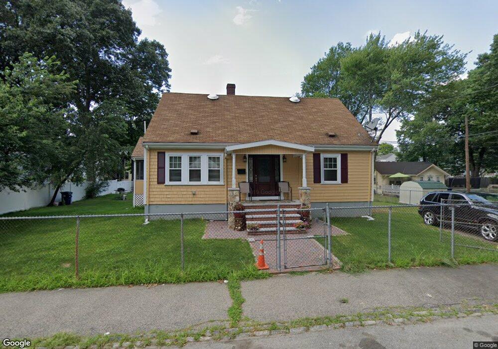
26 Brockton St Mattapan, MA 02126
Southern Mattapan NeighborhoodEstimated Value: $607,000 - $671,000
2
Beds
2
Baths
1,744
Sq Ft
$369/Sq Ft
Est. Value
About This Home
This home is located at 26 Brockton St, Mattapan, MA 02126 and is currently estimated at $643,269, approximately $368 per square foot. 26 Brockton St is a home located in Suffolk County with nearby schools including KIPP Academy Boston Charter School and Berea Seventh-day Adventist Academy.
Ownership History
Date
Name
Owned For
Owner Type
Purchase Details
Closed on
May 31, 2005
Sold by
Brasfield Susie
Bought by
Denton-Anderson Dennize
Current Estimated Value
Home Financials for this Owner
Home Financials are based on the most recent Mortgage that was taken out on this home.
Original Mortgage
$338,200
Outstanding Balance
$178,602
Interest Rate
5.94%
Mortgage Type
Purchase Money Mortgage
Estimated Equity
$464,667
Purchase Details
Closed on
Jul 29, 1997
Sold by
Fergus Joseph
Bought by
Parham Steven G
Home Financials for this Owner
Home Financials are based on the most recent Mortgage that was taken out on this home.
Original Mortgage
$149,150
Interest Rate
7.7%
Mortgage Type
Purchase Money Mortgage
Create a Home Valuation Report for This Property
The Home Valuation Report is an in-depth analysis detailing your home's value as well as a comparison with similar homes in the area
Home Values in the Area
Average Home Value in this Area
Purchase History
| Date | Buyer | Sale Price | Title Company |
|---|---|---|---|
| Denton-Anderson Dennize | $356,000 | -- | |
| Parham Steven G | $157,000 | -- |
Source: Public Records
Mortgage History
| Date | Status | Borrower | Loan Amount |
|---|---|---|---|
| Open | Parham Steven G | $15,000 | |
| Open | Denton-Anderson Dennize | $338,200 | |
| Previous Owner | Parham Steven G | $192,000 | |
| Previous Owner | Parham Steven G | $149,150 |
Source: Public Records
Tax History Compared to Growth
Tax History
| Year | Tax Paid | Tax Assessment Tax Assessment Total Assessment is a certain percentage of the fair market value that is determined by local assessors to be the total taxable value of land and additions on the property. | Land | Improvement |
|---|---|---|---|---|
| 2025 | $6,264 | $540,900 | $229,100 | $311,800 |
| 2024 | $5,685 | $521,600 | $225,200 | $296,400 |
| 2023 | $5,333 | $496,600 | $214,400 | $282,200 |
| 2022 | $5,004 | $459,900 | $198,600 | $261,300 |
| 2021 | $4,498 | $421,600 | $189,100 | $232,500 |
| 2020 | $4,426 | $419,100 | $192,100 | $227,000 |
| 2019 | $4,248 | $403,000 | $144,900 | $258,100 |
| 2018 | $3,947 | $376,600 | $144,900 | $231,700 |
| 2017 | $3,659 | $345,500 | $144,900 | $200,600 |
| 2016 | $3,455 | $314,100 | $144,900 | $169,200 |
| 2015 | $3,242 | $267,700 | $128,600 | $139,100 |
| 2014 | $3,088 | $245,500 | $128,600 | $116,900 |
Source: Public Records
Map
Nearby Homes
- 95 Woodhaven St
- 10 Brockton St
- 770 Cummins Hwy Unit 1
- 770 Cummins Hwy Unit 22
- 839-843 Cummins Hwy
- 20 Monterey Ave
- 1465 Blue Hill Ave
- 100 Itasca St
- 60 and 64 Monterey Ave
- 231 Itasca St
- 116 Almont St
- 12 Hiawatha Rd
- 48-50 Rockdale St
- 90 Hollingsworth St
- 4 Crossman St Unit 4
- 14-14R Kennebec St
- 58 Mattapan St
- 49 Fottler Rd
- 11 French St
- 45 1st Ave Unit 111
- 22 Brockton St
- 30 Brockton St
- 57 Favre St
- 53 Favre St
- 53 Favre St Unit 2
- 34 Brockton St
- 61 Favre St
- 49 Favre St
- 20 Brockton St
- 25 Brockton St
- 45 Favre St
- 45 Favre St Unit 2
- 45 Favre St Unit 45 Favre St 2
- 27 Brockton St
- 65 Favre St
- 23 Brockton St
- 31 Brockton St
- 38 Brockton St
- 21 Brockton St
- 41 Favre St