Estimated Value: $152,288 - $186,000
3
Beds
1
Bath
1,152
Sq Ft
$148/Sq Ft
Est. Value
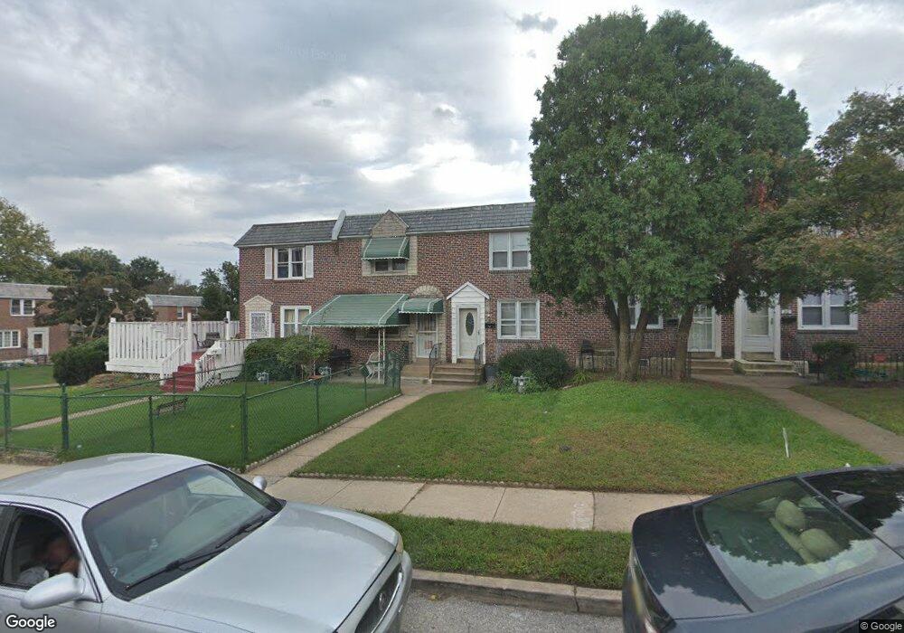
About This Home
This home is located at 26 Clarendon Dr, Darby, PA 19023 and is currently estimated at $171,072, approximately $148 per square foot. 26 Clarendon Dr is a home located in Delaware County with nearby schools including Ardmore Avenue School, Penn Wood Middle School, and Penn Wood High School - Cypress Street Campus.
Ownership History
Date
Name
Owned For
Owner Type
Purchase Details
Closed on
Sep 5, 2019
Sold by
Allen Raymond and Moore Dora E
Bought by
Moore Dora E
Current Estimated Value
Purchase Details
Closed on
Sep 28, 2005
Sold by
Rosato Gary F and Rosato Heather C
Bought by
Allen Raymond and Moore Allen Dora E
Home Financials for this Owner
Home Financials are based on the most recent Mortgage that was taken out on this home.
Original Mortgage
$91,248
Outstanding Balance
$48,902
Interest Rate
5.78%
Mortgage Type
Fannie Mae Freddie Mac
Estimated Equity
$122,170
Purchase Details
Closed on
Mar 30, 2001
Sold by
Bove James G and Bove Melissa A
Bought by
Rosato Gary F and Geddes Heather C
Home Financials for this Owner
Home Financials are based on the most recent Mortgage that was taken out on this home.
Original Mortgage
$49,914
Interest Rate
7.05%
Mortgage Type
FHA
Purchase Details
Closed on
Mar 4, 1997
Sold by
King David
Bought by
Bove James G and Bove George Melissa
Purchase Details
Closed on
Jul 16, 1996
Sold by
Ciglinsky Catherine
Bought by
Hud
Create a Home Valuation Report for This Property
The Home Valuation Report is an in-depth analysis detailing your home's value as well as a comparison with similar homes in the area
Home Values in the Area
Average Home Value in this Area
Purchase History
| Date | Buyer | Sale Price | Title Company |
|---|---|---|---|
| Moore Dora E | -- | None Available | |
| Allen Raymond | $89,900 | None Available | |
| Rosato Gary F | $49,800 | Commonwealth Land Title Ins | |
| Bove James G | $47,900 | Commonwealth Land Title Ins | |
| King David | $43,506 | Commonwealth Land Title Ins | |
| Hud | -- | -- |
Source: Public Records
Mortgage History
| Date | Status | Borrower | Loan Amount |
|---|---|---|---|
| Open | Allen Raymond | $91,248 | |
| Previous Owner | Rosato Gary F | $49,914 |
Source: Public Records
Tax History Compared to Growth
Tax History
| Year | Tax Paid | Tax Assessment Tax Assessment Total Assessment is a certain percentage of the fair market value that is determined by local assessors to be the total taxable value of land and additions on the property. | Land | Improvement |
|---|---|---|---|---|
| 2025 | $3,251 | $65,650 | $18,490 | $47,160 |
| 2024 | $3,251 | $65,650 | $18,490 | $47,160 |
| 2023 | $3,059 | $65,650 | $18,490 | $47,160 |
| 2022 | $2,975 | $65,650 | $18,490 | $47,160 |
| 2021 | $4,152 | $65,650 | $18,490 | $47,160 |
| 2020 | $4,014 | $54,950 | $14,980 | $39,970 |
| 2019 | $3,844 | $54,950 | $14,980 | $39,970 |
| 2018 | $3,797 | $54,950 | $0 | $0 |
| 2017 | $3,727 | $54,950 | $0 | $0 |
| 2016 | $302 | $54,950 | $0 | $0 |
| 2015 | $302 | $54,950 | $0 | $0 |
| 2014 | $302 | $54,950 | $0 | $0 |
Source: Public Records
Map
Nearby Homes
- 1007 Tyler Ave
- 4 Creek Ave
- 1008 Springfield Rd
- 1115 Chestnut St
- 134 S Macdade Blvd
- 28 S 12th St
- 1143 Chestnut St
- 1125 Main St
- 14 N Macdade Blvd
- 113 Hillside Ave
- 112 Pusey Ave
- 212 Pusey Ave
- 1210 Berkley Rd
- 439 Beechwood Ave
- 221 Highland Ave
- 17 Kern St
- 1017 Lawrence Ave
- 1044 Pine St
- 33 Mermont Cir
- 416 Jackson Ave
- 24 Clarendon Dr
- 28 Clarendon Dr
- 22 Clarendon Dr
- 20 Clarendon Dr
- 18 Clarendon Dr
- 16 Clarendon Dr
- 25 Southridge Rd
- 27 Southridge Rd
- 23 Southridge Rd
- 21 Southridge Rd
- 14 Clarendon Dr
- 19 Southridge Rd
- 12 Clarendon Dr
- 17 Southridge Rd
- 15 Southridge Rd
- 10 Clarendon Dr
- 13 Southridge Rd
- 25 Clarendon Dr
- 8 Clarendon Dr
- 23 Clarendon Dr