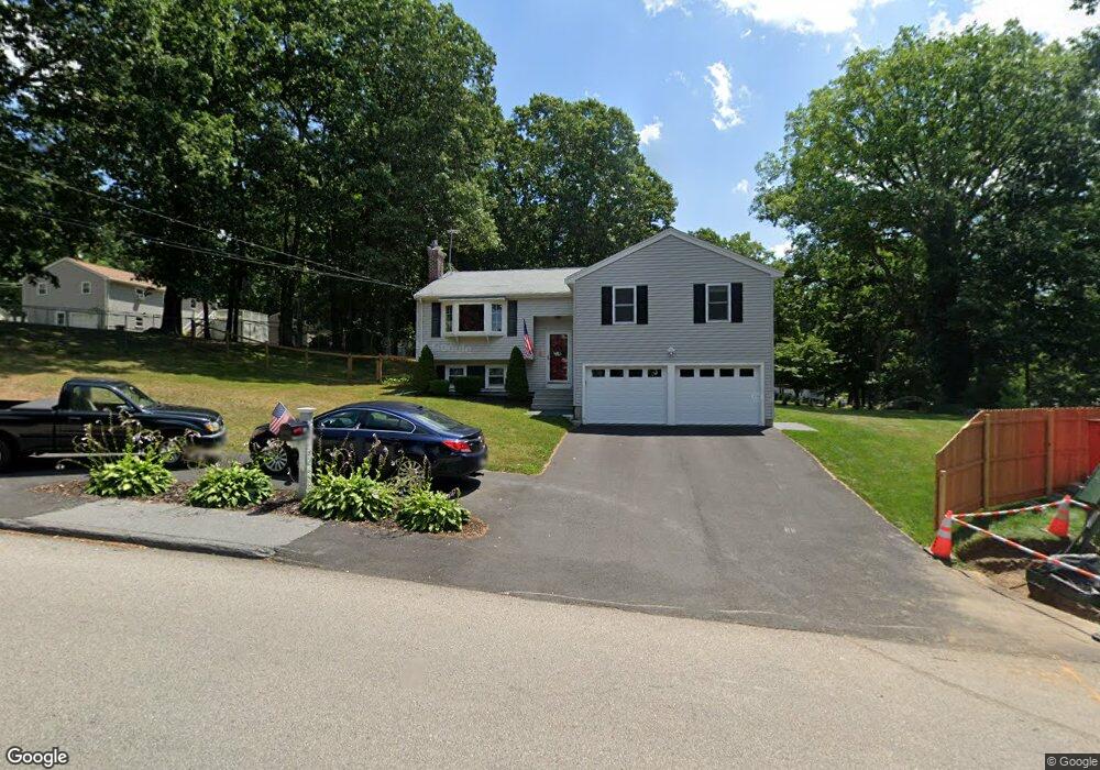
26 Dartmouth Dr Milford, MA 01757
Estimated Value: $567,000 - $608,311
3
Beds
2
Baths
1,608
Sq Ft
$365/Sq Ft
Est. Value
About This Home
This home is located at 26 Dartmouth Dr, Milford, MA 01757 and is currently estimated at $586,828, approximately $364 per square foot. 26 Dartmouth Dr is a home located in Worcester County with nearby schools including Milford High School.
Ownership History
Date
Name
Owned For
Owner Type
Purchase Details
Closed on
Apr 25, 2003
Sold by
Dharma Ronald R and Laksono Erlinawati
Bought by
Fitzgerald Mark W and Fitzgerald Sylvia M
Current Estimated Value
Home Financials for this Owner
Home Financials are based on the most recent Mortgage that was taken out on this home.
Original Mortgage
$239,900
Outstanding Balance
$102,227
Interest Rate
5.64%
Mortgage Type
Purchase Money Mortgage
Estimated Equity
$484,601
Purchase Details
Closed on
Jun 15, 2000
Sold by
Harlin Danny R and Harlin Gail R
Bought by
Oharma Ronald R
Home Financials for this Owner
Home Financials are based on the most recent Mortgage that was taken out on this home.
Original Mortgage
$99,900
Interest Rate
8.24%
Mortgage Type
Purchase Money Mortgage
Purchase Details
Closed on
Jul 21, 1995
Sold by
Harrison Richard and Harrison Vana S
Bought by
Harlin Danny and Harlin Gail
Create a Home Valuation Report for This Property
The Home Valuation Report is an in-depth analysis detailing your home's value as well as a comparison with similar homes in the area
Home Values in the Area
Average Home Value in this Area
Purchase History
| Date | Buyer | Sale Price | Title Company |
|---|---|---|---|
| Fitzgerald Mark W | $299,900 | -- | |
| Oharma Ronald R | $199,900 | -- | |
| Harlin Danny | $135,000 | -- |
Source: Public Records
Mortgage History
| Date | Status | Borrower | Loan Amount |
|---|---|---|---|
| Open | Harlin Danny | $239,900 | |
| Previous Owner | Harlin Danny | $97,300 | |
| Previous Owner | Harlin Danny | $99,900 |
Source: Public Records
Tax History Compared to Growth
Tax History
| Year | Tax Paid | Tax Assessment Tax Assessment Total Assessment is a certain percentage of the fair market value that is determined by local assessors to be the total taxable value of land and additions on the property. | Land | Improvement |
|---|---|---|---|---|
| 2025 | $7,003 | $547,100 | $184,100 | $363,000 |
| 2024 | $6,820 | $513,200 | $176,800 | $336,400 |
| 2023 | $6,359 | $440,100 | $147,300 | $292,800 |
| 2022 | $6,110 | $397,000 | $136,200 | $260,800 |
| 2021 | $6,104 | $382,000 | $136,200 | $245,800 |
| 2020 | $6,001 | $376,000 | $136,200 | $239,800 |
| 2019 | $5,595 | $338,300 | $136,200 | $202,100 |
| 2018 | $5,357 | $323,500 | $130,700 | $192,800 |
| 2017 | $4,747 | $282,700 | $130,700 | $152,000 |
| 2016 | $4,570 | $266,000 | $130,700 | $135,300 |
| 2015 | $4,414 | $251,500 | $125,200 | $126,300 |
Source: Public Records
Map
Nearby Homes
- 14 C Country Club Ln
- 33 Country Club Ln Unit D
- 14 Country Club Ln Unit C
- 94 Highland St
- 8 Country Club Ln Unit B
- 0 West St
- 5 Stanford Cir
- 9 Hancock St
- 8 Vassar Dr
- 20 Senate Rd
- 76 Jones Rd
- 175 West St
- 130 Dutcher St
- 15 Tammie Rd
- 8 Colonial Rd
- 1 Godfrey Ln Unit 1
- 104 Jones Rd
- 101 Jones Rd Unit 101
- 7 Highland St
- 9 Packard Rd