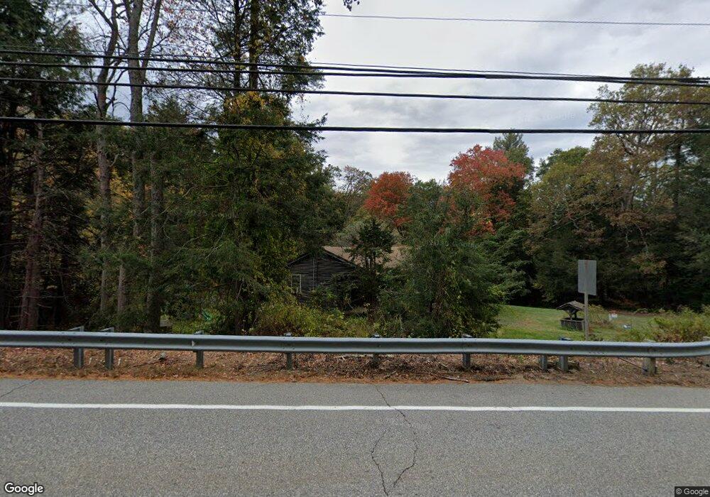
260 Buckley Hwy Stafford Springs, CT 06076
Stafford NeighborhoodEstimated Value: $294,000 - $372,000
3
Beds
1
Bath
1,185
Sq Ft
$283/Sq Ft
Est. Value
About This Home
This home is located at 260 Buckley Hwy, Stafford Springs, CT 06076 and is currently estimated at $335,798, approximately $283 per square foot. 260 Buckley Hwy is a home located in Tolland County with nearby schools including Stafford Elementary School, Stafford Middle School, and Stafford High School.
Ownership History
Date
Name
Owned For
Owner Type
Purchase Details
Closed on
May 11, 2005
Sold by
Demers Dean and Demers Margaret
Bought by
Irwin Sean and Irwin Lisa
Current Estimated Value
Home Financials for this Owner
Home Financials are based on the most recent Mortgage that was taken out on this home.
Original Mortgage
$162,400
Interest Rate
7.37%
Purchase Details
Closed on
May 15, 2003
Sold by
Sterling Kathleen
Bought by
Demers Dean and Demers Margaret
Home Financials for this Owner
Home Financials are based on the most recent Mortgage that was taken out on this home.
Original Mortgage
$150,000
Interest Rate
5.84%
Purchase Details
Closed on
Jan 9, 2003
Sold by
Stack Amy and Courchesne Shawn
Bought by
Sterling Kathleen
Purchase Details
Closed on
Dec 30, 1998
Sold by
Dion Edward and Dion Darlene
Bought by
Stark Amy and Courchesne Shawn
Create a Home Valuation Report for This Property
The Home Valuation Report is an in-depth analysis detailing your home's value as well as a comparison with similar homes in the area
Home Values in the Area
Average Home Value in this Area
Purchase History
| Date | Buyer | Sale Price | Title Company |
|---|---|---|---|
| Irwin Sean | $203,000 | -- | |
| Demers Dean | $175,000 | -- | |
| Sterling Kathleen | $136,000 | -- | |
| Stark Amy | $117,500 | -- |
Source: Public Records
Mortgage History
| Date | Status | Borrower | Loan Amount |
|---|---|---|---|
| Open | Stark Amy | $222,525 | |
| Closed | Stark Amy | $162,400 | |
| Closed | Stark Amy | $40,600 | |
| Previous Owner | Stark Amy | $150,000 |
Source: Public Records
Tax History Compared to Growth
Tax History
| Year | Tax Paid | Tax Assessment Tax Assessment Total Assessment is a certain percentage of the fair market value that is determined by local assessors to be the total taxable value of land and additions on the property. | Land | Improvement |
|---|---|---|---|---|
| 2025 | $6,699 | $118,510 | $29,820 | $88,690 |
| 2024 | $4,573 | $118,510 | $29,820 | $88,690 |
| 2023 | $4,356 | $118,510 | $29,820 | $88,690 |
| 2022 | $4,240 | $118,510 | $29,820 | $88,690 |
| 2021 | $4,179 | $118,510 | $29,820 | $88,690 |
| 2020 | $4,869 | $114,380 | $34,650 | $79,730 |
| 2019 | $3,971 | $113,680 | $34,650 | $79,030 |
| 2018 | $3,895 | $113,680 | $34,650 | $79,030 |
| 2017 | $3,857 | $113,680 | $34,650 | $79,030 |
| 2016 | $5,950 | $113,680 | $34,650 | $79,030 |
| 2015 | $3,809 | $126,280 | $34,650 | $91,630 |
| 2014 | $4,171 | $126,280 | $34,650 | $91,630 |
Source: Public Records
Map
Nearby Homes
- 257 Buckley Hwy
- 256 Buckley Hwy
- 176 Fenton Rd
- 246 Buckley Hwy
- 173 Crooked S Rd
- 284 Buckley Hwy
- 165 Crooked S Rd
- 301 Buckley Hwy
- 161-65 Crooked Rd S
- 236 Buckley Hwy
- 228 Buckley Hwy
- 313 Buckley Hwy
- 159 Crooked S Rd
- 321 Buckley Hwy
- 325 Buckley Hwy
- 140 Crooked S Rd
- 329 Buckley Hwy
- 204 Buckley Hwy
- 196 Buckley Hwy
- 334 Buckley Hwy