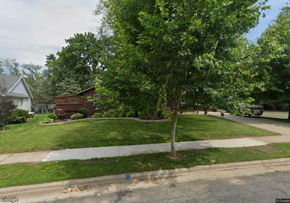
261 White Tail Dr Sun Prairie, WI 53590
Eastern Sun Prairie NeighborhoodEstimated Value: $392,000 - $432,000
3
Beds
2
Baths
1,575
Sq Ft
$259/Sq Ft
Est. Value
About This Home
This home is located at 261 White Tail Dr, Sun Prairie, WI 53590 and is currently estimated at $408,005, approximately $259 per square foot. 261 White Tail Dr is a home located in Dane County with nearby schools including Northside Elementary School, Sun Prairie East High School, and Central Heights Middle School.
Ownership History
Date
Name
Owned For
Owner Type
Purchase Details
Closed on
Apr 30, 2019
Sold by
Carol Brandt Charles E and Carol Lbrandt
Bought by
Brandt Revocable Trust
Current Estimated Value
Purchase Details
Closed on
Jan 16, 2009
Sold by
Sullivan Jesse and Sullivan Annette
Bought by
Brandt Charles E and Brandt Carol L
Home Financials for this Owner
Home Financials are based on the most recent Mortgage that was taken out on this home.
Original Mortgage
$184,500
Interest Rate
5.44%
Mortgage Type
Purchase Money Mortgage
Purchase Details
Closed on
Dec 11, 2006
Sold by
Lisowe Aaron and Lisowe Kristina S
Bought by
Sullivan Jesse
Home Financials for this Owner
Home Financials are based on the most recent Mortgage that was taken out on this home.
Original Mortgage
$200,172
Interest Rate
6.33%
Mortgage Type
Purchase Money Mortgage
Create a Home Valuation Report for This Property
The Home Valuation Report is an in-depth analysis detailing your home's value as well as a comparison with similar homes in the area
Home Values in the Area
Average Home Value in this Area
Purchase History
| Date | Buyer | Sale Price | Title Company |
|---|---|---|---|
| Brandt Revocable Trust | -- | None Available | |
| Brandt Charles E | $205,000 | None Available | |
| Sullivan Jesse | $203,000 | None Available |
Source: Public Records
Mortgage History
| Date | Status | Borrower | Loan Amount |
|---|---|---|---|
| Previous Owner | Brandt Charles E | $184,500 | |
| Previous Owner | Sullivan Jesse | $200,172 |
Source: Public Records
Tax History Compared to Growth
Tax History
| Year | Tax Paid | Tax Assessment Tax Assessment Total Assessment is a certain percentage of the fair market value that is determined by local assessors to be the total taxable value of land and additions on the property. | Land | Improvement |
|---|---|---|---|---|
| 2024 | $6,125 | $326,500 | $73,400 | $253,100 |
| 2023 | $5,547 | $326,500 | $73,400 | $253,100 |
| 2021 | $5,541 | $267,000 | $68,500 | $198,500 |
| 2020 | $5,686 | $267,000 | $68,500 | $198,500 |
| 2019 | $5,551 | $231,800 | $51,500 | $180,300 |
| 2018 | $5,145 | $231,800 | $51,500 | $180,300 |
| 2017 | $4,947 | $231,800 | $51,500 | $180,300 |
| 2016 | $4,658 | $198,100 | $44,400 | $153,700 |
| 2015 | $4,528 | $198,100 | $44,400 | $153,700 |
| 2014 | $4,436 | $192,900 | $44,400 | $148,500 |
| 2013 | $4,601 | $192,900 | $44,400 | $148,500 |
Source: Public Records
Map
Nearby Homes
- 111 White Tail Dr
- 626 Sanibel Ln
- 223 Larkspur Ct
- 311 Spoke Cir
- 201 E Lane St Unit 202
- 1077 Gas Light Dr
- 2543 Water Lily Cir
- 2560 Water Lily Cir
- 2535 Water Lily Cir
- 2522 Water Lily Cir
- 566 Gerald Ave
- 1171 Carriage Dr
- 116 Gary Ct
- 227 Windsor St
- Phase 2 Lots Town Hall Dr
- 147 Flint St
- 1300 Swordleaf Ln
- 530 W Main St
- 1323 Prairie Rose Dr
- 5801 Town Hall Dr
- 253 White Tail Dr
- 253 White Tail Dr
- 716 Bluestem Ct
- 720 Bluestem Ct
- 303 White Tail Dr
- 724 Bluestem Ct
- 245 White Tail Dr
- 244 White Tail Dr
- 715 Robin Dr
- 699 Robin Dr
- 728 Bluestem Ct
- 727 Robin Dr
- 95 Whitetail Dr
- 313 White Tail Dr
- 748 Bluestem Ct
- 744 Bluestem Ct
- L88 White Tail Dr
- L101 White Tail Dr
- L100 White Tail Dr
- L92 White Tail Dr