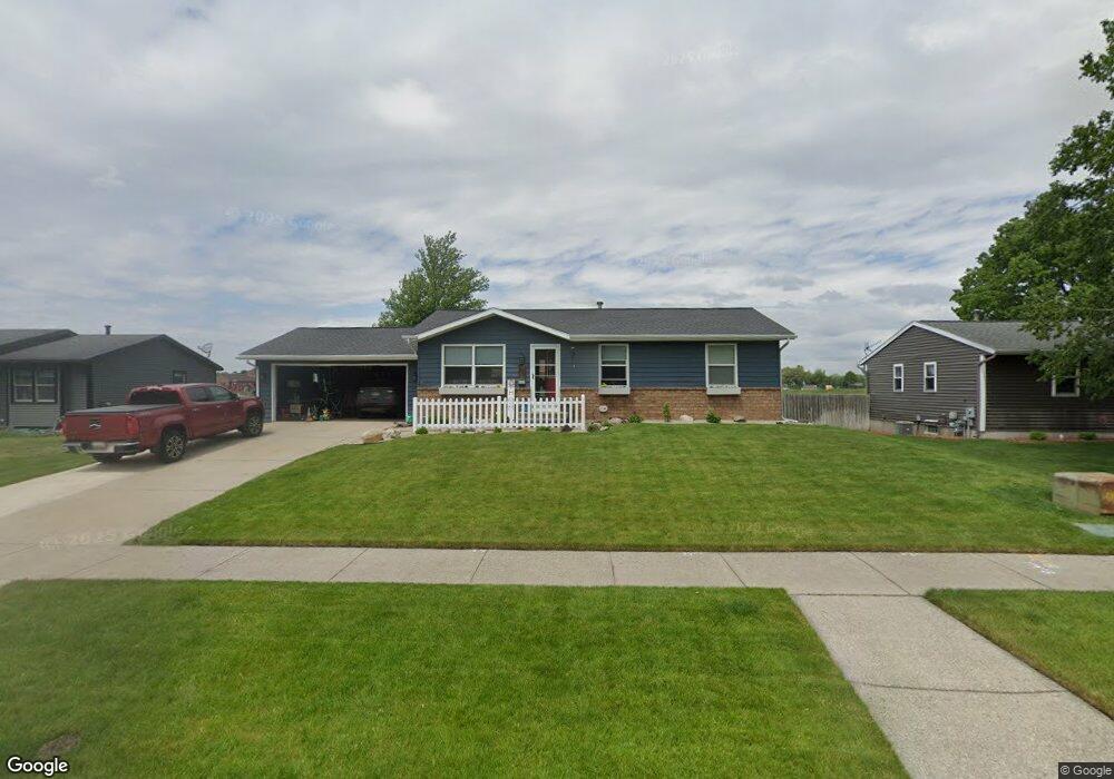
2625 Springdale Dr Hudsonville, MI 49426
Estimated Value: $335,000 - $360,389
4
Beds
1
Bath
1
Sq Ft
$347,347/Sq Ft
Est. Value
About This Home
This home is located at 2625 Springdale Dr, Hudsonville, MI 49426 and is currently estimated at $347,347, approximately $347,347 per square foot. 2625 Springdale Dr is a home located in Ottawa County with nearby schools including Hudsonville Freshman Campus, Baldwin Street Middle School, and Riley Street Middle School.
Ownership History
Date
Name
Owned For
Owner Type
Purchase Details
Closed on
Sep 15, 2005
Sold by
Dehaan Chad P and Dehaan Jennifer
Bought by
Thomas Ronald and Thomas Rebecca
Current Estimated Value
Home Financials for this Owner
Home Financials are based on the most recent Mortgage that was taken out on this home.
Original Mortgage
$126,000
Outstanding Balance
$68,087
Interest Rate
6.01%
Mortgage Type
Fannie Mae Freddie Mac
Estimated Equity
$279,260
Create a Home Valuation Report for This Property
The Home Valuation Report is an in-depth analysis detailing your home's value as well as a comparison with similar homes in the area
Home Values in the Area
Average Home Value in this Area
Purchase History
| Date | Buyer | Sale Price | Title Company |
|---|---|---|---|
| Thomas Ronald | $157,590 | Lighthouse Title Inc |
Source: Public Records
Mortgage History
| Date | Status | Borrower | Loan Amount |
|---|---|---|---|
| Open | Thomas Ronald | $126,000 | |
| Closed | Thomas Ronald | $31,500 |
Source: Public Records
Tax History Compared to Growth
Tax History
| Year | Tax Paid | Tax Assessment Tax Assessment Total Assessment is a certain percentage of the fair market value that is determined by local assessors to be the total taxable value of land and additions on the property. | Land | Improvement |
|---|---|---|---|---|
| 2025 | $2,850 | $161,300 | $0 | $0 |
| 2024 | $2,734 | $152,100 | $0 | $0 |
| 2023 | $2,609 | $133,800 | $0 | $0 |
| 2022 | $2,517 | $112,900 | $0 | $0 |
| 2021 | $2,443 | $107,300 | $0 | $0 |
| 2020 | $2,415 | $88,800 | $0 | $0 |
| 2019 | $2,375 | $84,400 | $0 | $0 |
| 2018 | $2,119 | $79,200 | $0 | $0 |
| 2017 | $2,119 | $79,200 | $0 | $0 |
| 2016 | -- | $68,500 | $0 | $0 |
| 2015 | -- | $63,400 | $0 | $0 |
| 2014 | -- | $58,800 | $0 | $0 |
Source: Public Records
Map
Nearby Homes
- 6340 Summer Dr
- 0 V/L Edson (Parcel B) Dr
- 6724 28th Ave
- 6714 Cedar Grove W
- 6760 N Wentward Ct
- 2921 N Wentward Ct
- 2339 Van Buren St
- 3204 Port Sheldon St
- 6129 W Bay Ct
- V/L Port Sheldon St
- 5833 Nelson Dr
- 3126 Van Buren St
- 6293 Eastridge Dr
- 6363 Eastridge Ct
- 5557 Pleasant Ave
- 2323 Rosewood St
- 2101 Rosewood St
- 2072 Oak Hollow Dr
- 5290 Southbrook Ct Unit 46
- 5270 Southbrook Ct Unit 64
- 2635 Springdale Dr
- 2635 Springdale St
- 2615 Springdale Dr
- 2647 Springdale Dr
- 2636 Springdale St
- 2616 Springdale Dr
- 2636 Springdale Dr
- 2657 Springdale Dr
- 2648 Springdale Dr
- 2665 Springdale Dr
- 2658 Springdale Dr
- 6178 Nellie Ave
- 2635 Hope St
- 2666 Springdale Dr
- 2651 Hope St
- 2675 Springdale Dr
- 6160 Nellie Ave
- 2676 Springdale Dr
- 2665 Hope St
- 2687 Springdale Dr