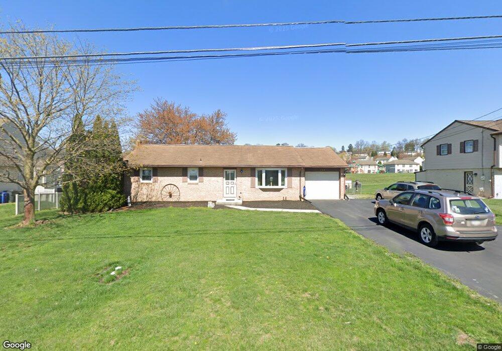
263 Tobacco Rd Ephrata, PA 17522
Estimated Value: $295,314 - $350,000
2
Beds
2
Baths
1,092
Sq Ft
$292/Sq Ft
Est. Value
About This Home
This home is located at 263 Tobacco Rd, Ephrata, PA 17522 and is currently estimated at $319,329, approximately $292 per square foot. 263 Tobacco Rd is a home located in Lancaster County with nearby schools including Brownstown El School, Gerald G. Huesken Middle School, and Conestoga Valley High School.
Ownership History
Date
Name
Owned For
Owner Type
Purchase Details
Closed on
Mar 22, 2014
Sold by
Leeper Roxann L
Bought by
Leeper Ronald C
Current Estimated Value
Purchase Details
Closed on
May 24, 1999
Sold by
Weinhold Dean M and Weinhold Linda J
Bought by
Leeper Ronald C and Leeper Roxann L
Home Financials for this Owner
Home Financials are based on the most recent Mortgage that was taken out on this home.
Original Mortgage
$59,000
Interest Rate
6.82%
Create a Home Valuation Report for This Property
The Home Valuation Report is an in-depth analysis detailing your home's value as well as a comparison with similar homes in the area
Home Values in the Area
Average Home Value in this Area
Purchase History
| Date | Buyer | Sale Price | Title Company |
|---|---|---|---|
| Leeper Ronald C | -- | None Available | |
| Leeper Ronald C | $117,500 | -- |
Source: Public Records
Mortgage History
| Date | Status | Borrower | Loan Amount |
|---|---|---|---|
| Closed | Leeper Ronald C | $59,000 |
Source: Public Records
Tax History Compared to Growth
Tax History
| Year | Tax Paid | Tax Assessment Tax Assessment Total Assessment is a certain percentage of the fair market value that is determined by local assessors to be the total taxable value of land and additions on the property. | Land | Improvement |
|---|---|---|---|---|
| 2025 | $2,615 | $131,400 | $48,100 | $83,300 |
| 2024 | $2,615 | $131,400 | $48,100 | $83,300 |
| 2023 | $2,554 | $131,400 | $48,100 | $83,300 |
| 2022 | $2,451 | $131,400 | $48,100 | $83,300 |
| 2021 | $2,361 | $131,400 | $48,100 | $83,300 |
| 2020 | $2,361 | $131,400 | $48,100 | $83,300 |
| 2019 | $2,309 | $131,400 | $48,100 | $83,300 |
| 2018 | $3,328 | $131,400 | $48,100 | $83,300 |
| 2017 | $3,019 | $142,100 | $50,400 | $91,700 |
| 2016 | $3,019 | $142,100 | $50,400 | $91,700 |
| 2015 | $757 | $142,100 | $50,400 | $91,700 |
| 2014 | $2,012 | $142,100 | $50,400 | $91,700 |
Source: Public Records
Map
Nearby Homes
- 13 Hilltop Ave
- 628 Fulton St
- 240 N 11th St
- 9 Circle Rock Dr
- 322 Main St
- 106 Westview Dr
- 103 Main St
- 244 Miller Rd
- 11 Fulton St
- 1127 S State St
- 283 Skyview Ln
- 43 Parkview Heights Rd
- 50 Allen Rd
- 205 E Main St
- 1059 Henn Ave
- 708 Primrose Ln
- 259 Heatherwood Dr
- 977 88 Rettew Mill Rd
- 112 Sycamore Rd
- 00 Wyndale Dr