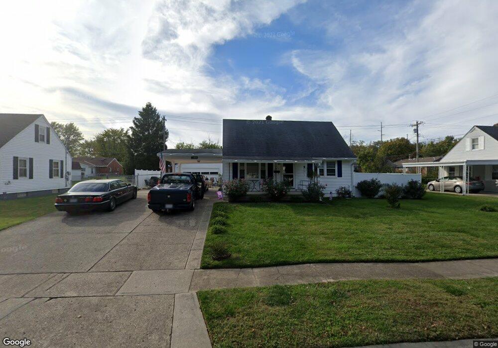
265 Westfield Ave Hamilton, OH 45013
Estimated Value: $232,000 - $246,000
3
Beds
2
Baths
1,834
Sq Ft
$129/Sq Ft
Est. Value
About This Home
This home is located at 265 Westfield Ave, Hamilton, OH 45013 and is currently estimated at $235,941, approximately $128 per square foot. 265 Westfield Ave is a home located in Butler County with nearby schools including Brookwood Elementary School, Wilson Middle School, and Hamilton High School Main Campus.
Ownership History
Date
Name
Owned For
Owner Type
Purchase Details
Closed on
May 7, 2010
Sold by
Lusk Randall L and Lusk Deborah T
Bought by
Thomas Michelle
Current Estimated Value
Home Financials for this Owner
Home Financials are based on the most recent Mortgage that was taken out on this home.
Original Mortgage
$111,443
Outstanding Balance
$75,097
Interest Rate
5.16%
Mortgage Type
FHA
Estimated Equity
$160,844
Purchase Details
Closed on
Dec 26, 2008
Sold by
Lusk Randall L and Lusk Deborah T
Bought by
Lusk Randall L and Lusk Deborah T
Purchase Details
Closed on
May 29, 1998
Sold by
Mitchell Janet
Bought by
Lusk Randall L
Home Financials for this Owner
Home Financials are based on the most recent Mortgage that was taken out on this home.
Original Mortgage
$87,720
Interest Rate
7.5%
Mortgage Type
VA
Purchase Details
Closed on
Apr 1, 1987
Purchase Details
Closed on
Mar 1, 1985
Create a Home Valuation Report for This Property
The Home Valuation Report is an in-depth analysis detailing your home's value as well as a comparison with similar homes in the area
Home Values in the Area
Average Home Value in this Area
Purchase History
| Date | Buyer | Sale Price | Title Company |
|---|---|---|---|
| Thomas Michelle | $113,500 | Attorney | |
| Lusk Randall L | -- | Attorney | |
| Lusk Randall L | $86,000 | Midland Title Security Inc | |
| -- | $64,000 | -- | |
| -- | $58,000 | -- |
Source: Public Records
Mortgage History
| Date | Status | Borrower | Loan Amount |
|---|---|---|---|
| Open | Thomas Michelle | $111,443 | |
| Previous Owner | Lusk Randall L | $87,720 |
Source: Public Records
Tax History Compared to Growth
Tax History
| Year | Tax Paid | Tax Assessment Tax Assessment Total Assessment is a certain percentage of the fair market value that is determined by local assessors to be the total taxable value of land and additions on the property. | Land | Improvement |
|---|---|---|---|---|
| 2024 | $2,089 | $58,950 | $7,960 | $50,990 |
| 2023 | $2,093 | $58,290 | $7,960 | $50,330 |
| 2022 | $1,679 | $41,900 | $7,960 | $33,940 |
| 2021 | $1,834 | $40,460 | $7,960 | $32,500 |
| 2020 | $1,911 | $40,460 | $7,960 | $32,500 |
| 2019 | $2,481 | $33,890 | $8,490 | $25,400 |
| 2018 | $1,577 | $33,890 | $8,490 | $25,400 |
| 2017 | $1,591 | $33,890 | $8,490 | $25,400 |
| 2016 | $1,530 | $31,050 | $8,490 | $22,560 |
| 2015 | $1,521 | $31,050 | $8,490 | $22,560 |
| 2014 | $1,700 | $31,050 | $8,490 | $22,560 |
| 2013 | $1,700 | $36,950 | $11,330 | $25,620 |
Source: Public Records
Map
Nearby Homes
- 885 Carlisle Ave
- 1415 Main St
- 82 N Brookwood Ave
- 560 Springvale Dr
- 16 Rockford Dr
- 1317 Glenbrook Dr
- 55 Cove Ct
- 781 Springvale Dr
- 75 Waterpoint Ln
- 5 Waterview Ct Unit 30
- 1350 Stahlheber Rd
- 1317 Goodman Ave
- 1593 Eden Park Dr
- 1210 Stephanie Dr
- 1210 Stephanie Dr Unit 3
- 2073 Sunset Dr
- 1311 Park Ave
- 1150 Franklin St
- 71 Livingston Dr
- 1230 Stephanie Dr
- 281 Westfield Ave
- 251 Westfield Ave
- 1062 Carlisle Ave
- 1076 Carlisle Ave
- 1050 Carlisle Ave
- 235 Westfield Ave
- 1088 Carlisle Ave
- 1036 Carlisle Ave
- 266 Westfield Ave
- 280 Westfield Ave
- 250 Westfield Ave
- 995 Stahlheber Rd
- 1024 Carlisle Ave
- 221 Westfield Ave
- 234 Westfield Ave
- 296 Westfield Ave
- 1014 Carlisle Ave
- 220 Westfield Ave
- 1095 Haverhill Dr
- 1075 Carlisle Ave