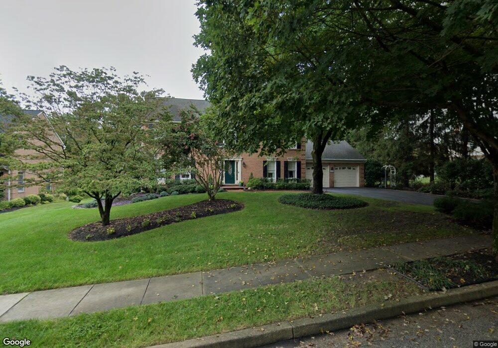
2665 Thornbrook Rd Ellicott City, MD 21042
Estimated Value: $816,972 - $937,000
--
Bed
3
Baths
2,668
Sq Ft
$329/Sq Ft
Est. Value
About This Home
This home is located at 2665 Thornbrook Rd, Ellicott City, MD 21042 and is currently estimated at $876,743, approximately $328 per square foot. 2665 Thornbrook Rd is a home located in Howard County with nearby schools including St. Johns Lane Elementary School, Patapsco Middle School, and Mount Hebron High School.
Ownership History
Date
Name
Owned For
Owner Type
Purchase Details
Closed on
Aug 14, 1995
Sold by
Abel Walter B
Bought by
Fruscello Thomas W
Current Estimated Value
Home Financials for this Owner
Home Financials are based on the most recent Mortgage that was taken out on this home.
Original Mortgage
$223,900
Interest Rate
7.48%
Purchase Details
Closed on
Oct 3, 1990
Sold by
Bacon Charles A
Bought by
Abel Walter B
Home Financials for this Owner
Home Financials are based on the most recent Mortgage that was taken out on this home.
Original Mortgage
$150,000
Interest Rate
10.22%
Purchase Details
Closed on
Sep 28, 1989
Sold by
Forty West Builders Inc
Bought by
Bacon Charles A
Home Financials for this Owner
Home Financials are based on the most recent Mortgage that was taken out on this home.
Original Mortgage
$213,900
Interest Rate
10.03%
Create a Home Valuation Report for This Property
The Home Valuation Report is an in-depth analysis detailing your home's value as well as a comparison with similar homes in the area
Home Values in the Area
Average Home Value in this Area
Purchase History
| Date | Buyer | Sale Price | Title Company |
|---|---|---|---|
| Fruscello Thomas W | $279,900 | -- | |
| Abel Walter B | $255,000 | -- | |
| Bacon Charles A | $237,700 | -- |
Source: Public Records
Mortgage History
| Date | Status | Borrower | Loan Amount |
|---|---|---|---|
| Closed | Fruscello Thomas W | $223,900 | |
| Previous Owner | Abel Walter B | $150,000 | |
| Previous Owner | Bacon Charles A | $213,900 |
Source: Public Records
Tax History Compared to Growth
Tax History
| Year | Tax Paid | Tax Assessment Tax Assessment Total Assessment is a certain percentage of the fair market value that is determined by local assessors to be the total taxable value of land and additions on the property. | Land | Improvement |
|---|---|---|---|---|
| 2025 | $9,608 | $665,400 | $0 | $0 |
| 2024 | $9,608 | $625,900 | $266,500 | $359,400 |
| 2023 | $9,022 | $597,467 | $0 | $0 |
| 2022 | $8,574 | $569,033 | $0 | $0 |
| 2021 | $8,079 | $540,600 | $197,100 | $343,500 |
| 2020 | $8,079 | $533,333 | $0 | $0 |
| 2019 | $8,080 | $526,067 | $0 | $0 |
| 2018 | $7,696 | $518,800 | $180,800 | $338,000 |
| 2017 | $7,342 | $518,800 | $0 | $0 |
| 2016 | -- | $472,200 | $0 | $0 |
| 2015 | -- | $448,900 | $0 | $0 |
| 2014 | -- | $448,900 | $0 | $0 |
Source: Public Records
Map
Nearby Homes
- 2515 Ashbrook Dr
- 9398 Furrow Ave
- 2331 Ridge Tree Ct
- 9305 Furrow Ave
- 9708 Harbin Ct
- 9371 Duff Ct
- 9337 Millbrook Rd
- 9814 Millwick Dr
- 9987 Old Mill Rd
- 9991 Old Mill Rd
- 9948 Baker Ln
- 2634 Queensland Dr
- 9920 Baker Ln
- 9969 Baker Ln
- 9980 Baker Ln
- Lowell Quick Move-In Plan at Bethany Glen - 55+ Villas
- 9792 Blue Ivy Way
- 9209 W Stayman Dr
- 9933 Baker Ln
- 9935 Baker Ln
- 2669 Thornbrook Rd
- 2525 Ashbrook Dr
- 2529 Ashbrook Dr
- 2660 Thornbrook Rd
- 2673 Thornbrook Rd
- 2533 Ashbrook Dr
- 2664 Thornbrook Rd
- 2511 Ashbrook Dr
- 2677 Thornbrook Rd
- 2607 Haven Oak Ct
- 2672 Haven Oak Ct
- 2672 Thornbrook Rd
- 2541 Ashbrook Dr
- 2520 Ashbrook Dr
- 2507 Ashbrook Dr
- 2524 Ashbrook Dr
- 2681 Thornbrook Rd
- 2604 Haven Oak Ct
- 2512 Ashbrook Dr
- 2528 Ashbrook Dr