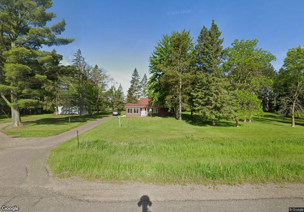
26815 Us Highway 169 Aitkin, MN 56431
Estimated Value: $232,732 - $317,000
3
Beds
1
Bath
960
Sq Ft
$278/Sq Ft
Est. Value
About This Home
This home is located at 26815 Us Highway 169, Aitkin, MN 56431 and is currently estimated at $266,433, approximately $277 per square foot. 26815 Us Highway 169 is a home located in Aitkin County with nearby schools including Rippleside Elementary School and Aitkin Secondary School.
Ownership History
Date
Name
Owned For
Owner Type
Purchase Details
Closed on
Jun 14, 2024
Sold by
Rono Darek and Rono Gabrialla
Bought by
Anderson Jack
Current Estimated Value
Home Financials for this Owner
Home Financials are based on the most recent Mortgage that was taken out on this home.
Original Mortgage
$191,920
Outstanding Balance
$189,563
Interest Rate
7.22%
Mortgage Type
New Conventional
Estimated Equity
$76,870
Purchase Details
Closed on
Apr 22, 2021
Sold by
Mesker and Tami
Bought by
Rono Darek T
Purchase Details
Closed on
Dec 1, 2012
Bought by
Mesker Derick and Mesker Tami
Create a Home Valuation Report for This Property
The Home Valuation Report is an in-depth analysis detailing your home's value as well as a comparison with similar homes in the area
Home Values in the Area
Average Home Value in this Area
Purchase History
| Date | Buyer | Sale Price | Title Company |
|---|---|---|---|
| Anderson Jack | $239,900 | -- | |
| Rono Darek T | $75,000 | -- | |
| Mesker Derick | $70,000 | -- |
Source: Public Records
Mortgage History
| Date | Status | Borrower | Loan Amount |
|---|---|---|---|
| Open | Anderson Jack | $191,920 |
Source: Public Records
Tax History Compared to Growth
Tax History
| Year | Tax Paid | Tax Assessment Tax Assessment Total Assessment is a certain percentage of the fair market value that is determined by local assessors to be the total taxable value of land and additions on the property. | Land | Improvement |
|---|---|---|---|---|
| 2025 | $360 | $194,600 | $56,400 | $138,200 |
| 2024 | $560 | $189,300 | $57,500 | $131,800 |
| 2023 | $474 | $182,600 | $50,800 | $131,800 |
| 2022 | $274 | $160,000 | $48,700 | $111,300 |
| 2021 | $714 | $102,700 | $39,900 | $62,800 |
| 2020 | $708 | $101,000 | $41,000 | $60,000 |
| 2019 | $706 | $95,600 | $43,100 | $52,500 |
| 2018 | $680 | $92,600 | $43,800 | $48,800 |
| 2017 | $634 | $90,200 | $44,100 | $46,100 |
| 2016 | $606 | $95,500 | $45,500 | $50,000 |
| 2014 | $568 | $87,500 | $40,400 | $47,100 |
| 2012 | $6 | $114,300 | $58,500 | $55,800 |
Source: Public Records
Map
Nearby Homes
- 29207 421st Place
- 29225 442nd Place
- 29957 436th Place
- 29351 410th Place
- 23007 430th Ave
- 41288 300th Ln
- 27311 Nelson Dr
- 29569 400th Ave
- TBD Taylor Rd
- 39751 State Highway 18
- Blk 6 Lot 32 Canterbury Town
- Blk 3 Lots 2 & 3 Nottingham Town
- 22129 437th Ave
- Blk 2 Lots 1 & 2 Canterbury Town
- Blk 8 Lot 31 Canterbury Town
- Blk 8 Lot 04
- C3-12 Sherwood Forest
- Blk 5 lot 12 Canterbury Town
- Blk 1 Lot 13 London Town
- 27162 Greenwood Isle Cir
- 26815 Us Highway 169
- 26838 Us Highway 169
- 26838 Us Hwy 169
- 27037 Us Highway 169
- 27076 Us Highway 169
- 27164 Us Highway 169
- 27190 Us Highway 169
- xxx Tame Fish Rd
- 26411 Us Highway 169
- 27264 435th Ave
- 27261 435th Ave
- 27249 435th Ave
- 27235 435th Ave
- 27269 435th Ave
- 27265 435th Ave
- 27219 435th Ave
- 27211 435th Ave
- 27179 435th Ave
- 27283 435th Ave
- 27207 435th Ave