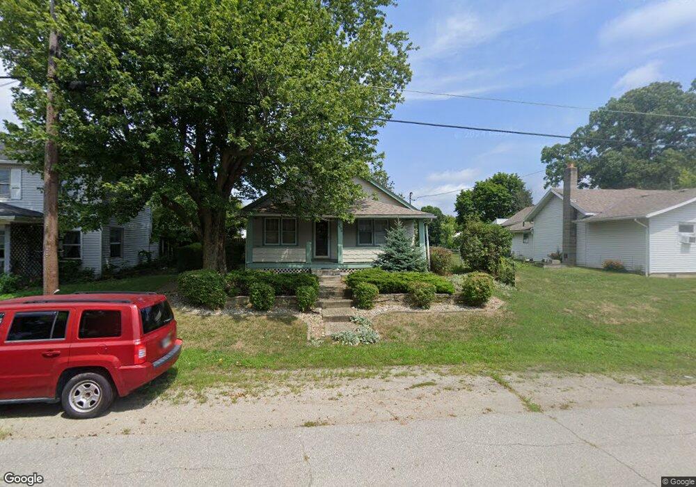
2690 U S Highway 40 London, OH 43140
Estimated Value: $157,000 - $283,000
3
Beds
1
Bath
1,008
Sq Ft
$213/Sq Ft
Est. Value
About This Home
This home is located at 2690 U S Highway 40, London, OH 43140 and is currently estimated at $214,266, approximately $212 per square foot. 2690 U S Highway 40 is a home located in Madison County with nearby schools including London Elementary School, London Middle School, and London High School.
Ownership History
Date
Name
Owned For
Owner Type
Purchase Details
Closed on
Apr 23, 2021
Sold by
Mathias Robin C
Bought by
Mathias Alden M
Current Estimated Value
Home Financials for this Owner
Home Financials are based on the most recent Mortgage that was taken out on this home.
Original Mortgage
$109,000
Outstanding Balance
$98,493
Interest Rate
3.05%
Mortgage Type
New Conventional
Estimated Equity
$115,773
Purchase Details
Closed on
May 14, 2003
Sold by
Boston Mark W and Boston Cindy
Bought by
Mathias Robin C
Home Financials for this Owner
Home Financials are based on the most recent Mortgage that was taken out on this home.
Original Mortgage
$78,850
Interest Rate
5.87%
Mortgage Type
Purchase Money Mortgage
Create a Home Valuation Report for This Property
The Home Valuation Report is an in-depth analysis detailing your home's value as well as a comparison with similar homes in the area
Home Values in the Area
Average Home Value in this Area
Purchase History
| Date | Buyer | Sale Price | Title Company |
|---|---|---|---|
| Mathias Alden M | $168,000 | Landsel Title Agency Inc | |
| Mathias Robin C | $83,000 | Midland Title |
Source: Public Records
Mortgage History
| Date | Status | Borrower | Loan Amount |
|---|---|---|---|
| Open | Mathias Alden M | $109,000 | |
| Previous Owner | Mathias Robin C | $78,850 |
Source: Public Records
Tax History Compared to Growth
Tax History
| Year | Tax Paid | Tax Assessment Tax Assessment Total Assessment is a certain percentage of the fair market value that is determined by local assessors to be the total taxable value of land and additions on the property. | Land | Improvement |
|---|---|---|---|---|
| 2024 | $955 | $26,930 | $2,450 | $24,480 |
| 2023 | $955 | $26,930 | $2,450 | $24,480 |
| 2022 | $905 | $22,390 | $2,040 | $20,350 |
| 2021 | $862 | $22,390 | $2,040 | $20,350 |
| 2020 | $863 | $22,390 | $2,040 | $20,350 |
| 2019 | $796 | $19,200 | $1,830 | $17,370 |
| 2018 | $705 | $19,200 | $1,830 | $17,370 |
| 2017 | $553 | $19,200 | $1,830 | $17,370 |
| 2016 | $553 | $15,610 | $1,830 | $13,780 |
| 2015 | $632 | $15,610 | $1,830 | $13,780 |
| 2014 | $632 | $15,610 | $1,830 | $13,780 |
| 2013 | -- | $21,400 | $2,080 | $19,320 |
Source: Public Records
Map
Nearby Homes
- 2425 Old Us Highway 40 NW
- 3211 Old Columbus Rd
- 1250 E Choctaw Dr
- 1300 W Choctaw Dr
- 1340 W Choctaw Dr
- 1405 Chickasaw Dr
- 108 Markley Rd
- 1495 W Choctaw Dr
- 1435 E Choctaw Dr
- 1427 Itawamba Trail
- 1490 Itawamba Trail
- 1730 W Choctaw Dr
- 1855 E Choctaw Dr
- 2055 Cherokee Dr
- 2086 Palouse Dr
- 2120 Palouse Dr
- 2460 Cherokee Dr
- 2206 State Route 56 SW
- 725 Cheney Pass
- 2600 Seneca Dr
- 2690 Us Hwy Unit 40
- 2690 Old Us Highway 40 NW
- 2700 Old Us Hwy Unit 40
- 2680 Old Us Highway 40 NW
- 2700 Old Us Highway 40 NW
- 2710 Old Us Highway 40 NW
- 2697 U S Highway 40
- 2705 Old Us Highway 40 NW Unit EAST
- 2685 U S Highway 40
- 2697 Old Us Rt 40
- 2697 Old Us 40 NW Unit EAST
- 2685 Old Us Highway 40 NW
- 2685 Old Us Highway 40 NW
- 2697 Old Us Highway 40 NW
- 2697 Old Us Highway 40 NW Unit 40
- 2705 Old Us Hwy Unit 40
- 2705 Old Us Highway 40 NW
- 2670 Old Us Highway 40 NW
- 2730 Old Us Highway 40 NW
- 2670 U S Highway 40