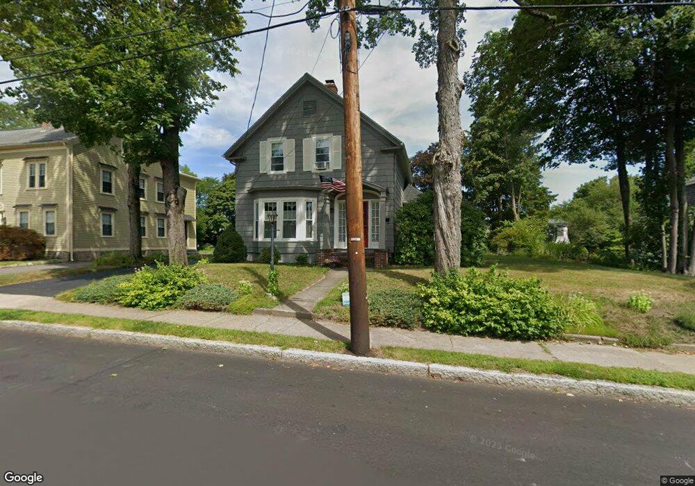
27 Ash St North Attleboro, MA 02760
North Attleboro NeighborhoodEstimated Value: $482,000 - $616,000
3
Beds
2
Baths
1,868
Sq Ft
$301/Sq Ft
Est. Value
About This Home
This home is located at 27 Ash St, North Attleboro, MA 02760 and is currently estimated at $562,595, approximately $301 per square foot. 27 Ash St is a home located in Bristol County with nearby schools including North Attleboro High School, Cadence Academy Preschool - North Attleborough, and Bishop Feehan High School.
Ownership History
Date
Name
Owned For
Owner Type
Purchase Details
Closed on
Apr 27, 1990
Sold by
Taber Edward F
Bought by
Bento Russell A
Current Estimated Value
Purchase Details
Closed on
Feb 26, 1988
Sold by
Sutherland A V
Bought by
Scholtes Paul
Create a Home Valuation Report for This Property
The Home Valuation Report is an in-depth analysis detailing your home's value as well as a comparison with similar homes in the area
Home Values in the Area
Average Home Value in this Area
Purchase History
| Date | Buyer | Sale Price | Title Company |
|---|---|---|---|
| Bento Russell A | $97,500 | -- | |
| Scholtes Paul | $167,500 | -- |
Source: Public Records
Mortgage History
| Date | Status | Borrower | Loan Amount |
|---|---|---|---|
| Open | Scholtes Paul | $200,000 | |
| Closed | Scholtes Paul | $26,000 | |
| Closed | Scholtes Paul | $25,000 |
Source: Public Records
Tax History Compared to Growth
Tax History
| Year | Tax Paid | Tax Assessment Tax Assessment Total Assessment is a certain percentage of the fair market value that is determined by local assessors to be the total taxable value of land and additions on the property. | Land | Improvement |
|---|---|---|---|---|
| 2025 | $6,433 | $545,600 | $145,400 | $400,200 |
| 2024 | $6,134 | $531,500 | $145,400 | $386,100 |
| 2023 | $6,126 | $479,000 | $151,800 | $327,200 |
| 2022 | $5,998 | $430,600 | $145,400 | $285,200 |
| 2021 | $6,568 | $399,900 | $145,400 | $254,500 |
| 2020 | $5,654 | $394,000 | $145,400 | $248,600 |
| 2019 | $5,283 | $371,000 | $132,200 | $238,800 |
| 2018 | $6,021 | $351,400 | $132,200 | $219,200 |
| 2017 | $4,386 | $331,800 | $132,200 | $199,600 |
| 2016 | $4,224 | $319,500 | $153,300 | $166,200 |
| 2015 | $4,023 | $306,200 | $159,600 | $146,600 |
| 2014 | $3,979 | $300,500 | $140,100 | $160,400 |
Source: Public Records
Map
Nearby Homes
- 80 Broadway Unit 9
- 50 Metcalf Rd
- 300 E Washington St Unit 54R
- 130 E Washington St Unit 57
- 130 E Washington St Unit 71
- 130 E Washington St Unit 36
- 130 E Washington St Unit 9
- 137 Sumner St
- 93 Bank St
- 16 Richards Ave Unit 106
- 160 Crescent Ave
- 40 Roosevelt Ave
- 19 Church St Unit C9
- 12 Roosevelt Ave
- 16 Johnson St
- 27 Taylor St
- 46 Westside Ave
- 0 Anawan Rd
- 30 Sperry Ln Unit Lot 15
- 121 E Washington St Unit 8