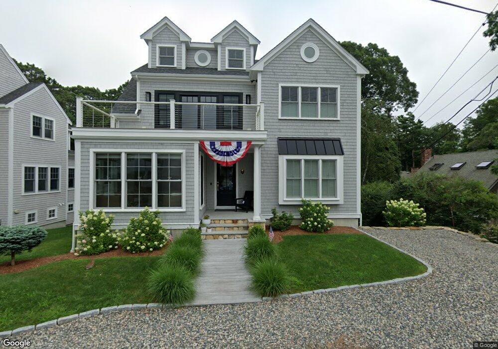
27 Homer Ave North Falmouth, MA 02556
Estimated Value: $1,289,000 - $2,106,989
3
Beds
1
Bath
1,125
Sq Ft
$1,542/Sq Ft
Est. Value
About This Home
This home is located at 27 Homer Ave, North Falmouth, MA 02556 and is currently estimated at $1,734,747, approximately $1,541 per square foot. 27 Homer Ave is a home located in Barnstable County with nearby schools including North Falmouth Elementary School, Morse Pond School, and Lawrence School.
Ownership History
Date
Name
Owned For
Owner Type
Purchase Details
Closed on
Mar 12, 2010
Sold by
Oconnell John and Oconnell Kelly
Bought by
Brunell Nancy
Current Estimated Value
Purchase Details
Closed on
Aug 13, 2007
Sold by
Rose R Aleixo Rt and Aleixo
Bought by
Oconnell John and Oconnell Kelly
Home Financials for this Owner
Home Financials are based on the most recent Mortgage that was taken out on this home.
Original Mortgage
$392,000
Interest Rate
6.72%
Mortgage Type
Purchase Money Mortgage
Create a Home Valuation Report for This Property
The Home Valuation Report is an in-depth analysis detailing your home's value as well as a comparison with similar homes in the area
Home Values in the Area
Average Home Value in this Area
Purchase History
| Date | Buyer | Sale Price | Title Company |
|---|---|---|---|
| Brunell Nancy | $415,000 | -- | |
| Oconnell John | $490,000 | -- |
Source: Public Records
Mortgage History
| Date | Status | Borrower | Loan Amount |
|---|---|---|---|
| Previous Owner | Oconnell John | $392,000 |
Source: Public Records
Tax History Compared to Growth
Tax History
| Year | Tax Paid | Tax Assessment Tax Assessment Total Assessment is a certain percentage of the fair market value that is determined by local assessors to be the total taxable value of land and additions on the property. | Land | Improvement |
|---|---|---|---|---|
| 2025 | $9,312 | $1,586,300 | $452,100 | $1,134,200 |
| 2024 | $8,738 | $1,391,400 | $411,000 | $980,400 |
| 2023 | $6,117 | $883,900 | $340,100 | $543,800 |
| 2022 | $3,490 | $433,500 | $299,000 | $134,500 |
| 2021 | $3,564 | $419,300 | $299,000 | $120,300 |
| 2020 | $3,368 | $392,100 | $271,800 | $120,300 |
| 2019 | $3,306 | $386,200 | $271,800 | $114,400 |
| 2018 | $3,273 | $380,600 | $271,800 | $108,800 |
| 2017 | $3,174 | $372,100 | $271,800 | $100,300 |
| 2016 | $3,114 | $372,100 | $271,800 | $100,300 |
| 2015 | $3,047 | $372,100 | $271,800 | $100,300 |
| 2014 | $3,026 | $371,300 | $271,700 | $99,600 |
Source: Public Records
Map
Nearby Homes
- 31 Homer Ave
- 25 Homer Ave
- 28 Homer Ave
- 33 Homer Ave
- 22 Homer Ave
- 24 Homer Ave
- 34 Pequossett Ave
- 37 Homer Ave
- 30 Pequossett Ave
- 18 Homer Ave
- 34 Homer Ave
- 36 Homer Ave
- 42 Pequossett Ave
- 42 Pequossett Ave Unit 1
- 44 Pequossett Ave
- 44 Pequossett and 0 Homer Ave
- 44 Pequossett Ave and 0 Homer Ave
- 38 Homer Ave
- 3 Phillips Ave
- 12 Homer Ave