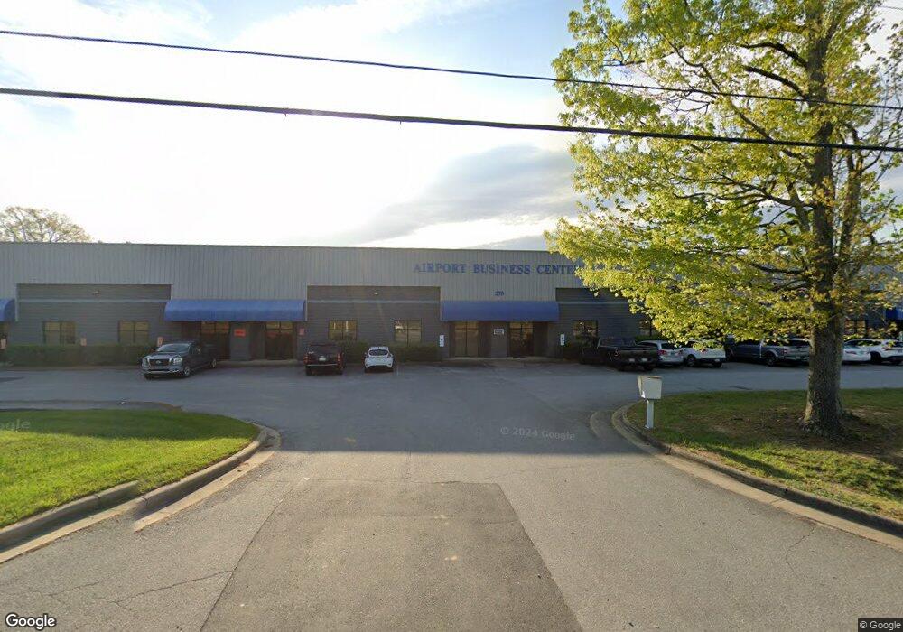
270 Rutledge Rd Fletcher, NC 28732
Oak Park NeighborhoodEstimated Value: $5,040,248
--
Bed
--
Bath
36,450
Sq Ft
$138/Sq Ft
Est. Value
About This Home
This home is located at 270 Rutledge Rd, Fletcher, NC 28732 and is currently estimated at $5,040,248, approximately $138 per square foot. 270 Rutledge Rd is a home located in Buncombe County with nearby schools including T.C. Roberson High School, Avery's Creek Elementary School, and Koontz Intermediate School.
Ownership History
Date
Name
Owned For
Owner Type
Purchase Details
Closed on
Mar 22, 2024
Sold by
Luna 1048 Llc and Rsw 2023 Llc
Bought by
Tam Rutledge Llc
Current Estimated Value
Home Financials for this Owner
Home Financials are based on the most recent Mortgage that was taken out on this home.
Original Mortgage
$6,726,000
Outstanding Balance
$6,614,337
Interest Rate
6.64%
Mortgage Type
Construction
Estimated Equity
-$1,574,089
Purchase Details
Closed on
Oct 21, 1999
Bought by
Rutledge Road Associates Llc
Purchase Details
Closed on
Aug 9, 1996
Sold by
Rice Stephen D
Bought by
Rice
Create a Home Valuation Report for This Property
The Home Valuation Report is an in-depth analysis detailing your home's value as well as a comparison with similar homes in the area
Home Values in the Area
Average Home Value in this Area
Purchase History
| Date | Buyer | Sale Price | Title Company |
|---|---|---|---|
| Tam Rutledge Llc | $5,000,000 | None Listed On Document | |
| Tam Rutledge Llc | $5,000,000 | None Listed On Document | |
| Rutledge Road Associates Llc | $1,350,000 | -- | |
| Rice | -- | -- |
Source: Public Records
Mortgage History
| Date | Status | Borrower | Loan Amount |
|---|---|---|---|
| Open | Tam Rutledge Llc | $6,726,000 | |
| Closed | Tam Rutledge Llc | $6,726,000 |
Source: Public Records
Tax History Compared to Growth
Tax History
| Year | Tax Paid | Tax Assessment Tax Assessment Total Assessment is a certain percentage of the fair market value that is determined by local assessors to be the total taxable value of land and additions on the property. | Land | Improvement |
|---|---|---|---|---|
| 2025 | $17,938 | $2,913,900 | $790,600 | $2,123,300 |
| 2024 | $17,938 | $2,913,900 | $790,600 | $2,123,300 |
| 2023 | $17,938 | $2,913,900 | $790,600 | $2,123,300 |
| 2022 | $17,075 | $2,913,900 | $0 | $0 |
| 2021 | $17,075 | $2,913,900 | $0 | $0 |
| 2020 | $16,391 | $2,601,700 | $0 | $0 |
| 2019 | $16,391 | $2,601,700 | $0 | $0 |
| 2018 | $16,391 | $2,601,700 | $0 | $0 |
| 2017 | $16,391 | $2,426,100 | $0 | $0 |
| 2016 | $16,861 | $2,426,100 | $0 | $0 |
| 2015 | $16,861 | $2,426,100 | $0 | $0 |
| 2014 | $16,861 | $2,426,100 | $0 | $0 |
Source: Public Records
Map
Nearby Homes
- 550 Airport Rd
- 412 Wiltshire Cir
- 24 Lanceford Cir
- 48 Lanceford Cir
- 3 E Wilde Way
- 93 Stafford Ct
- 324 Wiltshire Cir
- 36 Twain Trail
- 52 N Christie Ct
- 85 Twain Trail
- Barrington Plan at The Authors
- Winston Plan at The Authors
- Palmer Plan at The Authors
- Madison Plan at The Authors
- Pelham Plan at The Authors
- Carlisle Plan at The Authors
- Kingsley Plan at The Authors
- Canterbury Plan at The Authors
- Oxford Plan at The Authors
- Hampton Plan at The Authors
- 260 Rutledge Rd
- 10 National Ave
- 15 Design Ave Unit 208
- 9 National Ave
- 318 Rutledge Rd
- 11 National Ave Unit C
- 11 National Ave Unit B
- 16 National Ave Unit A
- 10 Branks Dr
- 34 Redmond Dr
- 34 Redmond Dr Unit D
- 34 Redmond Dr
- 550 Airport Rd Unit Lot 1
- 550 Airport Rd Unit Lot 4
- 550 Airport Rd Unit Lot 3
- 550 Airport Rd Unit Lot 2
- 65 Redmond Dr
- 328 Rutledge Rd
- 231 Rutledge Rd
- 22 Redmond Dr