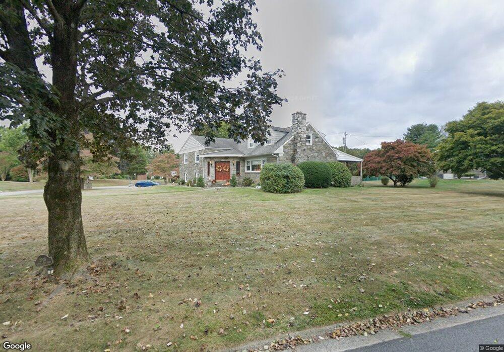
2708 S Kent Rd Broomall, PA 19008
Marple Township Delaware NeighborhoodEstimated Value: $823,000 - $883,000
4
Beds
4
Baths
3,468
Sq Ft
$248/Sq Ft
Est. Value
About This Home
This home is located at 2708 S Kent Rd, Broomall, PA 19008 and is currently estimated at $859,109, approximately $247 per square foot. 2708 S Kent Rd is a home with nearby schools including Russell Elementary School, Paxon Hollow Middle School, and Marple Newtown Senior High School.
Ownership History
Date
Name
Owned For
Owner Type
Purchase Details
Closed on
Oct 16, 2017
Sold by
Tenaglia Anthony L and Tenaglia Anna M
Bought by
Tenaglian Michael A and Larkin Holly F
Current Estimated Value
Home Financials for this Owner
Home Financials are based on the most recent Mortgage that was taken out on this home.
Original Mortgage
$350,000
Outstanding Balance
$189,934
Interest Rate
3.78%
Mortgage Type
New Conventional
Estimated Equity
$669,175
Purchase Details
Closed on
Sep 4, 1969
Bought by
Tenaglia Anthony L and Tenaglia Anna M
Create a Home Valuation Report for This Property
The Home Valuation Report is an in-depth analysis detailing your home's value as well as a comparison with similar homes in the area
Home Values in the Area
Average Home Value in this Area
Purchase History
| Date | Buyer | Sale Price | Title Company |
|---|---|---|---|
| Tenaglian Michael A | $450,000 | None Available | |
| Tenaglia Anthony L | -- | -- |
Source: Public Records
Mortgage History
| Date | Status | Borrower | Loan Amount |
|---|---|---|---|
| Open | Tenaglian Michael A | $350,000 |
Source: Public Records
Tax History Compared to Growth
Tax History
| Year | Tax Paid | Tax Assessment Tax Assessment Total Assessment is a certain percentage of the fair market value that is determined by local assessors to be the total taxable value of land and additions on the property. | Land | Improvement |
|---|---|---|---|---|
| 2025 | $8,276 | $478,910 | $135,160 | $343,750 |
| 2024 | $8,276 | $478,910 | $135,160 | $343,750 |
| 2023 | $8,014 | $478,910 | $135,160 | $343,750 |
| 2022 | $7,862 | $478,910 | $135,160 | $343,750 |
| 2021 | $11,865 | $478,910 | $135,160 | $343,750 |
| 2020 | $6,791 | $235,990 | $63,670 | $172,320 |
| 2019 | $6,709 | $235,990 | $63,670 | $172,320 |
| 2018 | $6,640 | $235,990 | $0 | $0 |
| 2017 | $6,643 | $235,990 | $0 | $0 |
| 2016 | $1,295 | $235,990 | $0 | $0 |
| 2015 | $1,322 | $235,990 | $0 | $0 |
| 2014 | $1,295 | $235,990 | $0 | $0 |
Source: Public Records
Map
Nearby Homes
- 124 Carli Dr
- 117 Bella Dr Unit 3AD
- 119 Bella Dr Unit 2MD
- 2604 Cynwyd Ave
- Lot 2 Cynwyd
- 127 Deerfield Rd
- Lot1 Cynwyd
- 3920 Darby Rd
- 12 Lincoln Ln
- 15 Oakland Rd
- 54 Sterner Ave
- 115 Newby Dr
- 2025 S Sproul Rd
- 88 4th Ave
- 106 2nd Ave
- 2839 Springfield Rd
- 50 Schoolhouse Ln
- 300 Rock Run Cir
- 202 Barren Rd
- 63 S Greenhill Rd