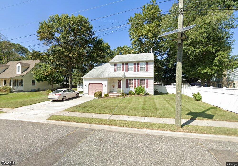
271 N Roosevelt Blvd West Deptford, NJ 08086
West Deptford Township NeighborhoodEstimated Value: $341,000 - $398,000
--
Bed
3
Baths
1,480
Sq Ft
$254/Sq Ft
Est. Value
About This Home
This home is located at 271 N Roosevelt Blvd, West Deptford, NJ 08086 and is currently estimated at $375,368, approximately $253 per square foot. 271 N Roosevelt Blvd is a home located in Gloucester County with nearby schools including Red Bank Elementary School, Oakview Elementary School, and Green-Fields Elementary School.
Ownership History
Date
Name
Owned For
Owner Type
Purchase Details
Closed on
Dec 12, 2023
Sold by
Chambers Mark and Chambers Patrice
Bought by
Pomponi Marc and Macwilliams Nicole L
Current Estimated Value
Home Financials for this Owner
Home Financials are based on the most recent Mortgage that was taken out on this home.
Original Mortgage
$334,650
Outstanding Balance
$328,868
Interest Rate
7.29%
Mortgage Type
New Conventional
Estimated Equity
$46,500
Purchase Details
Closed on
Oct 27, 1997
Sold by
Luciano Thomas and Luciano Margaret
Bought by
Chambers Mark and Allison Patrice
Home Financials for this Owner
Home Financials are based on the most recent Mortgage that was taken out on this home.
Original Mortgage
$111,000
Interest Rate
7.31%
Create a Home Valuation Report for This Property
The Home Valuation Report is an in-depth analysis detailing your home's value as well as a comparison with similar homes in the area
Home Values in the Area
Average Home Value in this Area
Purchase History
| Date | Buyer | Sale Price | Title Company |
|---|---|---|---|
| Pomponi Marc | $345,000 | None Listed On Document | |
| Pomponi Marc | $345,000 | None Listed On Document | |
| Chambers Mark | $126,000 | Congress Title Corp |
Source: Public Records
Mortgage History
| Date | Status | Borrower | Loan Amount |
|---|---|---|---|
| Open | Pomponi Marc | $334,650 | |
| Closed | Pomponi Marc | $334,650 | |
| Previous Owner | Chambers Mark | $111,000 |
Source: Public Records
Tax History Compared to Growth
Tax History
| Year | Tax Paid | Tax Assessment Tax Assessment Total Assessment is a certain percentage of the fair market value that is determined by local assessors to be the total taxable value of land and additions on the property. | Land | Improvement |
|---|---|---|---|---|
| 2025 | $7,504 | $214,900 | $54,800 | $160,100 |
| 2024 | $7,408 | $214,900 | $54,800 | $160,100 |
| 2023 | $7,408 | $214,900 | $54,800 | $160,100 |
| 2022 | $7,373 | $214,900 | $54,800 | $160,100 |
| 2021 | $7,347 | $214,900 | $54,800 | $160,100 |
| 2020 | $7,330 | $214,900 | $54,800 | $160,100 |
| 2019 | $7,126 | $214,900 | $54,800 | $160,100 |
| 2018 | $6,933 | $214,900 | $54,800 | $160,100 |
| 2017 | $6,772 | $214,900 | $54,800 | $160,100 |
| 2016 | $6,582 | $214,900 | $54,800 | $160,100 |
| 2015 | $6,271 | $214,900 | $54,800 | $160,100 |
| 2014 | $5,959 | $214,900 | $54,800 | $160,100 |
Source: Public Records
Map
Nearby Homes
- 266 Passaic Ave
- 107 Audubon Ave
- 121 Cape May Ave
- 10 Kennedy Ct
- 400 Audubon Ave
- 64 Tilden Rd
- 439 Crown Point Rd
- 112 N Drexel St
- 124 Brent Ct
- 433 Crown Point Rd
- 67 Pelican Place
- 1810 Fernwood Dr
- 558 Prince St
- 21 S Columbia St
- 1311 Barnesdale Rd
- 136 Sandpiper Ln
- 344 S Girard St
- 4 Saint Emilion Ct
- 340 High St
- 83 Lynn Dr
- 271 Roosevelt Blvd
- 125 Harding Ave
- 267 Roosevelt Blvd
- 270 Middlesex Ave
- 274 Middlesex Ave
- 266 Middlesex Ave
- 270 Roosevelt Blvd
- 270 N Roosevelt Blvd
- 131 Harding Ave
- 307 N Roosevelt Blvd
- 307 Roosevelt Blvd
- 261 Roosevelt Blvd
- 266 Roosevelt Blvd
- 262 Middlesex Ave
- 300 Roosevelt Blvd
- 120 Harding Ave
- 261 Passaic Ave
- 267 Passaic Ave
- 311 Roosevelt Blvd
- 260 Roosevelt Blvd