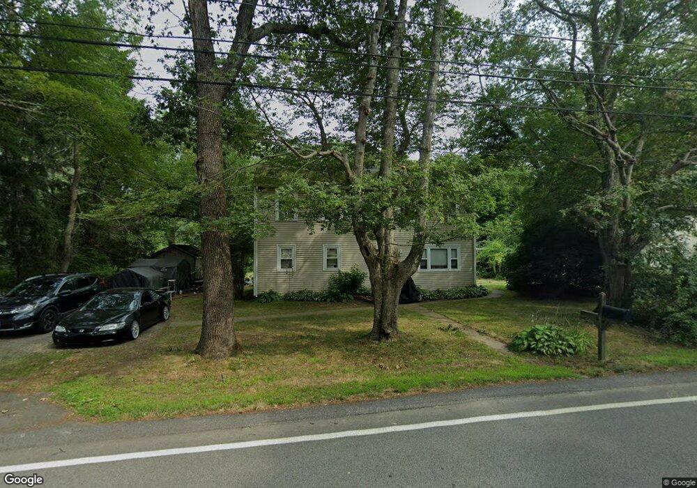
271 Snuff Mill Rd Saunderstown, RI 02874
Saunderstown NeighborhoodEstimated Value: $595,000 - $690,000
2
Beds
2
Baths
1,520
Sq Ft
$413/Sq Ft
Est. Value
About This Home
This home is located at 271 Snuff Mill Rd, Saunderstown, RI 02874 and is currently estimated at $628,468, approximately $413 per square foot. 271 Snuff Mill Rd is a home located in Washington County with nearby schools including Hamilton Elementary School, Wickford Middle School, and North Kingstown Sr. High School.
Ownership History
Date
Name
Owned For
Owner Type
Purchase Details
Closed on
Mar 13, 1998
Sold by
Hammond Asa S and Hammond Lonny
Bought by
Crawford Willima C and Crawford Karen
Current Estimated Value
Home Financials for this Owner
Home Financials are based on the most recent Mortgage that was taken out on this home.
Original Mortgage
$102,000
Interest Rate
7.03%
Create a Home Valuation Report for This Property
The Home Valuation Report is an in-depth analysis detailing your home's value as well as a comparison with similar homes in the area
Home Values in the Area
Average Home Value in this Area
Purchase History
| Date | Buyer | Sale Price | Title Company |
|---|---|---|---|
| Crawford Willima C | $102,000 | -- |
Source: Public Records
Mortgage History
| Date | Status | Borrower | Loan Amount |
|---|---|---|---|
| Open | Crawford Willima C | $81,800 | |
| Closed | Crawford Willima C | $70,500 | |
| Closed | Crawford Willima C | $70,500 | |
| Closed | Crawford Willima C | $102,000 |
Source: Public Records
Tax History Compared to Growth
Tax History
| Year | Tax Paid | Tax Assessment Tax Assessment Total Assessment is a certain percentage of the fair market value that is determined by local assessors to be the total taxable value of land and additions on the property. | Land | Improvement |
|---|---|---|---|---|
| 2025 | $5,319 | $481,800 | $263,300 | $218,500 |
| 2024 | $5,428 | $378,500 | $217,100 | $161,400 |
| 2023 | $5,428 | $378,500 | $217,100 | $161,400 |
| 2022 | $5,322 | $378,500 | $217,100 | $161,400 |
| 2021 | $4,697 | $268,400 | $133,600 | $134,800 |
| 2020 | $4,587 | $268,400 | $133,600 | $134,800 |
| 2019 | $4,587 | $268,400 | $133,600 | $134,800 |
| 2018 | $4,623 | $243,700 | $128,400 | $115,300 |
| 2017 | $4,530 | $243,700 | $128,400 | $115,300 |
| 2016 | $4,401 | $243,700 | $128,400 | $115,300 |
| 2015 | $4,514 | $233,900 | $128,400 | $105,500 |
| 2014 | $4,423 | $233,900 | $128,400 | $105,500 |
Source: Public Records
Map
Nearby Homes
- 10 Highland Rd
- 2180 Tower Hill Rd
- 2424 Tower Hill Rd
- 73 Oceanwoods Dr
- 127 Oceanwoods Dr
- 47 Wake Robin Trail
- 49 Meadow Sweet Trail
- 65 Village Hill Ln
- 46 Hillside Ct
- 51 Salisbury Ave
- 297 Walmsley Ln
- 66 Essex Manor Ln
- 47 Shady Lea Rd
- 12 Overlook Rd
- 121 Seaside Dr
- 94 Spindrift St
- 174 Seaside Dr
- 18 Lakeview Dr
- 21 Helm St
- 229 Earle Dr
- 263 Snuff Mill Rd
- 950 Gilbert Ln
- 1175 Gilbert Ln
- 0 Snuff Mill Rd
- 285 Snuff Mill Rd
- 251 Snuff Mill Rd
- 290 Snuff Mill Rd
- 303 Snuff Mill Rd
- 274 Snuff Mill Rd
- 283 Snuff Mill Rd
- 225 Snuff Mill Rd
- 314 Snuff Mill Rd
- 281 Snuff Mill Rd
- 345 Snuff Mill Rd
- 117 Gilbert Ln
- 75 Gilbert Ln
- 95 Gilbert Ln
- 96 Gilbert Ln
- 55 Gilbert Ln
- 350 Snuff Mill Rd