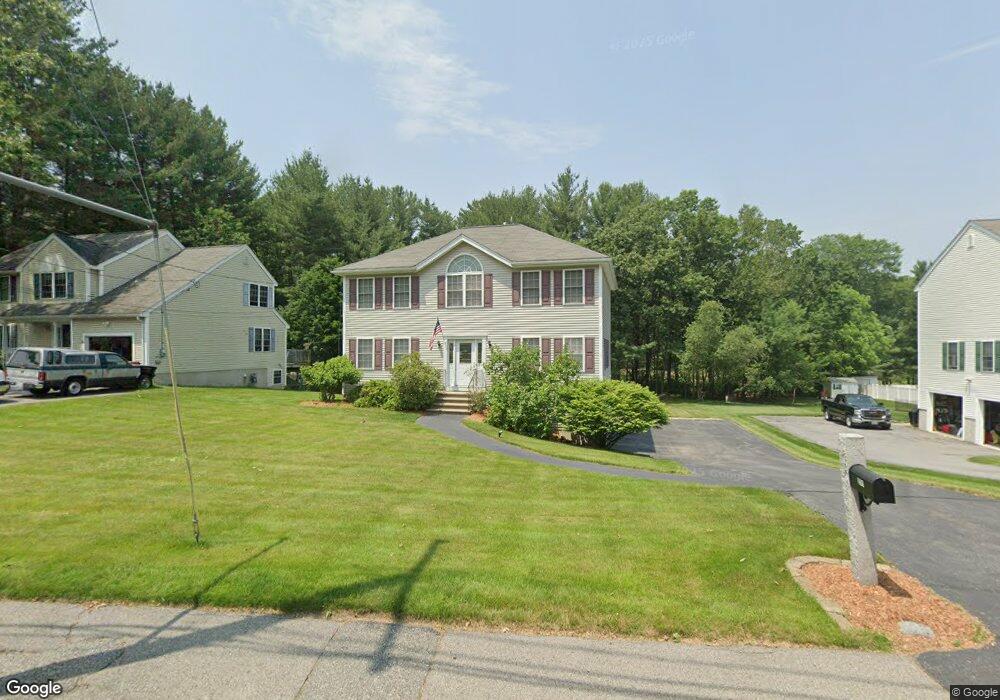
271 W Meadow Rd Lowell, MA 01854
Pawtucketville NeighborhoodEstimated Value: $691,000 - $762,000
4
Beds
3
Baths
2,128
Sq Ft
$340/Sq Ft
Est. Value
About This Home
This home is located at 271 W Meadow Rd, Lowell, MA 01854 and is currently estimated at $723,443, approximately $339 per square foot. 271 W Meadow Rd is a home located in Middlesex County with nearby schools including Joseph McAvinnue Elementary School, Charlotte M. Murkland Elementary School, and Charles W. Morey Elementary School.
Ownership History
Date
Name
Owned For
Owner Type
Purchase Details
Closed on
Aug 11, 2009
Sold by
Wyman Robert T and Oriakhi Nicholas A
Bought by
Sprowl Gregory B and Sprowl Dana Lee
Current Estimated Value
Home Financials for this Owner
Home Financials are based on the most recent Mortgage that was taken out on this home.
Original Mortgage
$260,000
Interest Rate
5.47%
Mortgage Type
Purchase Money Mortgage
Purchase Details
Closed on
Feb 26, 2004
Sold by
Pav Prop Llc
Bought by
Oriakhi Angela U
Home Financials for this Owner
Home Financials are based on the most recent Mortgage that was taken out on this home.
Original Mortgage
$359,000
Interest Rate
5.65%
Mortgage Type
Purchase Money Mortgage
Create a Home Valuation Report for This Property
The Home Valuation Report is an in-depth analysis detailing your home's value as well as a comparison with similar homes in the area
Home Values in the Area
Average Home Value in this Area
Purchase History
| Date | Buyer | Sale Price | Title Company |
|---|---|---|---|
| Sprowl Gregory B | $325,000 | -- | |
| Sprowl Gregory B | $325,000 | -- | |
| Oriakhi Angela U | $359,900 | -- | |
| Oriakhi Angela U | $359,900 | -- |
Source: Public Records
Mortgage History
| Date | Status | Borrower | Loan Amount |
|---|---|---|---|
| Open | Oriakhi Angela U | $252,000 | |
| Closed | Sprowl Gregory B | $260,000 | |
| Previous Owner | Oriakhi Angela U | $359,000 |
Source: Public Records
Tax History Compared to Growth
Tax History
| Year | Tax Paid | Tax Assessment Tax Assessment Total Assessment is a certain percentage of the fair market value that is determined by local assessors to be the total taxable value of land and additions on the property. | Land | Improvement |
|---|---|---|---|---|
| 2025 | $7,083 | $617,000 | $195,600 | $421,400 |
| 2024 | $7,441 | $624,800 | $182,900 | $441,900 |
| 2023 | $7,045 | $567,200 | $159,000 | $408,200 |
| 2022 | $6,483 | $510,900 | $144,800 | $366,100 |
| 2021 | $6,072 | $451,100 | $126,200 | $324,900 |
| 2020 | $5,876 | $439,800 | $128,700 | $311,100 |
| 2019 | $5,961 | $424,600 | $113,500 | $311,100 |
| 2018 | $5,927 | $411,900 | $108,200 | $303,700 |
| 2017 | $5,652 | $378,800 | $98,400 | $280,400 |
| 2016 | $5,693 | $375,500 | $91,900 | $283,600 |
| 2015 | $5,372 | $347,000 | $90,000 | $257,000 |
| 2013 | $5,100 | $339,800 | $113,100 | $226,700 |
Source: Public Records
Map
Nearby Homes
- 1820 Skyline Dr Unit 18
- 1410 Skyline Dr Unit 9
- 1710 Skyline Dr Unit 10
- 1600 Skyline Dr Unit 2
- 2200 Skyline Dr Unit 5
- 49 Tolman Ave
- 33 W Meadow Rd
- 25 W 5th Ave
- 101 Laurie Ln
- 69 Coburn Dr
- 49 Coburn Dr
- 307 Pawtucket Blvd Unit 13
- 70 Pawtucket Dr
- 61 7th Ave W
- 295 Pawtucket Blvd Unit 7
- 30 4th Ave
- 527 Pawtucket Blvd Unit 304
- 89 Mammoth Rd
- 107 7th Ave
- 10 3rd Ave