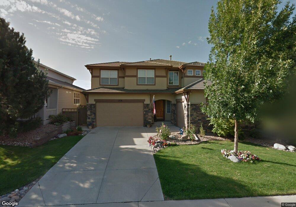
2726 Greensborough Dr Highlands Ranch, CO 80129
Westridge NeighborhoodEstimated Value: $934,663 - $1,166,000
4
Beds
4
Baths
3,007
Sq Ft
$349/Sq Ft
Est. Value
About This Home
This home is located at 2726 Greensborough Dr, Highlands Ranch, CO 80129 and is currently estimated at $1,049,166, approximately $348 per square foot. 2726 Greensborough Dr is a home located in Douglas County with nearby schools including Northridge Elementary School, Mountain Ridge Middle School, and Mountain Vista High School.
Ownership History
Date
Name
Owned For
Owner Type
Purchase Details
Closed on
Feb 6, 2025
Sold by
Smaus Peter A and Smaus Karen E
Bought by
Smaus Family Trust
Current Estimated Value
Purchase Details
Closed on
Apr 21, 2001
Sold by
Richmond American Homes Of Colorado Inc
Bought by
Smaus Peter A and Smaus Karen E
Home Financials for this Owner
Home Financials are based on the most recent Mortgage that was taken out on this home.
Original Mortgage
$320,000
Interest Rate
6.93%
Purchase Details
Closed on
Mar 6, 2001
Sold by
Richmond American Homes Of Colorado Inc
Bought by
Smaus Peter A and Smaus Karen E
Home Financials for this Owner
Home Financials are based on the most recent Mortgage that was taken out on this home.
Original Mortgage
$320,000
Interest Rate
6.93%
Purchase Details
Closed on
Dec 23, 1998
Sold by
Shea Homes
Bought by
Richmond American Homes Colo Inc
Create a Home Valuation Report for This Property
The Home Valuation Report is an in-depth analysis detailing your home's value as well as a comparison with similar homes in the area
Home Values in the Area
Average Home Value in this Area
Purchase History
| Date | Buyer | Sale Price | Title Company |
|---|---|---|---|
| Smaus Family Trust | -- | None Listed On Document | |
| Smaus Peter A | $441,200 | -- | |
| Smaus Peter A | $441,170 | -- | |
| Richmond American Homes Colo Inc | $5,460,000 | -- |
Source: Public Records
Mortgage History
| Date | Status | Borrower | Loan Amount |
|---|---|---|---|
| Previous Owner | Smaus Peter A | $320,000 |
Source: Public Records
Tax History Compared to Growth
Tax History
| Year | Tax Paid | Tax Assessment Tax Assessment Total Assessment is a certain percentage of the fair market value that is determined by local assessors to be the total taxable value of land and additions on the property. | Land | Improvement |
|---|---|---|---|---|
| 2024 | $5,249 | $66,080 | $15,450 | $50,630 |
| 2023 | $5,239 | $66,080 | $15,450 | $50,630 |
| 2022 | $3,734 | $47,810 | $11,290 | $36,520 |
| 2021 | $3,883 | $47,810 | $11,290 | $36,520 |
| 2020 | $3,771 | $47,810 | $10,480 | $37,330 |
| 2019 | $3,785 | $47,810 | $10,480 | $37,330 |
| 2018 | $3,546 | $44,730 | $9,800 | $34,930 |
| 2017 | $3,229 | $44,730 | $9,800 | $34,930 |
| 2016 | $3,165 | $44,050 | $9,170 | $34,880 |
| 2015 | $3,233 | $44,050 | $9,170 | $34,880 |
| 2014 | $1,430 | $37,450 | $8,690 | $28,760 |
Source: Public Records
Map
Nearby Homes
- 2795 Rockbridge Cir
- 8993 Stonecrest Way
- 2558 Rockbridge Dr
- 2590 W Bitterroot Place
- 2572 W Bitterroot Place
- 2596 Bitterroot Place
- 2460 W Bitterroot Place
- 8886 Tappy Toorie Cir
- 9178 Gold Lace Place
- 2496 W Bitterroot Place
- 8911 Tappy Toorie Place
- Daley Plan at Westridge
- Dayton Plan at Westridge
- Dillon II Plan at Westridge
- 9185 Gold Lace Place
- Delaney Plan at Westridge
- Daniel Plan at Westridge
- 9109 Ironwood Way
- 8835 Edinburgh Cir
- 8943 Tappy Toorie Cir
- 2744 Greensborough Dr
- 2708 Greensborough Dr
- 2762 Greensborough Dr
- 2690 Greensborough Dr
- 2725 Greensborough Dr
- 2745 Greensborough Dr
- 2780 Greensborough Dr
- 2672 Greensborough Dr
- 2763 Greensborough Dr
- 2701 Rockbridge Cir
- 2798 Greensborough Dr
- 2781 Greensborough Dr
- 2654 Greensborough Dr
- 2752 Rockbridge Cir
- 2717 Rockbridge Cir
- 2685 Greensborough Cir
- 2794 Rockbridge Cir
- 2799 Greensborough Dr
- 2636 Greensborough Dr
- 2731 Rockbridge Cir