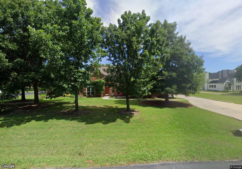
275 Canyon Oaks Dr Argyle, TX 76226
Estimated Value: $760,000 - $953,000
4
Beds
3
Baths
2,814
Sq Ft
$294/Sq Ft
Est. Value
About This Home
This home is located at 275 Canyon Oaks Dr, Argyle, TX 76226 and is currently estimated at $827,710, approximately $294 per square foot. 275 Canyon Oaks Dr is a home located in Denton County with nearby schools including Dorothy P Adkins Elementary School, Harpool Middle School, and Guyer High School.
Ownership History
Date
Name
Owned For
Owner Type
Purchase Details
Closed on
Jun 3, 2025
Sold by
Anderson Family Trust and Anderson Eric M
Bought by
Cb Green Investments Llc
Current Estimated Value
Purchase Details
Closed on
Mar 3, 2023
Sold by
Anderson Eric M
Bought by
Anderson Family Trust
Purchase Details
Closed on
Feb 28, 2013
Sold by
Cartus Financial Corporation
Bought by
Anderson Eric and Anderson Donna
Home Financials for this Owner
Home Financials are based on the most recent Mortgage that was taken out on this home.
Original Mortgage
$305,999
Interest Rate
3.44%
Mortgage Type
New Conventional
Purchase Details
Closed on
Feb 5, 2013
Sold by
Schulten Louk B and Schulten Gaywood Nicola
Bought by
Cartus Financial Corporation
Home Financials for this Owner
Home Financials are based on the most recent Mortgage that was taken out on this home.
Original Mortgage
$305,999
Interest Rate
3.44%
Mortgage Type
New Conventional
Purchase Details
Closed on
Jun 24, 2010
Sold by
Kleven Eric D and Huynh Xuyen N
Bought by
Schulten Louk B and Schulten Nicola
Home Financials for this Owner
Home Financials are based on the most recent Mortgage that was taken out on this home.
Original Mortgage
$269,999
Interest Rate
4.87%
Mortgage Type
New Conventional
Purchase Details
Closed on
Oct 10, 2007
Sold by
Holian Matthew T and Holian Hillary K
Bought by
Kleven Eric D and Huynh Xuyen N
Home Financials for this Owner
Home Financials are based on the most recent Mortgage that was taken out on this home.
Original Mortgage
$254,400
Interest Rate
6.48%
Mortgage Type
Purchase Money Mortgage
Purchase Details
Closed on
Oct 17, 2006
Sold by
Brunson Eddie A and Brunson Paula Jo
Bought by
Holian Matthew T and Holian Hillary K
Home Financials for this Owner
Home Financials are based on the most recent Mortgage that was taken out on this home.
Original Mortgage
$209,230
Interest Rate
6.41%
Mortgage Type
Purchase Money Mortgage
Create a Home Valuation Report for This Property
The Home Valuation Report is an in-depth analysis detailing your home's value as well as a comparison with similar homes in the area
Home Values in the Area
Average Home Value in this Area
Purchase History
| Date | Buyer | Sale Price | Title Company |
|---|---|---|---|
| Cb Green Investments Llc | -- | National Title | |
| Anderson Family Trust | -- | -- | |
| Anderson Eric | -- | Allegiance Title Company | |
| Cartus Financial Corporation | -- | Allegiance Title Company | |
| Schulten Louk B | -- | None Available | |
| Kleven Eric D | -- | Freedom Title | |
| Holian Matthew T | -- | None Available |
Source: Public Records
Mortgage History
| Date | Status | Borrower | Loan Amount |
|---|---|---|---|
| Previous Owner | Anderson Eric | $305,999 | |
| Previous Owner | Schulten Louk B | $269,999 | |
| Previous Owner | Kleven Eric D | $254,400 | |
| Previous Owner | Holian Matthew T | $209,230 |
Source: Public Records
Tax History Compared to Growth
Tax History
| Year | Tax Paid | Tax Assessment Tax Assessment Total Assessment is a certain percentage of the fair market value that is determined by local assessors to be the total taxable value of land and additions on the property. | Land | Improvement |
|---|---|---|---|---|
| 2025 | $6,350 | $732,699 | $185,297 | $574,301 |
| 2024 | $9,357 | $666,090 | $0 | $0 |
| 2023 | $5,831 | $605,536 | $185,297 | $572,420 |
| 2022 | $9,113 | $550,487 | $185,297 | $439,703 |
| 2021 | $8,386 | $518,859 | $108,998 | $409,861 |
| 2020 | $7,899 | $440,000 | $108,998 | $331,002 |
| 2019 | $8,059 | $432,000 | $108,998 | $323,002 |
| 2018 | $8,091 | $430,856 | $108,998 | $321,858 |
| 2017 | $8,286 | $438,836 | $108,998 | $329,838 |
| 2016 | $7,742 | $410,000 | $108,998 | $301,002 |
| 2015 | $6,784 | $388,523 | $108,998 | $279,525 |
| 2014 | $6,784 | $366,844 | $108,998 | $257,846 |
| 2013 | -- | $334,298 | $108,998 | $225,300 |
Source: Public Records
Map
Nearby Homes
- 9114 Parson Dr
- 190 Fawn Hollow Dr
- 9155 Calvert Rd
- 1210 Bailey Dr
- 9121 Crockett Dr
- 651 Lockridge Rd
- 959 Terrace Dr
- 1908 Somerville Cir
- 1110 Central Way
- 250 Timberleaf Dr
- 1151 Central Way
- 1661 Terrace Dr
- 1620 Terrace Dr
- 8950 Mustang Way
- 9117 Kaitlyn Ct
- TBD Copper Canyon
- 9108 Cypress Creek Rd
- 9101 Cypress Creek Rd
- 9328 Kaitlyn Ct
- 8930 Crockett Dr
- 285 Canyon Oaks Dr
- 250 Canyon Oaks Dr
- 290 Canyon Oaks Dr
- 240 Canyon Oaks Dr
- 280 Canyon Oaks Dr
- 265 Canyon Oaks Dr
- 270 Canyon Oaks Dr
- 300 Canyon Oaks Dr
- 230 Canyon Oaks Dr
- 220 Fawn Hollow Dr
- 220 Canyon Oaks Dr
- 310 Canyon Oaks Dr
- 255 Canyon Oaks Dr
- 105 Hunters Hill Cir
- 1351 Mercer Ave
- 1321 Mercer Ave
- 1331 Mercer Ave
- 1341 Mercer Ave
- 315 Canyon Oaks Dr
- 1301 Mercer Ave