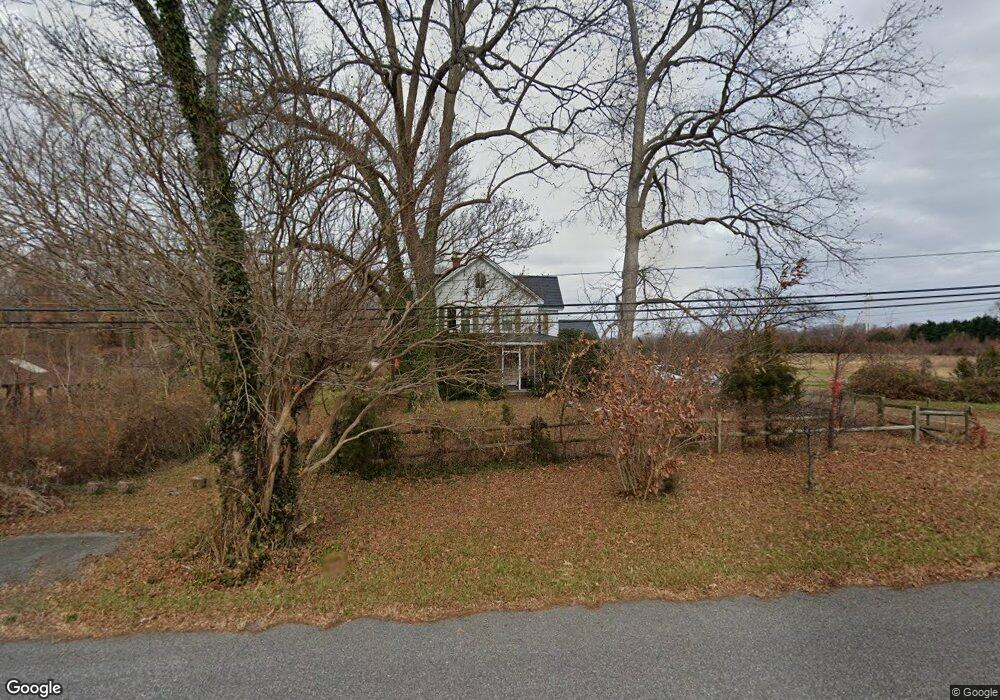
2780 Saint Leonard Rd Port Republic, MD 20676
Port Republic NeighborhoodEstimated Value: $681,356 - $827,000
--
Bed
4
Baths
3,166
Sq Ft
$237/Sq Ft
Est. Value
About This Home
This home is located at 2780 Saint Leonard Rd, Port Republic, MD 20676 and is currently estimated at $749,589, approximately $236 per square foot. 2780 Saint Leonard Rd is a home located in Calvert County with nearby schools including Barstow Elementary School, Calvert Middle School, and Calvert High School.
Ownership History
Date
Name
Owned For
Owner Type
Purchase Details
Closed on
Dec 29, 2016
Sold by
Davis Thomas J and Davis Susan L
Bought by
Lamb Marjorie M
Current Estimated Value
Home Financials for this Owner
Home Financials are based on the most recent Mortgage that was taken out on this home.
Original Mortgage
$211,500
Outstanding Balance
$174,096
Interest Rate
4.08%
Mortgage Type
New Conventional
Estimated Equity
$575,493
Purchase Details
Closed on
Jan 6, 2004
Sold by
Davis Thomas J and Davis Susan L
Bought by
Davis Thomas J and Davis Susan L
Purchase Details
Closed on
Jun 3, 2002
Sold by
Calvert Farmland Trust Inc
Bought by
Davis Thomas J and Davis Susan L
Purchase Details
Closed on
Aug 16, 2001
Sold by
Sherbert Eloise S
Bought by
Calvert Farmland Trust Inc
Create a Home Valuation Report for This Property
The Home Valuation Report is an in-depth analysis detailing your home's value as well as a comparison with similar homes in the area
Home Values in the Area
Average Home Value in this Area
Purchase History
| Date | Buyer | Sale Price | Title Company |
|---|---|---|---|
| Lamb Marjorie M | -- | None Available | |
| Davis Thomas J | -- | -- | |
| Davis Thomas J | $320,000 | -- | |
| Calvert Farmland Trust Inc | $450,000 | -- |
Source: Public Records
Mortgage History
| Date | Status | Borrower | Loan Amount |
|---|---|---|---|
| Open | Lamb Marjorie M | $211,500 |
Source: Public Records
Tax History Compared to Growth
Tax History
| Year | Tax Paid | Tax Assessment Tax Assessment Total Assessment is a certain percentage of the fair market value that is determined by local assessors to be the total taxable value of land and additions on the property. | Land | Improvement |
|---|---|---|---|---|
| 2025 | $4,217 | $408,200 | $0 | $0 |
| 2024 | $4,217 | $381,900 | $0 | $0 |
| 2023 | $3,695 | $355,600 | $134,500 | $221,100 |
| 2022 | $3,672 | $344,300 | $0 | $0 |
| 2021 | $3,446 | $333,000 | $0 | $0 |
| 2020 | $3,446 | $321,700 | $134,500 | $187,200 |
| 2019 | $3,403 | $316,267 | $0 | $0 |
| 2018 | $3,333 | $310,833 | $0 | $0 |
| 2017 | $3,316 | $305,400 | $0 | $0 |
| 2016 | -- | $305,400 | $0 | $0 |
| 2015 | $3,690 | $305,400 | $0 | $0 |
| 2014 | $3,690 | $309,300 | $0 | $0 |
Source: Public Records
Map
Nearby Homes
- 1525 Sharpes Ct
- 3005 Blackberry Ln
- 3199 Broomes Island Rd
- 2409 Senate Ct
- 2683 Sequoia Way
- 2412 Comptrollers Ct
- 126 Kinsey Dr
- 118 Kinsey Dr
- 130 Kinsey Dr
- 134 Kinsey Dr
- 105 Kinsey Dr
- 1928 Elm Rd
- 2836 Allspice Rd
- 2011 North Ave
- 2105 Millstone Ct
- 3325 First St
- 4035 Saint Leonard Rd
- 4450 Lancaster Dr
- 115 Austyn Ct
- 2095 Natures Way
- 1960 Kate Dr
- 2425 Parkers Creek Rd
- 2385 Parkers Creek Rd
- 1990 Kate Dr
- 2395 Parkers Creek Rd
- 2485 Parkers Creek Rd
- 2335 Parkers Creek Rd
- 1820 Parkers Creek Rd
- 2325 Parkers Creek Rd
- 2339 Parkers Creek Rd
- 2455 Parkers Creek Rd
- 2295 Parkers Creek Rd
- 2545 Parkers Creek Rd
- 2420 Parkers Creek Rd
- 2540 Parkers Creek Rd
- 2550 Solomons Island Rd S
- 2580 Solomons Island Rd S
- 2310 Parkers Creek Rd
- 2460 Parkers Creek Rd
- 2420 Solomons Island Rd S