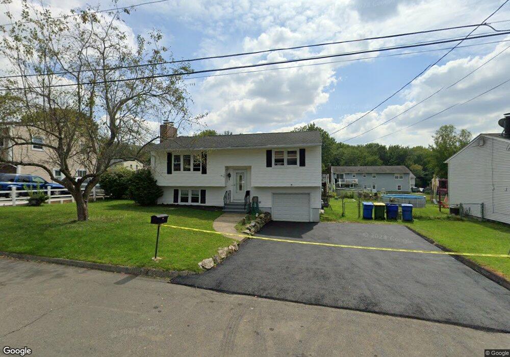
28 Brookfield Rd Waterbury, CT 06704
Bucks Hill NeighborhoodEstimated Value: $317,000 - $386,000
2
Beds
3
Baths
1,348
Sq Ft
$260/Sq Ft
Est. Value
About This Home
This home is located at 28 Brookfield Rd, Waterbury, CT 06704 and is currently estimated at $349,948, approximately $259 per square foot. 28 Brookfield Rd is a home located in New Haven County with nearby schools including Bucks Hill Elementary School, North End Middle School, and Wilby High School.
Ownership History
Date
Name
Owned For
Owner Type
Purchase Details
Closed on
Jun 27, 2007
Sold by
Robinson Darlene and Robinson Ellis
Bought by
Sierra Sheila
Current Estimated Value
Home Financials for this Owner
Home Financials are based on the most recent Mortgage that was taken out on this home.
Original Mortgage
$134,000
Outstanding Balance
$82,610
Interest Rate
6.24%
Mortgage Type
Purchase Money Mortgage
Estimated Equity
$267,338
Purchase Details
Closed on
Jan 14, 2004
Sold by
Joo Miklos
Bought by
Robinson Ellis and Robinson Darlene
Purchase Details
Closed on
Jul 16, 2001
Sold by
Mascolo Joseph A and Mascolo Sonja
Bought by
Joo Miklos
Purchase Details
Closed on
Oct 25, 1996
Sold by
Ford Consumer Finance
Bought by
Masiolo Joseph A and Mascolo Sonja
Create a Home Valuation Report for This Property
The Home Valuation Report is an in-depth analysis detailing your home's value as well as a comparison with similar homes in the area
Home Values in the Area
Average Home Value in this Area
Purchase History
| Date | Buyer | Sale Price | Title Company |
|---|---|---|---|
| Sierra Sheila | $176,000 | -- | |
| Robinson Ellis | $140,000 | -- | |
| Joo Miklos | $128,000 | -- | |
| Masiolo Joseph A | $50,000 | -- |
Source: Public Records
Mortgage History
| Date | Status | Borrower | Loan Amount |
|---|---|---|---|
| Open | Masiolo Joseph A | $134,000 | |
| Closed | Masiolo Joseph A | $43,900 | |
| Previous Owner | Masiolo Joseph A | $195,000 |
Source: Public Records
Tax History Compared to Growth
Tax History
| Year | Tax Paid | Tax Assessment Tax Assessment Total Assessment is a certain percentage of the fair market value that is determined by local assessors to be the total taxable value of land and additions on the property. | Land | Improvement |
|---|---|---|---|---|
| 2025 | $7,475 | $166,180 | $23,940 | $142,240 |
| 2024 | $8,216 | $166,180 | $23,940 | $142,240 |
| 2023 | $9,005 | $166,180 | $23,940 | $142,240 |
| 2022 | $5,916 | $98,260 | $23,940 | $74,320 |
| 2021 | $5,916 | $98,260 | $23,940 | $74,320 |
| 2020 | $5,916 | $98,260 | $23,940 | $74,320 |
| 2019 | $5,916 | $98,260 | $23,940 | $74,320 |
| 2018 | $5,916 | $98,260 | $23,940 | $74,320 |
| 2017 | $6,176 | $102,580 | $23,950 | $78,630 |
| 2016 | $6,176 | $102,580 | $23,950 | $78,630 |
| 2015 | $5,972 | $102,580 | $23,950 | $78,630 |
| 2014 | $5,972 | $102,580 | $23,950 | $78,630 |
Source: Public Records
Map
Nearby Homes
- 45 Fieldstream Dr
- 8 Hayfield Rd
- 119 Lincolndale Dr
- 79 Fieldstone Rd
- 189 Fieldwood Rd
- 267 Fieldwood Rd
- 123 Chipper Rd
- 64 Deerwood Ln Unit 10
- 64 Deerwood Ln Unit 2
- 0 Grassy Hill Rd Unit 24070167
- 701 Bucks Hill Rd
- 15 Yorktown Ridge Unit Lot 2
- 00 Halperin Ct
- 36 Randall Place
- 474 Chestnut Hill Ave
- 16 Kingsley Ct Unit Lot 9
- 440 Chestnut Hill Ave
- 245 Montoe Rd
- 0 Montoe Rd
- 0 Goff St
- 36 Brookfield Rd
- 18 Brookfield Rd
- 46 Brookfield Rd
- 25 Brookfield Rd
- 35 Brookfield Rd
- 6 Brookfield Rd
- 15 Brookfield Rd
- 43 Brookfield Rd
- 7 Brookfield Rd
- 134 Lincolndale Dr
- 124 Lincolndale Dr
- 146 Lincolndale Dr
- 146 Lincolndale Dr Unit 6
- 40 Spread Oak Ln
- 112 Lincolndale Dr
- 17 Fieldstream Dr
- 25 Fieldstream Dr
- 24 Spread Oak Ln
- 31 Fieldstream Dr
- 62 Brookfield Rd Unit 2