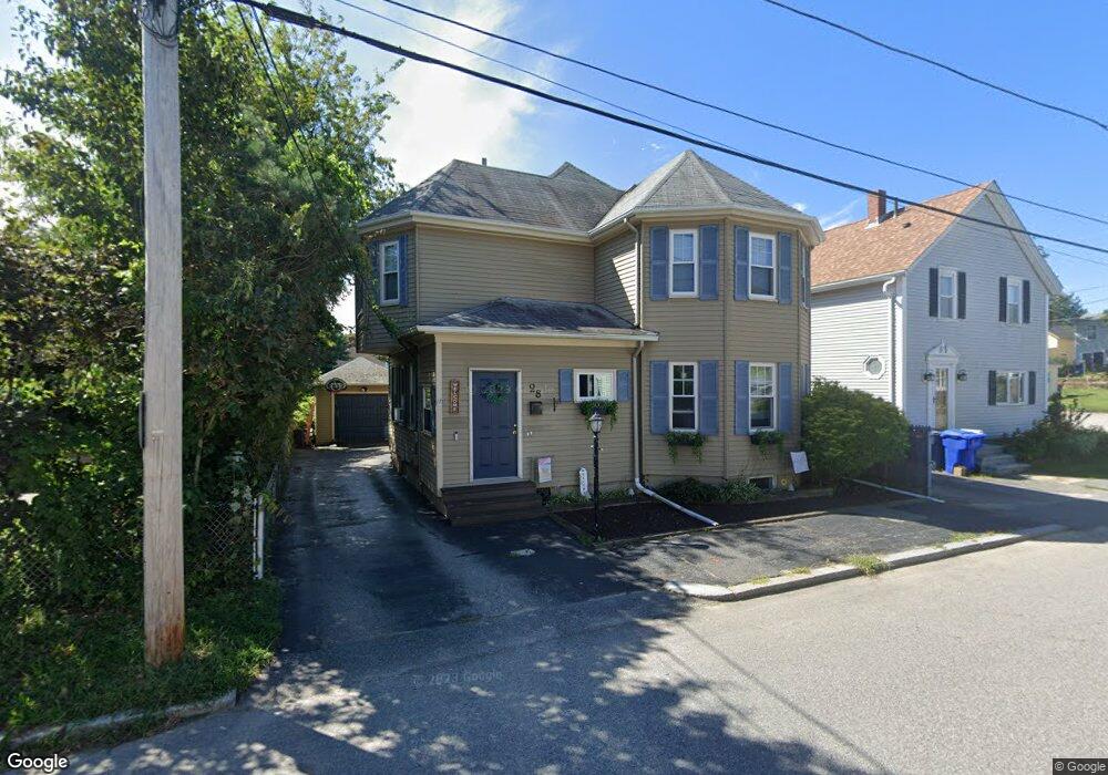
28 Sherman St Riverside, RI 02915
Riverside NeighborhoodEstimated Value: $538,000 - $561,000
4
Beds
3
Baths
3,068
Sq Ft
$179/Sq Ft
Est. Value
About This Home
This home is located at 28 Sherman St, Riverside, RI 02915 and is currently estimated at $549,663, approximately $179 per square foot. 28 Sherman St is a home located in Providence County with nearby schools including East Providence High School, St Mary Academy-Bay View, and St Luke Elementary School.
Ownership History
Date
Name
Owned For
Owner Type
Purchase Details
Closed on
Jun 1, 2016
Sold by
Howe Shane M
Bought by
Black Jason T
Current Estimated Value
Home Financials for this Owner
Home Financials are based on the most recent Mortgage that was taken out on this home.
Original Mortgage
$216,015
Outstanding Balance
$171,570
Interest Rate
3.59%
Mortgage Type
FHA
Estimated Equity
$378,093
Purchase Details
Closed on
Aug 6, 2014
Sold by
Howe Carleen V
Bought by
Howe Shae M
Purchase Details
Closed on
Sep 11, 2002
Sold by
Cole Dorothy Est and Corbett
Bought by
Howe Christopher F
Home Financials for this Owner
Home Financials are based on the most recent Mortgage that was taken out on this home.
Original Mortgage
$106,000
Interest Rate
6.18%
Create a Home Valuation Report for This Property
The Home Valuation Report is an in-depth analysis detailing your home's value as well as a comparison with similar homes in the area
Home Values in the Area
Average Home Value in this Area
Purchase History
| Date | Buyer | Sale Price | Title Company |
|---|---|---|---|
| Black Jason T | $220,000 | -- | |
| Black Jason T | $220,000 | -- | |
| Howe Shae M | -- | -- | |
| Howe Shae M | -- | -- | |
| Howe Shae M | -- | -- | |
| Howe Christopher F | $70,000 | -- | |
| Howe Christopher F | $70,000 | -- |
Source: Public Records
Mortgage History
| Date | Status | Borrower | Loan Amount |
|---|---|---|---|
| Open | Black Jason T | $216,015 | |
| Closed | Howe Christopher F | $216,015 | |
| Previous Owner | Howe Christopher F | $150,000 | |
| Previous Owner | Howe Christopher F | $106,000 |
Source: Public Records
Tax History Compared to Growth
Tax History
| Year | Tax Paid | Tax Assessment Tax Assessment Total Assessment is a certain percentage of the fair market value that is determined by local assessors to be the total taxable value of land and additions on the property. | Land | Improvement |
|---|---|---|---|---|
| 2025 | $7,805 | $597,200 | $80,400 | $516,800 |
| 2024 | $6,042 | $394,100 | $67,000 | $327,100 |
| 2023 | $5,817 | $394,100 | $67,000 | $327,100 |
| 2022 | $5,579 | $255,200 | $49,400 | $205,800 |
| 2021 | $5,487 | $255,200 | $47,100 | $208,100 |
| 2020 | $5,255 | $255,200 | $47,100 | $208,100 |
| 2019 | $5,109 | $255,200 | $47,100 | $208,100 |
| 2018 | $4,846 | $211,800 | $47,200 | $164,600 |
| 2017 | $4,738 | $211,800 | $47,200 | $164,600 |
| 2016 | $4,715 | $211,800 | $47,200 | $164,600 |
| 2015 | $4,707 | $205,100 | $48,100 | $157,000 |
| 2014 | $4,707 | $205,100 | $48,100 | $157,000 |
Source: Public Records
Map
Nearby Homes
- 26 Sherman St
- 493 Bullocks Point Ave
- 501 Bullocks Point Ave
- 25 Sherman St
- 489 Bullocks Point Ave
- 487 Bullocks Point Ave
- 139 Stanton Ave Unit 141
- 145 Stanton Ave
- 147 Stanton Ave
- 17 Sherman St
- 481 Bullocks Point Ave
- 503 Bullocks Point Ave
- 149 Stanton Ave
- 149 Stanton Ave Unit 2
- 12 Sherman St
- 481 Bullocks Pt Ave
- 40 Sherman St
- 123 Stanton Ave
- 477 Bullocks Point Ave
- 0 White Ave