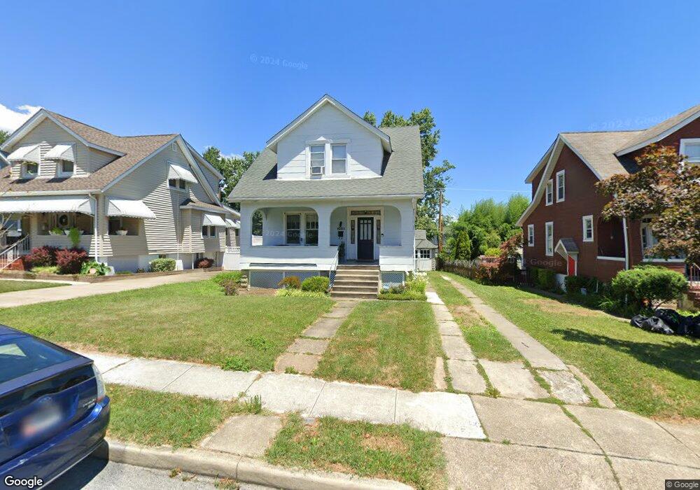
2808 Westfield Ave Baltimore, MD 21214
Westfield NeighborhoodEstimated Value: $211,820 - $258,000
--
Bed
1
Bath
1,380
Sq Ft
$170/Sq Ft
Est. Value
About This Home
This home is located at 2808 Westfield Ave, Baltimore, MD 21214 and is currently estimated at $234,910, approximately $170 per square foot. 2808 Westfield Ave is a home located in Baltimore City with nearby schools including Hamilton Elementary Middle School, Booker T. Washington Middle School, and Paul Laurence Dunbar High School.
Ownership History
Date
Name
Owned For
Owner Type
Purchase Details
Closed on
Dec 13, 1993
Sold by
Wunderlich A W
Bought by
Currie Bruce L
Current Estimated Value
Home Financials for this Owner
Home Financials are based on the most recent Mortgage that was taken out on this home.
Original Mortgage
$78,450
Interest Rate
6.78%
Create a Home Valuation Report for This Property
The Home Valuation Report is an in-depth analysis detailing your home's value as well as a comparison with similar homes in the area
Home Values in the Area
Average Home Value in this Area
Purchase History
| Date | Buyer | Sale Price | Title Company |
|---|---|---|---|
| Currie Bruce L | $77,000 | -- |
Source: Public Records
Mortgage History
| Date | Status | Borrower | Loan Amount |
|---|---|---|---|
| Closed | Currie Bruce L | $78,450 | |
| Closed | Currie Bruce L | $4,700 |
Source: Public Records
Tax History Compared to Growth
Tax History
| Year | Tax Paid | Tax Assessment Tax Assessment Total Assessment is a certain percentage of the fair market value that is determined by local assessors to be the total taxable value of land and additions on the property. | Land | Improvement |
|---|---|---|---|---|
| 2025 | $3,097 | $149,733 | -- | -- |
| 2024 | $3,097 | $141,800 | $51,400 | $90,400 |
| 2023 | $3,090 | $141,800 | $51,400 | $90,400 |
| 2022 | $3,096 | $141,800 | $51,400 | $90,400 |
| 2021 | $3,389 | $143,600 | $51,400 | $92,200 |
| 2020 | $2,957 | $137,733 | $0 | $0 |
| 2019 | $2,818 | $131,867 | $0 | $0 |
| 2018 | $2,787 | $126,000 | $51,400 | $74,600 |
| 2017 | $2,793 | $125,433 | $0 | $0 |
| 2016 | $2,381 | $124,867 | $0 | $0 |
| 2015 | $2,381 | $124,300 | $0 | $0 |
| 2014 | $2,381 | $124,300 | $0 | $0 |
Source: Public Records
Map
Nearby Homes
- 2905 Westfield Ave
- 2803 Fleetwood Ave
- 2821 Hemlock Ave
- 6110 Old Harford Rd
- 6419 Marietta Ave
- 2808 E Northern Pkwy
- 2924 Fleetwood Ave
- 2926 Christopher Ave
- 2803 Berwick Ave
- 6405 Birchwood Ave
- 3013 Westfield Ave
- 2707 Kildaire Dr
- 2810 Roselawn Ave
- 3027 Fleetwood Ave
- 6814 Harford Rd
- 3010 Northway Dr
- 2607 Chesley Ave
- 2412 Pinewood Ave
- 6407 Fernbank Ave
- 2600 Roselawn Ave
- 2806 Westfield Ave
- 2810 Westfield Ave
- 2812 Westfield Ave
- 2804 Westfield Ave
- 2817 Pinewood Ave
- 2815 Pinewood Ave
- 2814 Westfield Ave
- 2819 Pinewood Ave
- 2802 Westfield Ave
- 2811 Pinewood Ave
- 2821 Pinewood Ave
- 2805 Westfield Ave
- 2807 Westfield Ave
- 2816 Westfield Ave
- 2809 Pinewood Ave
- 2800 Westfield Ave
- 2809 Westfield Ave
- 2823 Pinewood Ave
- 2818 Westfield Ave
- 2807 Pinewood Ave