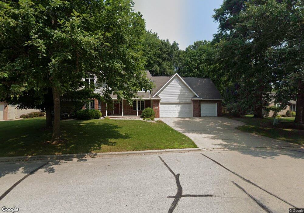
2822 Ogdan Woods Dr Green Bay, WI 54313
Westside NeighborhoodEstimated Value: $492,242 - $611,000
--
Bed
--
Bath
--
Sq Ft
0.37
Acres
About This Home
This home is located at 2822 Ogdan Woods Dr, Green Bay, WI 54313 and is currently estimated at $570,811. 2822 Ogdan Woods Dr is a home located in Brown County with nearby schools including King Elementary School, Lombardi Middle School, and Southwest High School.
Ownership History
Date
Name
Owned For
Owner Type
Purchase Details
Closed on
May 30, 2003
Sold by
Gerndt Steven J and Gerndt Mary M
Bought by
Kahnk Kevin K and Kahnk Michele L
Current Estimated Value
Home Financials for this Owner
Home Financials are based on the most recent Mortgage that was taken out on this home.
Original Mortgage
$279,750
Outstanding Balance
$111,117
Interest Rate
4.5%
Mortgage Type
Purchase Money Mortgage
Estimated Equity
$459,694
Create a Home Valuation Report for This Property
The Home Valuation Report is an in-depth analysis detailing your home's value as well as a comparison with similar homes in the area
Home Values in the Area
Average Home Value in this Area
Purchase History
| Date | Buyer | Sale Price | Title Company |
|---|---|---|---|
| Kahnk Kevin K | $294,500 | Bay Title & Abstract |
Source: Public Records
Mortgage History
| Date | Status | Borrower | Loan Amount |
|---|---|---|---|
| Open | Kahnk Kevin K | $279,750 |
Source: Public Records
Tax History Compared to Growth
Tax History
| Year | Tax Paid | Tax Assessment Tax Assessment Total Assessment is a certain percentage of the fair market value that is determined by local assessors to be the total taxable value of land and additions on the property. | Land | Improvement |
|---|---|---|---|---|
| 2024 | $6,844 | $358,300 | $57,600 | $300,700 |
| 2023 | $6,578 | $358,300 | $57,600 | $300,700 |
| 2022 | $6,402 | $358,300 | $57,600 | $300,700 |
| 2021 | $6,793 | $286,300 | $57,600 | $228,700 |
| 2020 | $6,810 | $286,300 | $57,600 | $228,700 |
| 2019 | $6,625 | $286,300 | $57,600 | $228,700 |
| 2018 | $6,455 | $286,300 | $57,600 | $228,700 |
| 2017 | $6,335 | $286,300 | $57,600 | $228,700 |
| 2016 | $6,243 | $286,300 | $57,600 | $228,700 |
| 2015 | $6,315 | $286,300 | $57,600 | $228,700 |
| 2014 | $6,581 | $286,300 | $57,600 | $228,700 |
| 2013 | $6,581 | $286,300 | $57,600 | $228,700 |
Source: Public Records
Map
Nearby Homes
- 2768 Independence Dr
- 1680 Cormier Rd
- 2060 Wintergreen Ct
- 2044 Ann Ln
- 3023 Crusade Ln
- 2640 He Nis Ra Ln
- 1940 Renaissance Ct
- 1433 Baumgart Rd Unit 1435
- 1570 Mesa Dr
- 2060 Trissino Way
- 2466 Parkwood Dr
- 2550 He Nis Ra Ln
- 3097 S Sandstone Ct
- 1602 W Crusade Ln
- 3096 S Sandstone Ct
- 2549 Babcock Rd Unit 2551
- 2445 Basswood St
- 1445 Cormier Rd
- 1439 Cormier Rd
- 2689 Clive St
- 2828 Ogdan Woods Dr
- 2820 Ogdan Woods Dr
- 2825 Parkwood Dr
- 2815 Parkwood Dr
- 2834 Ogdan Woods Dr
- 2829 Ogdan Dr
- 2831 Parkwood Dr
- 2829 Ogdan Woods Dr
- 2837 Parkwood Dr
- 2166 S Point Rd
- 2835 Ogdan Woods Dr
- 2852 Ogdan Woods Dr
- 2117 S Point Rd
- 2121 S Point Rd
- 2111 S Point Rd
- 2127 S Point Rd
- 2845 Ogdan Woods Dr
- 2095 Wintercress Dr
- 2799 Parkwood Dr
- 2847 Parkwood Dr