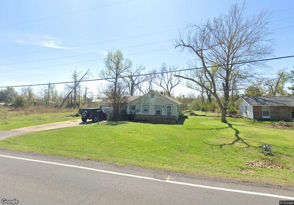
2849 Hudson Dr Westlake, LA 70669
Estimated Value: $76,579 - $140,000
2
Beds
1
Bath
1,182
Sq Ft
$97/Sq Ft
Est. Value
About This Home
This home is located at 2849 Hudson Dr, Westlake, LA 70669 and is currently estimated at $114,895, approximately $97 per square foot. 2849 Hudson Dr is a home located in Calcasieu Parish with nearby schools including Westwood Elementary School, Western Heights Elementary School, and S.P. Arnett Middle School.
Ownership History
Date
Name
Owned For
Owner Type
Purchase Details
Closed on
Jun 17, 2010
Sold by
Lee Chad Everett and Lee Brandi Nicole
Bought by
Bevers Jonathan Michael
Current Estimated Value
Home Financials for this Owner
Home Financials are based on the most recent Mortgage that was taken out on this home.
Original Mortgage
$62,755
Outstanding Balance
$41,976
Interest Rate
4.93%
Mortgage Type
New Conventional
Estimated Equity
$72,919
Create a Home Valuation Report for This Property
The Home Valuation Report is an in-depth analysis detailing your home's value as well as a comparison with similar homes in the area
Home Values in the Area
Average Home Value in this Area
Purchase History
| Date | Buyer | Sale Price | Title Company |
|---|---|---|---|
| Bevers Jonathan Michael | $59,900 | None Available |
Source: Public Records
Mortgage History
| Date | Status | Borrower | Loan Amount |
|---|---|---|---|
| Open | Bevers Jonathan Michael | $62,755 |
Source: Public Records
Tax History Compared to Growth
Tax History
| Year | Tax Paid | Tax Assessment Tax Assessment Total Assessment is a certain percentage of the fair market value that is determined by local assessors to be the total taxable value of land and additions on the property. | Land | Improvement |
|---|---|---|---|---|
| 2024 | $304 | $2,830 | $490 | $2,340 |
| 2023 | $310 | $2,830 | $490 | $2,340 |
| 2022 | $311 | $2,830 | $490 | $2,340 |
| 2021 | $0 | $2,830 | $490 | $2,340 |
| 2020 | $282 | $2,580 | $470 | $2,110 |
| 2019 | $315 | $2,790 | $450 | $2,340 |
| 2018 | $305 | $2,790 | $450 | $2,340 |
| 2017 | $301 | $2,790 | $450 | $2,340 |
| 2016 | $298 | $2,790 | $450 | $2,340 |
| 2015 | $305 | $2,790 | $450 | $2,340 |
Source: Public Records
Map
Nearby Homes
- 2725 Smith Ferry Rd
- 0 Fletcher Rd
- 0 W Wayside Dr Unit SWL25001592
- 109 W Wayside Dr
- 0 Davis Rd
- 2502 & 2504 German Rd
- 369 Ann Terrace Ave
- 0 Charlotte Ave Unit SWL25001918
- 2525 Davis Rd
- 590 Landry Rd
- 570 Ann Terrace Ave
- 2518 Donnelly Rd
- 1545 S Perkins Ferry Rd
- 1567 S Perkins Ferry Rd
- 141 Cureton Rd
- 0 Niel Rd Unit SWL23002840
- 320 Mcguire Rd
- 2526 Cox Rd
- 345 Fred Lutz Rd
- 2524 Cox Rd
- 2853 Hudson Dr
- 2851 Hudson Dr
- 2852 Hudson Dr
- 2906 Carlock Rd
- 341 E Dick Hayes Rd
- 2927 Carlock Rd
- 2835 Miller Ave
- 353 E Dick Hayes Rd
- 2854A Hudson Dr
- 2865 Hudson Dr
- 359 E Dick Hayes Rd
- 347 E Dick Hayes Rd
- 2806 Hudson Dr
- 2936 Hudson Dr Unit B
- 2936 Davis Rd
- 365 E Dick Hayes Rd
- 343 E Dick Hayes Rd
- 2869 Hudson Dr
- 2869 Miller Ave
- 0 Dick Hayes Rd Unit 59965